 Atlas of China
Kaiyuan Changhong Bridge 开远长虹桥Kāiyuǎn Chánghóng Qiáo
National heritage site · Honghe, Yunnan
- Time needed
- Under an hour
- Days to budget
- Half a day
- City
- Honghe
- Region
- Yunnan
- Type
- Heritage
- Listed as
- National heritage site
About Kaiyuan Changhong Bridge
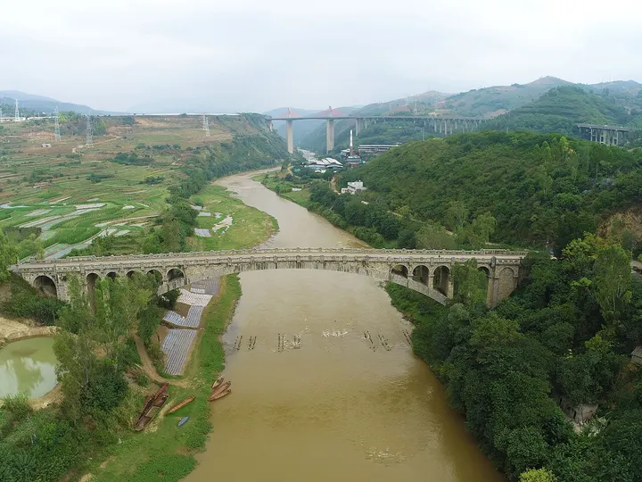
An open-spandrel stone arch bridge over the Nanpan River, completed in 1961, with a main span of 113 m, a total length of 171 m and a height of 30 m. The arch centring collapsed in a storm during construction in 1960, killing 18 people, and slogans of the period are carved on the parapet posts. Since a new bridge opened in 1996 it has carried only a county road.
How to get to Kaiyuan Changhong Bridge
About 12 km north of Kaiyuan city on the former National Highway 326.
Nearby
- Jianshui Ancient Town 建水古城 50 km
A Ming gate tower, a great Confucian temple and grilled tofu on the way to Yuanyang
Also within 20 km: Fenghuang Eco-Park 凤凰生态公园 (10 km), Nandong Cave, Kaiyuan 开远南洞 (20 km).
On the map
Open Kaiyuan Changhong Bridge on the illustrated map to see the terrain around it and what else is close, and to add it to a trip.
Open Kaiyuan Changhong Bridge on the map