
 An illustrated travel map
Keelung Islet 基隆屿Jīlóng Yǔ
Keelung, Taiwan
- Time needed
- Half a day
- Days to budget
- Half a day
- City
- Keelung
- Region
- Taiwan
- Type
- Nature
About Keelung Islet
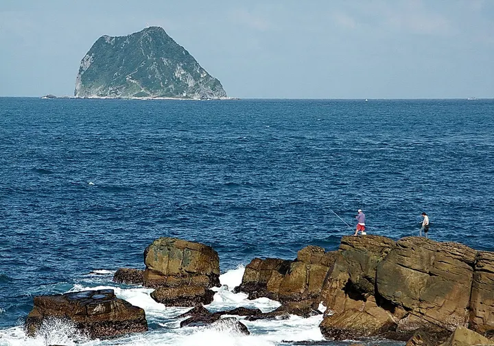
Keelung Islet is an uninhabited volcanic island of about 24 hectares, the highest point being 182 m, and a clear landmark from the Keelung coast. It was long a restricted military zone and has been opened to visitors, with a stair path up the island, a shore path and a lookout. Landing is permitted only in certain months of the year and only by pre-booked boat.
How to get to Keelung Islet
The islet lies about 4 km off the port of Keelung and about 5.5 km north of Bisha Fishing Port, where boats leave; visits are only offered in certain months.
Nearby
- Yehliu Geopark 野柳地质公园 under 10 km
A headland of wind- and wave-carved rock mushrooms on the north coast - Jiufen and Jinguashi 九份与金瓜石 10 km
Hillside gold-rush lanes and Japanese-era mines above the northeast coast - Pingxi Line Villages (Shifen) 平溪十分 20 km
Sky lanterns, a street where trains pass shop doors, and Taiwan's broadest waterfall - National Palace Museum 台北故宫博物院 30 km
Imperial treasures from the Forbidden City, from Jadeite Cabbage to bronzes - Taipei 101 台北101 30 km
A 508-metre tower with a giant wind damper you can watch swaying
Also within 20 km: Bisha Fishing Port 碧砂渔港 (under 10 km), Gongziliao Battery 杠子寮炮台 (under 10 km), National Museum of Marine Science and Technology 国立海洋科技博物馆 (under 10 km), Baimiweng Fort 白米瓮炮台 (under 10 km), Keelung Fortress Commander's Residence 基隆要塞司令官邸 (under 10 km), Xiandong Rock 仙洞岩 (under 10 km).
On the map
Open Keelung Islet on the illustrated map to see the terrain around it and what else is close, and to add it to a trip.
Open Keelung Islet on the map