
 An illustrated travel map
Chenglong Wetlands 成龙湿地Chénglóng Shīdì
Yunlin, Taiwan
- Time needed
- 1–2 hours
- Days to budget
- Half a day
- City
- Yunlin
- Region
- Taiwan
- Type
- Nature
About Chenglong Wetlands
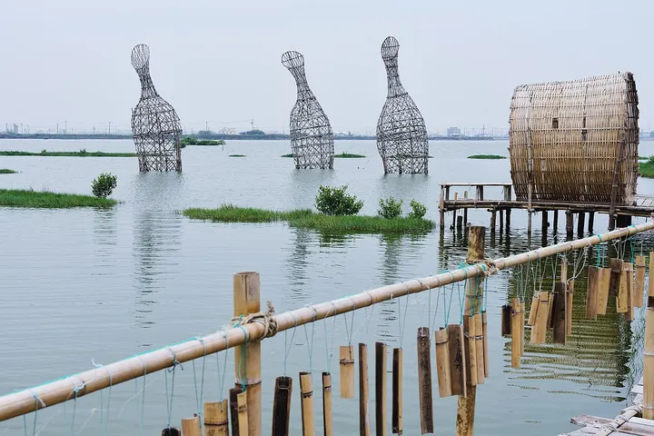
A coastal wetland of about 171 hectares in Kouhu, in the Yunchianan Coast scenic area, formed from man-made wetland and a small area of natural wetland. The land was abandoned as farmland after subsidence and seawater intrusion, and now attracts birds such as the black-faced spoonbill. An art installation called Water Core stands on the site, and the sunsets are a draw.
How to get to Chenglong Wetlands
Beside the Kouhu interchange of the West Coast Expressway, about 3.7 km south-west of Kouhu township.
Nearby
Also within 20 km: Aogu Wetland Forest Park 鳌鼓湿地森林园区 (under 10 km), Dongshi Fisherman's Wharf 东石渔人码头 (10 km), Peitian Temple 配天宫 (10 km), Beigang Tourist Bridge 北港观光大桥 (10 km), Chaotian Temple, Beigang 北港朝天宫 (10 km), Bengang Shuixian Temple 笨港水仙宫 (10 km).
On the map
Open Chenglong Wetlands on the illustrated map to see the terrain around it and what else is close, and to add it to a trip.
Open Chenglong Wetlands on the map