 Atlas of China
Fort Dona Maria II 马交石炮台Mǎjiāoshí Pàotái
Classified heritage · Macau, Macau
- Time needed
- 45 minutes
- Days to budget
- Half a day
- City
- Macau
- Region
- Macau
- Type
- Heritage
- Listed as
- Classified heritage
About Fort Dona Maria II
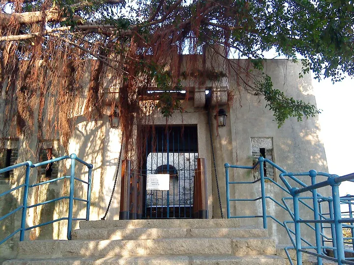
Fort Dona Maria II (Fortaleza de D. Maria II) stands at the top of Ma Kau Seac Hill, 48.2 metres high, in the north-east of the Macau Peninsula. Built in 1852 to support Mong-Há Fort, it is an irregular hexagon entered across a movable bridge, with a vaulted corridor behind the gate; American aircraft bombed it on 16 January 1945. The grassy eastern slope of the hill is a recreation area with views towards the sea, and the park around the fort reopened in December 2023 after renovation.
How to get to Fort Dona Maria II
Beside the Communications Museum on Estrada de D. Maria II in the north-east of the peninsula, about 1.9 km east-north-east of Senado Square.
Nearby
- Historic Centre of Macau 澳门历史城区 under 10 km
Portuguese tiled squares, baroque churches and Chinese temples, a short walk apart - Tian Tan Buddha & Ngong Ping 天坛大佛与昂坪 40 km
A giant bronze Buddha on Lantau, reached by a 25-minute cable car ride
Also within 20 km: Communications Museum 通讯博物馆 (under 10 km), Macau Mosque and Cemetery 澳门清真寺及坟场 (under 10 km), Tin Hau Temple, Areia Preta 天后古庙(黑沙环) (under 10 km), Montanha Russa Garden 螺丝山公园 (under 10 km), Stone with the Coat of Arms of Portugal, Rampa dos Cavaleiros 刻有葡国徽号的石块(望厦马交石斜坡旁) (under 10 km), Kun Iam Temple, Mong-Há 普济禅院(观音堂) (under 10 km).
On the map
Open Fort Dona Maria II on the illustrated map to see the terrain around it and what else is close, and to add it to a trip.
Open Fort Dona Maria II on the map