
 An illustrated travel map
Cape Fugui 富贵角Fùguìjiǎo
New Taipei, Taiwan
- Time needed
- 1–2 hours
- Days to budget
- Half a day
- City
- New Taipei
- Region
- Taiwan
- Type
- Nature
About Cape Fugui
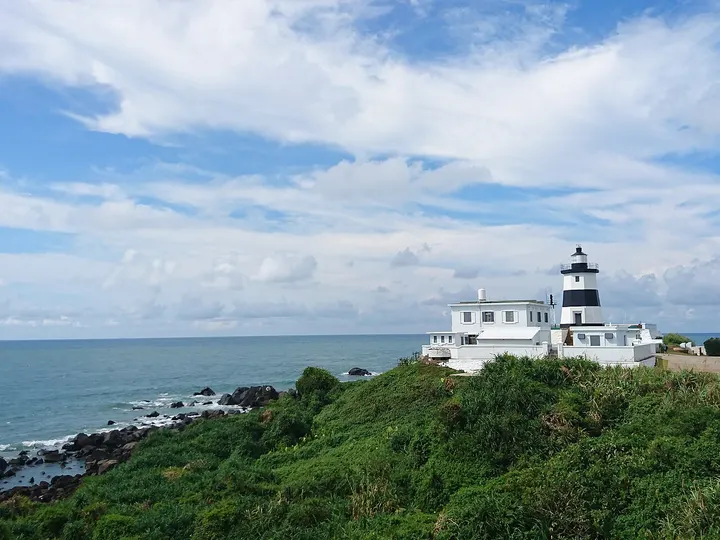
The northernmost point of Taiwan island, with a gentle coastal path, a viewing platform, wind-sculpted rock and wind-pruned trees. An octagonal black-and-white lighthouse stands on the cape; it was the first lighthouse the Japanese authorities built in Taiwan, and its fog horn was a first for the island. In April and May Taiwan lilies bloom and the green rock troughs of nearby Laomei appear.
How to get to Cape Fugui
On the north coast, about 17 km north-north-east of Tamsui MRT station.
Nearby
- Tamsui 淡水 20 km
A river-mouth port with a Dutch-era fort, a red-brick consulate and sunset walks - Beitou and Yangmingshan 北投·阳明山 20 km
Steaming hot-spring valley and a volcanic park, both inside Taipei - Yehliu Geopark 野柳地质公园 20 km
A headland of wind- and wave-carved rock mushrooms on the north coast - National Palace Museum 台北故宫博物院 20 km
Imperial treasures from the Forbidden City, from Jadeite Cabbage to bronzes - Dadaocheng and Dihua Street 大稻埕·迪化街 30 km
Taipei's old tea and dried-goods quarter, with riverside sunsets
Also within 20 km: Fuji Fishing Port 富基渔港 (under 10 km), Baisha Bay 白沙湾海水浴场 (under 10 km), Juming Museum 朱铭美术馆 (under 10 km), Dharma Drum Mountain 法鼓山 (10 km), Twin Candlestick Islets 烛台双屿 (10 km), Yangming Shuwu (Zhongxing Guesthouse) 阳明书屋 (20 km).
On the map
Open Cape Fugui on the illustrated map to see the terrain around it and what else is close, and to add it to a trip.
Open Cape Fugui on the map