
 An illustrated travel map
Taroko Gorge 太鲁阁峡谷Tàilǔgé Xiágǔ
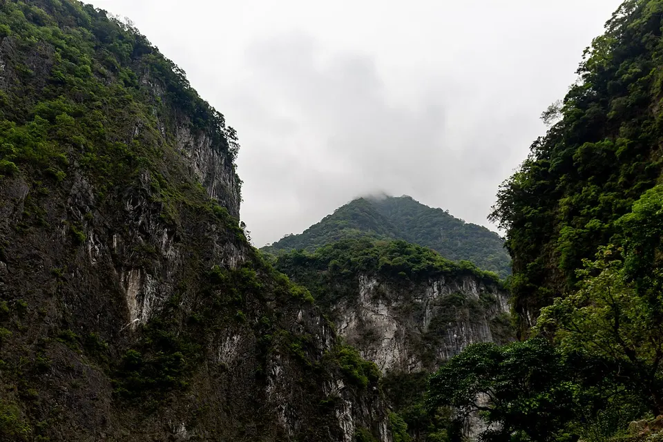
A marble canyon cut by the Liwu River, with many trails still shut after the 2024 quake
- Best time
- Mar–May, Oct–Nov
- Time needed
- Half a day to 1 day
- Days to budget
- 1 day
- Stay in
- Hualien
- Region
- Taiwan
- Type
- Nature
Why go to Taroko Gorge
Taroko Gorge is the signature sight of Taroko National Park: a canyon with near-vertical marble walls cut by the Liwu River, about 40 minutes by road from Hualien to the park headquarters. Since the April 2024 earthquake the gorge is only partly open. Most of the famous riverside trails, including Shakadang, Swallow Grotto and Baiyang, were still closed in autumn 2026, and the gorge road runs on controlled schedules. What remains is a shorter, quieter visit built around the visitor centre, Dekalun Trail, the upper gorge at Tianxiang and the Qingshui Cliff viewpoint.
The story
The park takes its name from the Truku people, who moved east into the Liwu River valley, and Truku villages still lie inside it. The gorge road was cut through the marble by hand in 1956–60 as part of the Central Cross-Island Highway, and Changchun Shrine, beside the road, commemorates more than 200 workers who died building it.
What to see at Taroko Gorge
- Taroko Visitor Centre 太鲁阁游客中心: The park's main information point just inside the entrance arch, with maps, displays on geology and Truku culture, and up-to-date notes on closures.
- Dekalun Trail 德卡伦步道: A short, stair-heavy walk behind the visitor centre, one of the few trails in the lower gorge that is open; the park also points hikers on to the long Dali–Datong route past Truku villages, a serious outing with no supply points.
- Gorge road (Highway 8) 台8线中横公路太鲁阁段: The narrow road through the marble gorge, with tunnels and overhanging walls above the Liwu River. It is open only in controlled windows, and you can stop only at a few roadside points.
- Tianxiang and Xiangde Temple 天祥与祥德寺: The upland end of the gorge road, with the Tianxiang Path, the short Tabiduo Trail and a walk across Pudu Bridge to Xiangde Temple, whose pagodas look over the gorge. Open in 2026 but reached only by car, taxi or tour.
- Qingshui Cliff 清水断崖: A sheer cliff plunging from the mountains to the Pacific coast north of the gorge, seen from the Chongde recreation area. Only the first viewing platform was open in 2026.
How to visit Taroko Gorge
Treat this as a visit to a damaged landscape: begin at the visitor centre to learn which trails are open, walk the Dekalun Trail, then use a car, taxi or tour to run the gorge road in an open window as far as Tianxiang, stopping at roadside viewpoints. Add Qingshui Cliff on the way to or from Hualien. Half a day covers the visitor centre and the road; a full day adds Tianxiang and the cliff.
How to get to Taroko Gorge
Express trains from Taipei reach Hualien in about two hours; Xincheng (Taroko) station, one stop before Hualien and close to the park entrance, is the other rail gateway. Bus 310 from Hualien runs only as far as the visitor centre, and the old Taroko–Tianxiang gorge bus is suspended, so taxis, charter cars and tours are the way to go further; confirm what is running before you go.
Where to stay
Base yourself in Hualien city, which has the most hotels, food and transport, or in Xincheng near the park entrance for an early start.
What to eat
- Hualien wonton soup 花莲扁食: Thin-skinned pork wontons in clear broth, the everyday local snack in Hualien.
- Hualien mochi 花莲麻糬: Soft glutinous-rice sweets rolled in peanut or sesame, sold in Hualien shops as the classic edible souvenir.
Tips for visiting Taroko Gorge
- Open as of late August 2026 (the latest dated guides; park notices to 26 October 2026 reopened only the permit-only high-mountain routes): the visitor centre and Dekalun Trail, the Tianxiang area with its Xiangde Temple walk, short sections of the Lushui trails, and the Chongde viewpoint for Qingshui Cliff.
- Closed in the same sources: Shakadang, Swallow Grotto and Baiyang (repairs not expected before 2031), Changchun Shrine (not before 2029), Zhuilu Old Road, and the Tunnel of Nine Turns and Buluowan, which the park said in March 2026 would reopen later in the year but which were still closed to visitors in autumn. You can still stop at some entrances for photos.
- The gorge road (Highway 8) opens only in short daily release windows, and rockfall or typhoons can close it at short notice. Check the road notice the day before; at Qingshui Cliff only the first viewing platform was open in 2026.
Nearby
- Sun Moon Lake 日月潭 80 km
Taiwan's largest lake, ringed by hills, temples and the home villages of the Thao people - Taipei 101 台北101 100 km
A 508-metre tower with a giant wind damper you can watch swaying - Longshan Temple 台北龙山寺 100 km
Taipei's most lived-in temple, set among the old streets of Bangka - Pingxi Line Villages (Shifen) 平溪十分 100 km
Sky lanterns, a street where trains pass shop doors, and Taiwan's broadest waterfall - Dadaocheng and Dihua Street 大稻埕·迪化街 100 km
Taipei's old tea and dried-goods quarter, with riverside sunsets - National Palace Museum 台北故宫博物院 110 km
Imperial treasures from the Forbidden City, from Jadeite Cabbage to bronzes
Also within 30 km: Shakadang Trail 砂卡礑步道 (under 10 km), Changchun Shrine 长春祠 (under 10 km), Qingshui Cliff 清水断崖 (under 10 km), Qixingtan Beach 七星潭 (10 km), Chihsing Tan Katsuo Museum 七星柴鱼博物馆 (10 km), Pine Garden 松园别馆 (20 km).
On the map
Open Taroko Gorge on the illustrated map to see the terrain around it, what else is close, and to add it to a trip and plan the days.
Open Taroko Gorge on the map