 Atlas of China
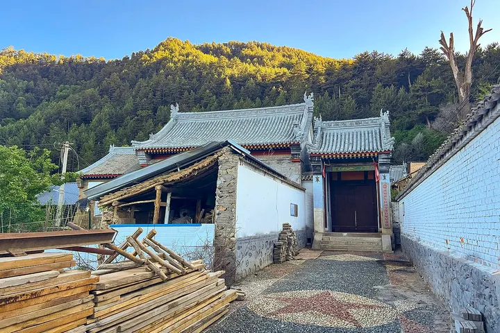
Shanxi-Chahar-Hebei Military Region Headquarters Site, Jingangku 金岗库村晋察冀军区司令部旧址Jīngāngkù Cūn Jìnchájì Jūnqū Sīlìngbù Jiùzhǐ
National heritage site · Xinzhou, Shanxi
- Time needed
- 1 hour
- Days to budget
- Half a day
- City
- Xinzhou
- Region
- Shanxi
- Type
- Heritage
- Listed as
- National heritage site
About Shanxi-Chahar-Hebei Military Region Headquarters Site, Jingangku
From March 1938 this village was the base of the Shanxi-Chahar-Hebei Military Region headquarters, the first base the Eighth Route Army built behind Japanese lines. The headquarters occupied a two-courtyard house at the foot of the hill, and the commander and political commissar Nie Rongzhen lived upstairs in its west wing. A memorial hall opened in 2003 and has exhibitions on the war history, on Nie's life and on the resistance offices around Mount Wutai.
How to get to Shanxi-Chahar-Hebei Military Region Headquarters Site, Jingangku
In Jingangku township, inside the Mount Wutai scenic area and about 40 km north-east of Wutai.
Nearby
- Mount Wutai 五台山 10 km
Temples, a towering white stupa and yellow-tiled roofs below five flat-topped holy peaks - Foguang Temple 佛光寺 20 km
A Tang timber hall of 857 on a quiet hillside, still filled with its Tang clay statues
Also within 20 km: Nanshan Temple, Mount Wutai 南山寺 (10 km), Luohou Temple 罗睺寺 (10 km), Bethune Model Ward, Songyankou 白求恩模范病室旧址 (20 km), Tianshengqiao Waterfalls 阜平天生桥 (20 km), Fanshi Glazed Pagoda 繁峙琉璃塔 (20 km).
On the map
Open Shanxi-Chahar-Hebei Military Region Headquarters Site, Jingangku on the illustrated map to see the terrain around it and what else is close, and to add it to a trip.
Open Shanxi-Chahar-Hebei Military Region Headquarters Site, Jingangku on the map