
 An illustrated travel map
Changle 长乐Chánglè
Where Zheng He's fleet waited for the monsoon
About Changle
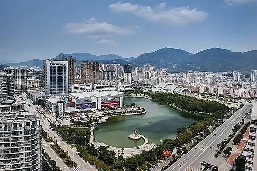
Changle lies across the Min River from Mawei, on the coast east of Fuzhou, and was a county seat from 623 until it became a district in 2017. The admiral Zheng He's fleet is recorded as waiting here for the monsoon before sailing. Its Shengshou Pagoda and the clay sculptures of Xianying Palace are listed, and the Minjiang Estuary National Wetland Park lies on its shore. Fuzhou's airport is here, and the district sends many emigrants abroad.
Listed sites in Changle
4 sites in Changle are on the official lists. Those with a page of their own link to it; the rest open as cards on the map.
- Minjiang Estuary National Wetland Park 闽江河口国家湿地公园 4A scenic area · on the map
A 282-hectare wetland park of tidal flats and restored fish ponds at the mouth of the Min River in north-east Changle, part of an estuary wetland that joined China's World Heritage tentative list in 2022 and became a Ramsar site in 2023. - Jiutouma Residences 九头马民居 National heritage site
A walled Qing-dynasty residential complex in Qiyang village, Heshang town, built by Chen Lihuan and his son from the Jiaqing era until about 1872 and named after nine large boulders scattered through it. - Shengshou Pagoda 圣寿宝塔 National heritage site
A 27.4 m seven-storey octagonal stone pagoda imitating timber construction, built between 1096 and 1117 on Taping Hill in what is now Zheng He Park, Changle. - Xianying Palace Clay Sculptures 显应宫 National heritage site · on the map
A Mazu temple in Xianqi village, Zhanggang, founded in 1138 and buried by drifting sand in the late Qing, then found again in 1992 when villagers dug house foundations.
Getting to Fuzhou
Train, flight and driving times from the cities most visitors come from, with stations, fares and how many run a day; each opens the full comparison.
On the map
Open Changle on the illustrated map to see its outline, its places and listed sites together, and to add them to a trip.
Open Changle on the map