 Atlas of China
Dingxi 定西Dìngxī
Potato country in the loess hills, where the Wei River begins
About Dingxi
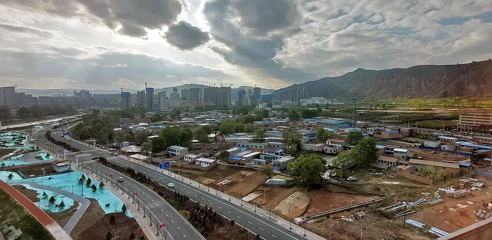
Dingxi lies in the dry loess hills between Lanzhou and Tianshui and is known across China for its potatoes. In Weiyuan, where the Wei River is said to rise in the Niaoshu Mountains, the covered timber Baling Bridge spans a stream near its source; Longxi keeps the Weiyuan drum tower, first built under the Northern Song. Lintao's Majiayao village gave its name to a Neolithic painted-pottery culture, found there in 1924, and the southern gorges of Zheyang and Guiqing are steep and wooded.
Listed sites in Dingxi
14 sites in Dingxi are on the official lists. Those with a page of their own link to it; the rest open as cards on the map.
- Bangluo Conference Site 榜罗镇会议旧址 4A scenic area · National heritage site · on the map
On 27 September 1935 the Communist Party's Politburo Standing Committee, then on the Long March, met in the principal's office of the Bangluo central school and decided to make the Shaan-Gan base area in northern Shaanxi the destination of the march; the next day Mao Zedong spoke to the Shaanxi–Gansu Detachment's company-level and higher officers at a threshing ground beside the school. - Changjiahe Hawthorn Town 常家河山楂小镇 4A scenic area · on the map
A farm-tourism area in Changjiahe town built around hawthorn orchards planted by a local cooperative from 2018, with blossom in spring and fruit in autumn. - Langdutan Grassland 狼渡滩 4A scenic area · on the map
Langdutan is a broad upland of wetland meadows and grassland at an average height of about 2,600 m around Lüjing town in eastern Min County, threaded by winding streams and grazed by yaks, cattle and sheep. - Lijia Longgong (Li Clan Ancestral Temple) 李家龙宫 4A scenic area · on the map
The Lijia Longgong is the ancestral temple of the Li clan in Longxi, the clan's ancestral seat, said to have been founded in the early Tang and named from an inscription by Emperor Taizong. - Minzhou Conference Site 岷州会议旧址 4A scenic area · on the map
A memorial at Sanshilipu outside Min County town to the Minzhou Conference of 16–18 September 1936, at which the Communist Party's Northwest Bureau, meeting while the Red Army's Second and Fourth Front Armies were in Min County, rejected Zhang Guotao's plan to take the Fourth Front Army west and decided that the forces should go north to join the First Front Army. - Nanping Mountain, Lintao 南屏山 4A scenic area · on the map
Nanping Mountain rises south of Lintao to an average height of about 2,800 m, and its snow-capped summit is the setting of 'Snow on the Southern Hills', one of the old Eight Views of Taoyang. - Shouyang Mountain, Weiyuan 首阳山 4A scenic area · on the map
Shouyang Mountain in Lianfeng town south of Weiyuan is one of several places claimed as the mountain where the brothers Bo Yi and Shu Qi, refusing to eat the grain of the Zhou, starved to death; its nine lotus-like peaks have had Buddhist, Daoist and Confucian cave temples and halls since the Han and Wei. - Weihe Source Scenic Area 渭河源 4A scenic area · on the map
The Wei River is traditionally said to rise here in the Niaoshu ('Bird and Rat') Mountains south-west of Weiyuan, where the Book of Documents records Yu the Great guiding its waters, and the springs that feed it emerge in the wooded headwater valley. - Yuangudui Village 元古堆 4A scenic area · on the map
Yuangudui is a hill village in Tianjiahe township, Weiyuan County, at about 2,440 m, which Xi Jinping visited in February 2013 and which has since developed rural tourism. - Yuelu Mountain, Lintao 岳麓山 4A scenic area · on the map
Yuelu Mountain is the wooded hill on the eastern edge of Lintao town, long a Daoist site and a meeting place for scholars. - Yuexin International Calligraphy and Painting Village 悦心国际书画村 4A scenic area · on the map
A cultural tourism complex in Tongwei county town, in a county known for its calligraphy and painting culture, made up of a long calligraphy and painting gallery with more than 100 commercial galleries, the Yuexin Art Museum, a hot-spring pool complex, a hotel and an organic fruit-picking farm outside the town. - Zheyang and Guiqing Mountains 遮阳山、贵清山 4A scenic area · on the map
Two forested mountain areas in the south of Zhang County that together make up a national forest park. - Baling Bridge, Weiyuan 灞陵桥 National heritage site · on the map
Baling Bridge spans the Qingyuan River in Weiyuan county town, close to the source of the Wei River: a covered timber cantilever-arch bridge 40 m long, with a gallery of 13 bays. - Weiyuan Tower, Longxi 威远楼 National heritage site · on the map
The Weiyuan Tower stands in the centre of Longxi: a three-storey timber drum tower 26 m tall on a brick base, first built under the Northern Song in the 11th century, moved to its present site in 1261 and rebuilt in 1368.
On the map
Open Dingxi on the illustrated map to see its outline, its places and listed sites together, and to add them to a trip.
Open Dingxi on the map