 Atlas of China
Qingyang 庆阳Qìngyáng
Gullied loess tablelands, Song pagodas and Buddhas cut into a river cliff
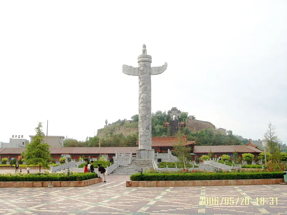
About Qingyang
Qingyang, long known as Longdong, 'east of Gansu', covers deeply gullied loess tablelands between Ningxia and Shaanxi. Its best-known sight is the North Grotto Temple near Xifeng, begun in 509 under the Northern Wei, where seven standing Buddhas fill the main cave; Song brick pagodas rise across the prefecture, and the roadbed of the First Emperor's Qin Straight Road runs along the forested Ziwuling ridge. Above Qingcheng, the Zhouzu Mausoleum honours Buzhu, legendary ancestor of the Zhou, who is said to have taught farming here.
Listed sites in Qingyang
19 sites in Qingyang are on the official lists. Those with a page of their own link to it; the rest open as cards on the map.
- Huanzhou Old Town and Huanxian Pagoda 环州故城 4A scenic area · National heritage site · on the map
A scenic area of 518 mu (about 35 ha) at the north gate of Huan county town, opened in September 2021 and laid out in Song style around the Huanxian Pagoda and the remains of the walled Song-era town of Huanzhou, a frontier post against the Western Xia in the time of Fan Zhongyan. - Longqi Valley (Heilaoguo) 龙栖谷 4A scenic area · on the map
A narrow rocky gorge more than 1 km long at Maosi village in the Pu River valley south of Xifeng, whose winding course is said to look from above like a coiled dragon; it is also called Heilaoguo, the "black pot", because the stream sinks underground and has scoured the dark rock into a pot shape. - Nanliang Revolutionary Sites 南梁革命旧址 4A scenic area · National heritage site · on the map
In 1934 Communist organisers led by Liu Zhidan, Xie Zichang and Xi Zhongxun made Nanliang, in the Ziwuling hills of eastern Huachi County, the base of a Soviet government for the Shaanxi–Gansu border area; it took the name Shaanxi–Gansu Border Region Soviet Government in November 1934 and moved to Xiasiwan in Shaanxi in April 1935. - North Grotto Temple 北石窟寺 4A scenic area · National heritage site · on the map
A Buddhist cave temple cut into a sandstone cliff about 20 m high and 120 m long on the east bank of the Pu River where it meets the Ru, south-west of Xifeng, begun in 509 under the Northern Wei and extended under later dynasties into the Qing. - Yaowangdong Wellness Town 药王洞养生小镇 4A scenic area · on the map
A modern tourist town in old-street style on the east bank of the Rouyuan River at Qingcheng, about 3.2 km long and below the Zhouzu Mausoleum; it takes its name from a cave associated with the legendary physician Qibo. - Zhouzu Mausoleum 周祖陵 4A scenic area · on the map
A forest park on the East Hill above Qingcheng, named after the tomb traditionally held to be that of Buzhu, the Xia-period ancestor of the Zhou royal house, who is said to have brought his people here and taught them farming. - Ziwu Huaxi Valley 子午花溪谷 4A scenic area · on the map
A flower-valley leisure area at Lianjiabian in Taibai town, on the edge of the Ziwuling forest in eastern Heshui County, laid out around a visitor centre and car park. - Dong Laoye Shan (Xinglong Shan) Temples 东老爷山 National heritage site · on the map
A Daoist mountain, 1,774 m high, in north-eastern Huan County near the meeting point of Gansu, Shaanxi and Ningxia, also called Xinglong Shan and known for the saying that a cock's crow here carries into three provinces. - Donghuachi Pagoda 东华池塔 National heritage site · on the map
An octagonal brick pagoda of seven storeys on Baota Hill above Donghuachi village in Linzhen township, built in 1099 under the Northern Song and repaired under the Jin and the Ming. - Former Shaanxi–Gansu–Ningxia Provincial Soviet Government, Helianwan 河连湾陕甘宁省苏维埃政府旧址 National heritage site · on the map
Helianwan village in Hongde town was the seat of the Communist Party's Shaanxi–Gansu–Ningxia Provincial Committee and Provincial Soviet Government from July 1936 to September 1937, after they moved here from Wuqi in northern Shaanxi, with Li Fuchun as party secretary and Ma Xiwu as chairman. - Luochuan Old Town: Zhao Stone Archways and Confucian Temple Hall 罗川古城 National heritage site · on the map
Luochuan, now a village on the Silang River in Yonghe town, was a county seat for many centuries, and three red-sandstone memorial archways of the late Ming stand on the axis of its main street, carved with scenes from the career of the official Zhao Bangqing, auspicious motifs and inscribed boards, one board a gift of the Wanli Emperor. - Ningshou Temple Pagoda 凝寿寺塔 National heritage site · on the map
A square brick pagoda of five storeys in the pavilion style, 21.2 m high and 6 m wide at the base, built in the Five Dynasties to Northern Song period at Zhengping village on the north bank of the Jing River. - Qin Straight Road (Qingyang Section) 秦直道 National heritage site · on the map
A military road that the First Emperor of Qin ordered General Meng Tian to build from 212 BC; its Qingyang section, a national heritage unit of roughly 300 km, follows the forested Ziwuling ridge through Zhengning, Ning, Heshui and Huachi counties, and scholars still debate whether the Gansu line was the main road or a branch. - Shanchengbao Battle Site 山城堡战役旧址 National heritage site · on the map
The site of the Battle of Shanchengbao in November 1936, the first major engagement fought by the Red Army after its three main forces had joined up at the end of the Long March, in which troops under Peng Dehuai defeated part of Hu Zongnan's Nationalist First Army around Shancheng. - Shuangta Temple Sculpted Pagodas 双塔寺造像塔 National heritage site · on the map
Two red-sandstone pagodas carved all over with Buddhist figures, the only standing remains of a temple founded in 1156–89 under the Jin in Linzhen township and destroyed by an earthquake in the Qianlong era. - Ta'erwan Sculpted Pagoda 塔儿湾造像塔 National heritage site · on the map
A slender octagonal stone pagoda of thirteen tiers of close-set eaves, 10.93 m high, carved from local red sandstone in 1102–06 under the Northern Song and moved from Ta'erwan village in Taibai to the courtyard of the Heshui County Museum, also called the Longdong Ancient Stone Carving Art Museum. - Xiangle Brick Pagoda 湘乐砖塔 National heritage site · on the map
A hexagonal brick pagoda in the pavilion style in Xiangle town, begun under the Song and described as seven storeys, now about 22 m high with its top collapsed. - Xiaojin Pagoda 肖金塔 National heritage site · on the map
A Song-dynasty brick pagoda, also called the Jincheng Temple Pagoda, on the south street of Xiaojin town; the temple around it has gone and only the tower survives, patched up in the Qing. - Zhoujiubang Wooden Archway 周旧邦木坊 National heritage site · on the map
A Ming-dynasty timber memorial archway, built in 1505 on South Street in Qingcheng, the old county town, by the Qingyang prefect to honour Buzhu, the ancestor of the Zhou royal house who tradition says brought his people to this valley.
On the map
Open Qingyang on the illustrated map to see its outline, its places and listed sites together, and to add them to a trip.
Open Qingyang on the map