
 An illustrated travel map
Nansha 南沙Nánshā
Guangzhou's door to the sea, at the mouth of the Pearl River
About Nansha
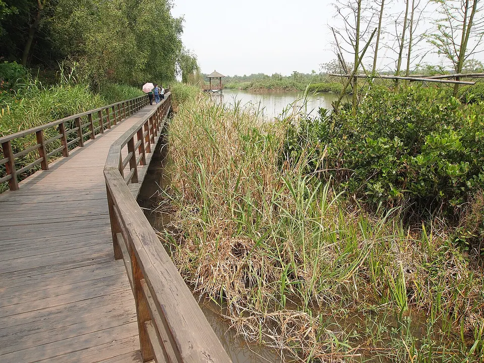
Nansha is the far south of Guangzhou, about 45 kilometres from the centre, the city's only coastal district, where the Pearl River meets the sea. It grew from a development zone created inside Panyu in 1993, became a district in 2005 and a national new area in 2012, and holds the deep-water port and a large free-trade zone. Visitors come for Nansha Tianhou Temple, a Mazu temple on Dajiao Hill above the estuary, and the Greater Bay Area Central Wetland Park, a 4A wetland.
Listed sites in Nansha
2 sites in Nansha are on the official lists. Those with a page of their own link to it; the rest open as cards on the map.
- Greater Bay Area Central Wetland Park (Nansha Wetland) 大湾区中央湿地公园 4A scenic area
Created on reclaimed mudflats at the mouth of the Pearl River in Wanqingsha, this wetland was planted with mangroves from the 1990s and opened to visitors in 2008, and it is the largest coastal wetland in Guangzhou. - Nansha Tianhou Temple 南沙天后宫 4A scenic area
Rebuilt in 1996 with funds from the Hong Kong businessman Henry Fok on the site of a Ming-dynasty shrine, this large temple to Mazu, the sea goddess Tianhou, climbs the south-east slope of Dajiao Hill above the Pearl River estuary.
Getting to Guangzhou
Train, flight and driving times from the cities most visitors come from, with stations, fares and how many run a day; each opens the full comparison.
- Shenzhen 深圳 high-speed train 29 min, 295 a day, from ¥75
- Hong Kong 香港 high-speed train 47 min, 50 a day, from ¥215; 3 nonstop flights a day, 1 h 20 min in the air
- Guilin 桂林 high-speed train 2 h 4 min, 62 a day, from ¥223
- Haikou 海口 train 11 h 36 min, 5 a day, from ¥164; 20 nonstop flights a day, 1 h 30 min in the air
- Xiamen 厦门 high-speed train 3 h 18 min, 21 a day, from ¥303; 6 nonstop flights a day, 1 h 20 min in the air
- Changsha 长沙 high-speed train 1 h 57 min, 149 a day, from ¥319; 3 nonstop flights a day, 1 h 20 min in the air
- Sanya 三亚 train 16 h 20 min, 2 a day, from ¥232; 11 nonstop flights a day, 1 h 40 min in the air
- Guiyang 贵阳 high-speed train 3 h 26 min, 49 a day, from ¥363; 3 nonstop flights a day, 1 h 40 min in the air
- Wuhan 武汉 high-speed train 3 h 17 min, 98 a day, from ¥553; 9 nonstop flights a day, 1 h 40 min in the air
- Chongqing 重庆 high-speed train 5 h 46 min, 31 a day, from ¥508; 19 nonstop flights a day, 2 h 5 min in the air
- Hangzhou 杭州 high-speed train 5 h 22 min, 15 a day, from ¥713; 34 nonstop flights a day, 2 h in the air
- Kunming 昆明 high-speed train 6 h 40 min, 21 a day, from ¥647; 19 nonstop flights a day, 2 h 35 min in the air
- Nanjing 南京 high-speed train 6 h 9 min, 6 a day, from ¥756; 23 nonstop flights a day, 2 h 10 min in the air
- Shanghai 上海 high-speed train 6 h 14 min, 11 a day, from ¥855; 57 nonstop flights a day, 2 h 35 min in the air
- Beijing 北京 high-speed train 7 h 17 min, 12 a day, from ¥1033; 44 nonstop flights a day, 3 h 25 min in the air
On the map
Open Nansha on the illustrated map to see its outline, its places and listed sites together, and to add them to a trip.
Open Nansha on the map