
 An illustrated travel map
Zengcheng 增城Zēngchéng
Waterfalls and forest on the Tropic of Cancer, east of Guangzhou
- Type
- District
- City
- Guangzhou
- Region
- Guangdong
- Listed sites
- 11 rated 4A
- Intangible heritage
- 1 item on the national list
About Zengcheng
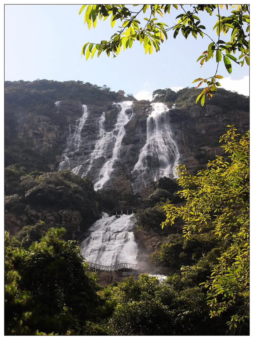
Zengcheng lies about 60 kilometres east of central Guangzhou. It has been a county since the Han dynasty, became a city in 1993 and a district in 2014. Its north is hill and forest country, and the Tropic of Cancer runs through Baishuizhai, a 4A scenic area of primeval woodland, a canyon, a high reservoir lake and the Baishui Fairy Waterfall, with a long stone stairway climbing beside it. Shimen and Nankunshan forest parks lie next door.
Listed sites in Zengcheng
1 site in Zengcheng is on the official lists. Those with a page of their own link to it; the rest open as cards on the map.
- Baishuizhai Scenic Area 白水寨 4A scenic area · on the map
Baishuizhai is a mountain scenic area in Paitan, northern Zengcheng, crossed by the Tropic of Cancer and best known for the Baishui Fairy Waterfall, which drops from a reservoir high on the slope.
Intangible heritage in Zengcheng
1 item on China's national list of intangible cultural heritage is filed for Zengcheng.
- Traditional art: Fruit-stone carving (Guangzhou olive-stone)
Getting to Guangzhou
Train, flight and driving times from the cities most visitors come from, with stations, fares and how many run a day; each opens the full comparison.
- Shenzhen 深圳 high-speed train 29 min, 295 a day, from ¥75
- Hong Kong 香港 high-speed train 47 min, 50 a day, from ¥215; 3 nonstop flights a day, 1 h 20 min in the air
- Guilin 桂林 high-speed train 2 h 4 min, 62 a day, from ¥223
- Haikou 海口 train 11 h 36 min, 5 a day, from ¥164; 20 nonstop flights a day, 1 h 30 min in the air
- Xiamen 厦门 high-speed train 3 h 18 min, 21 a day, from ¥303; 6 nonstop flights a day, 1 h 20 min in the air
- Changsha 长沙 high-speed train 1 h 57 min, 149 a day, from ¥319; 3 nonstop flights a day, 1 h 20 min in the air
- Sanya 三亚 train 16 h 20 min, 2 a day, from ¥232; 11 nonstop flights a day, 1 h 40 min in the air
- Guiyang 贵阳 high-speed train 3 h 26 min, 49 a day, from ¥363; 3 nonstop flights a day, 1 h 40 min in the air
- Wuhan 武汉 high-speed train 3 h 17 min, 98 a day, from ¥553; 9 nonstop flights a day, 1 h 40 min in the air
- Chongqing 重庆 high-speed train 5 h 46 min, 31 a day, from ¥508; 19 nonstop flights a day, 2 h 5 min in the air
- Hangzhou 杭州 high-speed train 5 h 22 min, 15 a day, from ¥713; 34 nonstop flights a day, 2 h in the air
- Kunming 昆明 high-speed train 6 h 40 min, 21 a day, from ¥647; 19 nonstop flights a day, 2 h 35 min in the air
- Nanjing 南京 high-speed train 6 h 9 min, 6 a day, from ¥756; 23 nonstop flights a day, 2 h 10 min in the air
- Shanghai 上海 high-speed train 6 h 14 min, 11 a day, from ¥855; 57 nonstop flights a day, 2 h 35 min in the air
- Beijing 北京 high-speed train 7 h 17 min, 12 a day, from ¥1033; 44 nonstop flights a day, 3 h 25 min in the air
On the map
Open Zengcheng on the illustrated map to see its outline, its places and listed sites together, and to add them to a trip.
Open Zengcheng on the map