 Atlas of China
Hegang 鹤岗Hègǎng
A coal city between two rivers, facing Russia's Jewish Autonomous Oblast
- Type
- City
- Region
- Heilongjiang
- Listed sites
- 77 rated 4A
About Hegang
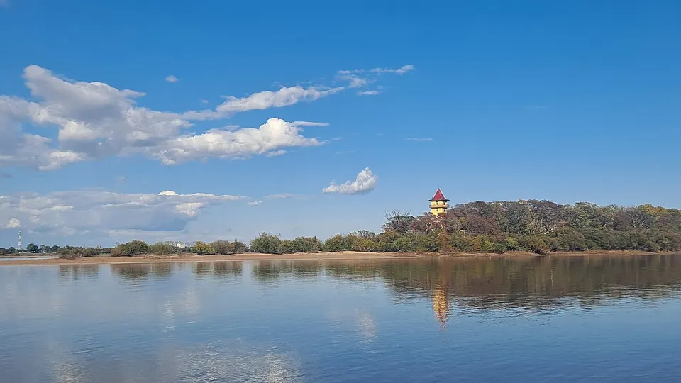
Hegang is a coal-mining city where the Lesser Khingan hills fall away to the Sanjiang Plain, with the Songhua River to the south and the Amur to the north, across from Russia's Jewish Autonomous Oblast. Sightseeing is modest. In Luobei County the Mingshan Scenic Area centres on a wooded island in the Amur and the Taipinggou Scenic Area follows the river's gorges, while in Suibin the Yueyahu Northern Ethnic Park presents the Daur, Oroqen and Hezhe peoples.
Listed sites in Hegang
7 sites in Hegang are on the official lists. Those with a page of their own link to it; the rest open as cards on the map.
- Baoquanling Modern Agriculture Eco-Park 宝泉岭现代农业生态园 4A scenic area · on the map
A farm-tourism park of the Baoquanling branch of the Beidahuang agricultural group, built around solar greenhouses where visitors pick fruit such as cherries, strawberries and dragon fruit. - Hegang National Forest Park 鹤岗森林公园 4A scenic area · on the map
A national forest park in the hills north of Hegang, run by the city forestry bureau and made up of the Xilinhe folk-culture park, the Shilihe ecological scenic area and the Tongzigou stand of old-growth Korean pine. - Mingshan Scenic Area, Luobei 萝北名山景区 4A scenic area · on the map
A riverside scenic area at Mingshan town on the Heilongjiang (Amur) River, centred on the wooded Mingshan Island and a riverside park along the shore. - Qingyuan Lake 清源湖 4A scenic area · on the map
A reservoir-lake scenic area in the Heli River valley west of Hegang, laid out with ten zones in a Nordic style across a core area of 147 hectares inside a wider area of 1,600 hectares. - Songhe West Lake Park 松鹤西湖 4A scenic area · on the map
A lake park of about 300 hectares, 60 of them water, in wooded foothills of the Lesser Khingan west of Hegang, enclosed by hills on three sides and centred on the lake and Feilai Peak. - Taipinggou Scenic Area, Luobei 萝北太平沟景区 4A scenic area · on the map
A scenic area in the Lesser Khingan foothills on the Heilongjiang River, known for the Longjiang Three Gorges (Longmen, Jinlong and Jinman gorges), which visitors see from boats, and the 5 km Xinglong Canyon, about 400 m deep, with forest walkways and a steel lookout tower. - Yueyahu Northern Ethnic Park, Suibin 月牙湖北方民族园 4A scenic area · on the map
A lakeside park of about 84 hectares on the Heilongjiang River plain, part of the 570-hectare Yueyahu (Crescent Lake) National Wetland Park.
On the map
Open Hegang on the illustrated map to see its outline, its places and listed sites together, and to add them to a trip.
Open Hegang on the map