 Atlas of China
Huaihua 怀化Huáihuà
Merchant houses of Hongjiang, Dong drum towers and the home of hybrid rice
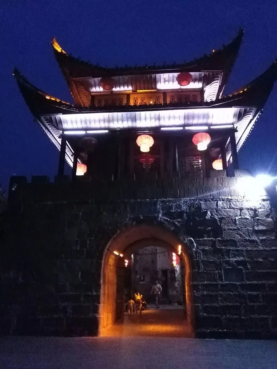
About Huaihua
Huaihua, Hunan's largest prefecture, follows the Yuan River north between the Wuling and Xuefeng mountains, and many of its people are Dong. Hongjiang's old trading town keeps more than 380 temples, banks, shops and inns from the Ming to the Republican era, and the Dong villages of Tongdao have drum towers and roofed bridges. At Zhijiang the Japanese surrender in China was arranged in August 1945, and at the Anjiang Agricultural School Yuan Longping developed hybrid rice.
What to eat in Huaihua
- Jietan tea from Yuanling (碣滩茶)
Listed sites in Huaihua
31 sites in Huaihua are on the official lists. Those with a page of their own link to it; the rest open as cards on the map.
- Anjiang Agricultural School Hybrid Rice Memorial Park 安江农校杂交水稻纪念园 4A scenic area · on the map
The former campus of the Anjiang Agricultural School in Anjiang town, where the rice scientist Yuan Longping taught and did research from 1953 and where his team developed China's three-line hybrid rice system. - Chuanyan Mountain 穿岩山 4A scenic area · on the map
A forested mountain area in Tongxihe town in the Xuefeng Mountains of Xupu County, rated 4A in 2019, with the hilltop Fengxiang Yao village of guesthouses as its main base. - Eryou Mountain 二酉山 4A scenic area · on the map
A hill at the meeting of the You River and the Youxi stream north-west of Yuanling town, tied by legend to the scholar Fu Sheng, who is said to have hidden banned books in a cave here during the Qin book burning; the place became a byword for learning in Chinese. - Feishan Mountain 飞山 4A scenic area · on the map
A 720 m mountain north-west of Jingzhou town whose summit temple honours Yang Zaisi (860–954), a local leader of the Five Dynasties period who styled himself Lord of Feishan and is revered across the Hunan–Guizhou–Guangxi borderlands. - Gaoyi Ancient Village 高椅古村 4A scenic area · National heritage site · on the map
A Dong village in Gaoyi township, Huitong County, ringed by hills on three sides and a river on the fourth, where 104 houses built between 1380 and 1881 survive. - Hongjiang Ancient Commercial Town 洪江古商城 4A scenic area · National heritage site · on the map
An old river port where the Wu River joins the Yuan, which in Ming and Qing times was the main transit point for the produce of south-western Hunan and eastern Guizhou. - Huangdu Dong Culture Village 皇都侗文化村 4A scenic area · on the map
A Dong village in Pingtan township, Tongdao, run as a cultural scenic area, with timber stilt houses, drum towers and covered bridges. - Huangyan Eco-Tourism Area 黄岩生态旅游区 4A scenic area · on the map
A karst upland on the slopes of Liangshan south-east of Huaihua city, at an average altitude of about 850 m, that is a provincial tourist resort and forest park and is promoted as a summer retreat. - Jingping Ancient Village 荆坪古村 4A scenic area · National heritage site · on the map
A village of Ming and Qing brick-and-timber houses on the west bank of the Wu River in Zhongfang County, most of whose residents belong to the Pan clan. - Jiufeng Modern Agricultural Expo Park 九丰现代农博园 4A scenic area · on the map
A modern agricultural park in Hecheng District, Huaihua, that opened in June 2018, built around large climate-controlled show glasshouses growing vegetables, fruit and some 360 unusual varieties. - Longxi Ancient Town 龙溪古镇 4A scenic area · on the map
The old riverside quarter of Longxikou in Xinhuang county town, near the Guizhou border, shaped by Ming and Qing trade on the Wu River, with more than 200 old buildings including a group of historic merchant houses. - Longxing Temple 龙兴讲寺 4A scenic area · National heritage site · on the map
A Buddhist temple on the southern foot of Huxi Hill in Yuanling town, traditionally founded in 628 by order of the Tang emperor Taizong, whose halls preserve building styles from the Song to the Qing and are described as the oldest surviving group of timber buildings in Hunan. - Qianyang Ancient Town 黔阳古城 4A scenic area · National heritage site · on the map
The old walled town of Qiancheng, former seat of Qianyang County, sits where the Wu River meets the Yuan, with water on three sides, and keeps about 0.8 km² of flagstone lanes lined mainly with Ming and Qing buildings. - Simeng Danxia Scenic Area 思蒙碧水丹霞 4A scenic area · on the map
A stretch of the Xu River at Simeng, west of Xupu county town, where red Danxia sandstone cliffs and peaks rise above the water, a landscape locally nicknamed little Guilin. - Su Yu's Hometown 粟裕故里 4A scenic area · on the map
The home village of Su Yu (1907–1984), a leading Communist military commander who later served as Chief of the PLA General Staff and held the rank of Senior General; he was born into a Dong family in Fengmushujiao village, now part of Pingcun town. - Teng Daiyuan Memorial Hall 滕代远纪念馆 4A scenic area · on the map
A memorial hall by the Jin River in Mayang county town to Teng Daiyuan (1904–1974), a Miao native of Mayang who was one of the leaders of the Pingjiang Uprising, a senior Red Army political commissar and later the first Minister of Railways of the People's Republic. - Tongdao Conference Site (Gongcheng Academy) 通道转兵纪念地 4A scenic area · National heritage site · on the map
Gongcheng Academy in Xianxi town was founded in 1105 as the Luomeng Academy and rebuilt by Dong craftsmen in 1792, and is one of the more complete academies surviving in a Dong area. - Wanfo Mountain 万佛山 4A scenic area · on the map
A Danxia landscape of red sandstone peaks, cliffs and forest in Wanfoshan town, Tongdao, whose main summit rises to 635 m; together with nearby Dong villages it became a national scenic area in 2009. - Yutou Dong Village 芋头侗寨 4A scenic area · National heritage site · on the map
A Dong village in Shuangjiang town founded in the Hongwu reign of the early Ming and rebuilt after a fire in the Shunzhi reign of the Qing, its seven clusters of houses strung along the Yutou stream. - Zhijiang Surrender Memorial 芷江受降旧址 4A scenic area · National heritage site
The site in Qiliqiao village outside Zhijiang town where, on 21 August 1945, a Japanese delegation led by Major General Takeo Imai received the Chinese terms for the surrender of Japan's forces in China, the first step towards the formal surrender ceremony in Nanjing that September. - Baiyi Temple 白衣观 National heritage site · on the map
A Taoist temple of 1759 in Boyang town, western Tongdao, also called the Qianqiu White Pagoda and described as the only Taoist temple in the Dong region. - Chongshi Academy, Xupu 溆浦崇实书院 National heritage site · on the map
A Qing-dynasty clan academy in the old village of Yanban, Longtan town, founded in 1834 as the Yanling family school of the Wu clan and renamed Chongshi Academy in 1855. - Former Residence of Xiang Jingyu 向警予故居 National heritage site · on the map
An early Qing courtyard house of pine and fir timber in Xupu county town where Xiang Jingyu (1895–1928), an early leader of the Chinese Communist Party and of its women's movement, was born. - Gaomiao Archaeological Site 高庙遗址 National heritage site · on the map
A Neolithic shell-midden site on a terrace of the Yuan River opposite Anjiang town, whose lower layers of about 7,800 to 6,600 years ago define the Gaomiao culture, known for white pottery stamped with phoenix-bird, fanged beast-face and eight-pointed star designs and for large ritual remains. - Matian Drum Tower 马田鼓楼 National heritage site · on the map
A Dong drum tower in Matian village, Pingyang township, in the far south of Tongdao, first built in the Shunzhi reign of the early Qing and restored in 1984. - Pingtan River Covered Bridges 坪坦风雨桥 National heritage site · on the map
Nine Dong covered bridges with long timber galleries span the Pingtan River in Pingtan township and Longcheng town; they were built between 1755 and 1853, and most were repaired in the 20th century. - Site of the Chenzhou Missionary Case 辰州教案发生地 National heritage site · on the map
A group of Western-style church and mission buildings on Malu Lane in Yuanling town, where two British missionaries of the China Inland Mission were killed in August 1902 after rumours during an epidemic accused them of poisoning, an affair known as the Chenzhou Missionary Case. - West Hunan Bandit Suppression Memorial Park 湘西剿匪胜利纪念园 National heritage site · on the map
The national heritage unit for the 1949–1952 campaign in which the PLA's 47th Army fought armed bandit groups across western Hunan has two parts: the 47th Army headquarters building in Yuanling town and the memorial hall in Victory Park on the high ground of old Chenxi town. - Xuefeng Mountain War of Resistance Sites 湘西雪峰山抗战旧址 National heritage site · on the map
A national heritage unit made up of sites from the Battle of West Hunan, fought around the Xuefeng Mountains from April to June 1945 when Japanese forces advanced towards the Zhijiang airfield and were driven back, spread over Xupu and Chenxi counties in Huaihua and Dongkou County in Shaoyang. - Zhijiang Confucian Temple 芷江文庙 National heritage site · on the map
The former Confucian temple of Yuanzhou prefecture on Xiaobei Street in Zhijiang town, moved to its present site in 1859 and built in 1862–63. - Zhijiang Tianhou Temple 芷江天后宫 National heritage site · on the map
A temple to the sea goddess Mazu on Jiangxi Street in Zhijiang town, first built in the Kangxi reign and enlarged in 1748 by Fujian merchants as their guild hall; it is described as the largest surviving Mazu temple in inland China.
On the map
Open Huaihua on the illustrated map to see its outline, its places and listed sites together, and to add them to a trip.
Open Huaihua on the map