
 An illustrated travel map
Horinger 和林格尔Hélíngé’ěr
Shengle, the Tuoba capital of the 4th century, and Mengniu's dairy country
- Type
- County
- City
- Hohhot
- Region
- Inner Mongolia
- Listed sites
- 55 rated 4A · 1 national heritage
- Intangible heritage
- 1 item on the national list1 UNESCO element
About Horinger
Horinger lies south of Hohhot. Its history is at Shengle, the 4th-century capital of the Xianbei-led Dai state and the first capital of the Northern Wei, whose ruins at Tuchengzi are now an archaeological park about 40 kilometres from Hohhot. The county is also dairy country, with the Mengniu Industrial Tourism Area, and has grassland and hill parks such as the Mengcao Grass Expo Park and Nanshan Scenic Area.
Listed sites in Horinger
5 sites in Horinger are on the official lists. Those with a page of their own link to it; the rest open as cards on the map.
- Mengcao Grass Expo Park 蒙草·草博园 4A scenic area · on the map
Mengcao Grass Expo Park is a plant-themed park run by the grassland-ecology company Mengcao in the Horinger New Area, showing native grassland plants. - Mengniu Industrial Tourism Area 蒙牛工业旅游区 4A scenic area · on the map
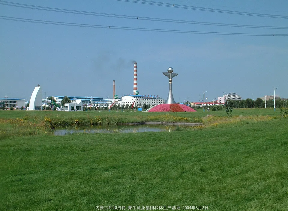
Mengniu Industrial Tourism Area is a dairy-industry visit at the Mengniu company's base in Horinger's dairy development zone, open to visitors since 2007 and named a national industrial tourism demonstration base in November 2022. - Nanshan Scenic Area, Horinger 南山旅游景区 4A scenic area · on the map
A landscaped hill park of about 5 sq km on the southern edge of Horinger, laid out from 2000 with themes drawn from the culture of Shengle, an early capital of the Northern Wei dynasty. - Saiwai Taoyuan Eco-tourism Area 塞外桃园 4A scenic area · on the map
Saiwai Taoyuan is a farm-based leisure area in Xindianzi town, in the south-east of Horinger County, which the county government describes as a green organic-farming tourism area. - Tuchengzi Archaeological Park (Shengle Ancient City) 土城子考古遗址公园 4A scenic area · National heritage site · on the map
Tuchengzi is regarded as the largest ancient city site on the north bank of the Yellow River's great bend, a walled city used from the Spring and Autumn period to the Yuan dynasty and identified with Shengle, the first capital of the Northern Wei.
Intangible heritage in Horinger
1 item on China's national list of intangible cultural heritage is filed for Horinger. Part of UNESCO's lists: Chinese paper-cut.
- Traditional art: Paper-cut (Horinger) UNESCO
Getting to Hohhot
Train, flight and driving times from the cities most visitors come from, with stations, fares and how many run a day; each opens the full comparison.
- Datong 大同 high-speed train 1 h 17 min, 25 a day, from ¥98
On the map
Open Horinger on the illustrated map to see its outline, its places and listed sites together, and to add them to a trip.
Open Horinger on the map