 Atlas of China
Hulunbuir 呼伦贝尔Hūlúnbèi’ěr
Open grassland, birch forest and China's only reindeer herders
- Type
- City
- Region
- Inner Mongolia
- Seat
- Hailar
- Featured places
- 1
- Listed sites
- 221 rated 5A · 17 rated 4A · 5 national heritage
About Hulunbuir
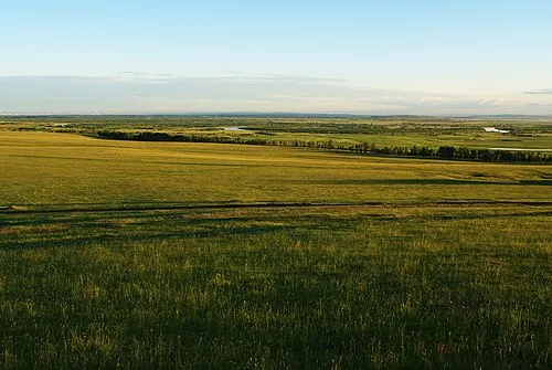
Hulunbuir fills the far north-east of Inner Mongolia, from the open Hulunbuir Grassland and Hulun Lake, the region's largest lake, to the larch and birch forests of the Greater Khingan range. Barag Mongols, Daur, Oroqen and Evenki live here, the Evenki of Aoluguya being the only people in China who herd reindeer, and Russian-descended families around Enhe still bake lieba bread. The rail and road port of Manzhouli adds Matryoshka Square.
What to eat in Hulunbuir
- Russian lieba bread (俄罗斯族列巴)
- Buryat buns (布里亚特包子)
- Barag hot-stone goat (呼伦贝尔包山羊)
Featured places in Hulunbuir
-
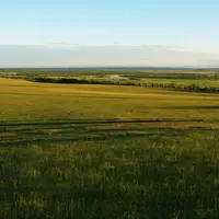
Hulunbuir Grassland 呼伦贝尔大草原
Summer grassland to the horizon, looping rivers and yurts near the Russian border
Listed sites in Hulunbuir
22 sites in Hulunbuir are on the official lists. Those with a page of their own link to it; the rest open as cards on the map.
- Manzhouli National Gate and Matryoshka Square 满洲里中俄边境旅游区 5A scenic area · on the map
Manzhouli is China's largest land port, and this 5A-rated zone takes in two of its best-known sights. - Aoluguya Reindeer Tribe 敖鲁古雅使鹿部落 4A scenic area · on the map
This scenic area beside Genhe presents the culture of the Aoluguya Ewenki, the only group in China that herds reindeer, who moved out of the forest into a settled township in 2003. - Barag Mongol Tribe Tourist Area 巴尔虎蒙古部落 4A scenic area · on the map
A folk-custom park and ger camp on the Hulunbuir grassland, named after the Barag Mongols, whom the Qing court settled in Hulunbuir in the 1730s. - Busuli Military Culture Area 布苏里北疆军事文化旅游区 4A scenic area · on the map
A former military logistics reserve base in the Greater Khingan forest of the Oroqen Autonomous Banner, now presented as a military-themed visitor area. - China Daur Ethnic Park 中国达斡尔民族园 4A scenic area · on the map
A newly built park beside Nirji, the seat of Morin Dawa Daur Autonomous Banner, themed on the history, culture and customs of the Daur people, one of China's recognised ethnic minorities. - Ergun National Wetland Park 额尔古纳国家湿地公园 4A scenic area · on the map
A river-wetland park in the Shangkuli area north-east of Ergun city, opened to visitors in 2018 and covering about 120 sq km, of which roughly 10 sq km is open to the public. - Ergun Wetland Scenic Area 额尔古纳湿地景区 4A scenic area · on the map
A hilltop viewing area on the edge of Ergun city, overlooking the winding channels of the wetland along the Genhe River and the town's blue and pink roofs. - Ergun White Birch Forest 额尔古纳白桦林 4A scenic area · on the map
A single-species stand of native white birch north of Ergun city, laid out with an elevated timber walkway and four themed zones for sightseeing and photography. - Gaxian Cave and Tuoba Xianbei Park 嘎仙洞 4A scenic area · National heritage site · on the map
Gaxian Cave is a granite cave in the forests of the northern Greater Khingan range whose west wall carries a 201-character inscription cut in 443 on the orders of the Northern Wei emperor Tuoba Tao, recording a prayer at the Tuoba Xianbei ancestral home; archaeologists identified it in 1980. - Genheyuan National Wetland Park 根河源国家湿地公园 4A scenic area · on the map
A national wetland park around the upper Genhe River in the Greater Khingan forest, where forest, marsh, river and lake habitats are interlaced across about 590 sq km, of which roughly 200 sq km is wetland. - Hohnuur Scenic Area 呼和诺尔景区 4A scenic area · on the map
A ger-camp resort on the shore of Hohnuur, a lake in the Chen Barag grassland, with about 4 sq km of steppe and 12 sq km of water inside the scenic area. - Honghuaerji Mongolian Pine National Forest Park 红花尔基樟子松国家森林公园 4A scenic area · on the map
A forest park of about 67 sq km on the southern edge of the Hulunbuir sands, protecting a large continuous belt of Mongolian pine, an evergreen conifer suited to sandy soil. - Hulun Lake 呼伦湖 4A scenic area
Hulun Lake, also called Dalai Lake, is the largest lake in Inner Mongolia and one of the largest freshwater lakes in China, covering about 2,300 sq km at the western end of the Hulunbuir grassland. - Jinlongshan Ski Resort, Zalantun 扎兰屯金龙山 4A scenic area · on the map
A ski and leisure resort in the hills north-west of Zalantun, with 18 pistes graded from beginner to advanced, a U-shaped snowboard halfpipe and an aerials course used by national ski teams for training. - Moerdaoga National Forest Park 莫尔道嘎国家森林公园 4A scenic area · on the map
Moerdaoga was the first national forest park in the Inner Mongolia part of the Greater Khingan range, covering cold-temperate forest of larch and birch that turns orange and yellow in autumn. - World Anti-Fascist War Memorial Park, Hailar 世界反法西斯战争海拉尔纪念园 4A scenic area · on the map
The park occupies Beishan hill on the northern edge of Hailar, where the Japanese Kwantung Army built a large underground fortress between 1934 and 1937. - Wulan Mountain, Ergun 额尔古纳乌兰山 4A scenic area · on the map
A hill scenic area of 4.7 sq km on open grassland in Heishantou town, with viewing platforms on the hill. - Zhalainur Mammoth Park 扎赉诺尔猛犸公园 4A scenic area · on the map
A landscaped park in the new town of Zhalainur District, centred on a large group of mammoth sculptures set among lakes and paths. - Bayanwula City Ruins 巴彦乌拉城址 National heritage site · on the map
The ramparts of a large square walled town of the Yuan period stand in open steppe in the south of the Ewenki Autonomous Banner. - Chinese Eastern Railway Buildings, Zalantun 扎兰屯中东铁路建筑群 National heritage site · on the map
Zalantun grew around a station of the Russian-built Chinese Eastern Railway, and the town keeps a large group of buildings from that period, protected as part of the national-level Chinese Eastern Railway complex. - Haotetaohai City Ruins 浩特陶海城址 National heritage site · on the map
The earthen ramparts of a rectangular walled town of the Liao period stand on open grassland at the edge of a village in Chen Barag Banner. - Heishantou City Ruins 黑山头城址 National heritage site · on the map
The earthen ramparts of a walled town of the Jin and Yuan periods survive on a terrace in the grassland near Heishantou, a large enclosure with a smaller walled compound at its centre.
Getting to Hulunbuir
Train, flight and driving times from the cities most visitors come from, with stations, fares and how many run a day; each opens the full comparison.
On the map
Open Hulunbuir on the illustrated map to see its outline, its places and listed sites together, and to add them to a trip.
Open Hulunbuir on the map