
 An illustrated travel map
Xuyi 盱眙Xūyí
A Huai River and Hongze Lake county holding the Ming founder's ancestral tomb
About Xuyi
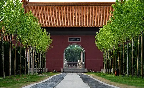
Xuyi lies where the Huai River runs into the west side of Hongze Lake, on the border with Anhui, and is noted for its crayfish. The Ming Ancestors Mausoleum, begun under the Hongwu emperor to honour his forebears, was swallowed by the lake from the 1680s and re-emerged in the 1960s. The map also lists Diyishan with its inscriptions and Tieshan Temple National Forest Park.
What to eat in Xuyi
- Xuyi crayfish (盱眙龙虾)
Listed sites in Xuyi
4 sites in Xuyi are on the official lists. Those with a page of their own link to it; the rest open as cards on the map.
- Diyishan (First Mountain) and its Inscriptions 第一山 4A scenic area · National heritage site · on the map
A wooded hill above the Huai River in the north of Xuyi town, named after the Song calligrapher Mi Fu, who climbed it in 1097 on his way to a post in Lianshui and wrote a poem calling it the "First Mountain"; a later copy of his three characters stands by the entrance. - Huanghuatang New Fourth Army Headquarters Site 黄花塘新四军军部旧址 4A scenic area · National heritage site · on the map
Huanghuatang village in southern Xuyi County was the seat of the New Fourth Army's headquarters from early 1943 to early 1945, during the later years of the war against Japan. - Ming Ancestors Mausoleum 明祖陵 4A scenic area · National heritage site
The first imperial tomb of the Ming dynasty, built from 1386 to about 1413 by the Hongwu Emperor and his son the Yongle Emperor beside Hongze Lake for the founder's grandfather, great-grandfather and great-great-grandfather; only the grandfather is actually buried here. - Tieshan Temple National Forest Park 铁山寺国家森林公园 4A scenic area · on the map
A forested area of low hills, up to about 200 m, in the far south of Xuyi County on the Anhui border, around the 9 km² Tianquan Lake reservoir.
On the map
Open Xuyi on the illustrated map to see its outline, its places and listed sites together, and to add them to a trip.
Open Xuyi on the map