 Atlas of China
Lianyungang 连云港Liányúngǎng
The Monkey King's mountain, Han cliff carvings and Jiangsu's largest island
About Lianyungang
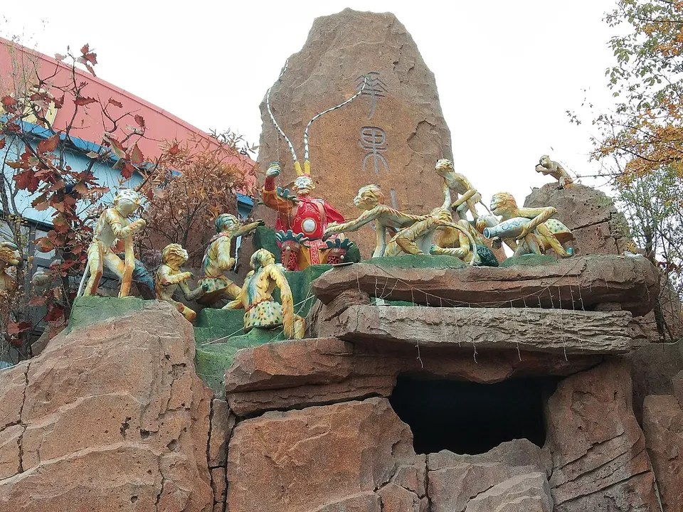
Lianyungang is a Yellow Sea port at the northern end of Jiangsu's coast, named after Lian Island, the province's largest, and the Yuntai Mountains, its highest peaks. Mount Huaguo in the Yuntai range is the place most often identified as the Flower and Fruit Mountain where the Monkey King is born in Journey to the West. At Kongwang Mountain, more than a hundred figures carved into the rock in the late Eastern Han mix Taoist and early Buddhist imagery.
Listed sites in Lianyungang
17 sites in Lianyungang are on the official lists. Those with a page of their own link to it; the rest open as cards on the map.
- Lian Island 连岛 5A scenic area · National heritage site
Jiangsu's largest island, joined to the mainland at Lianyungang port by a long sea wall, with wooded hills, the sandy Dashawan beach and the quieter Sumawan bay linked by a seaside boardwalk. - Mount Huaguo 花果山 5A scenic area · National heritage site
The mountain that the novel Journey to the West made the home of the Monkey King, now a scenic area of 136 peaks crowned by Yunü Peak, at 624.4 m the highest point in Jiangsu. - Chaohe Bay, Guanyun 潮河湾 4A scenic area · on the map
A rural leisure area on a reed-fringed stretch of water east of Guanyun county town, with an eco-restaurant, a fishing centre and a campervan and camping base. - Dayi Mountain, Guanyun 大伊山 4A scenic area · National heritage site · on the map
A cluster of twelve low peaks, the highest 226.7 m, on the northern edge of Guanyun county town, with the centuries-old Stone Buddha Temple (Shifo Si), a large bronze seated Buddha completed in 2009 and old rock carvings such as a Yuan-dynasty sika deer. - Donghai Crystal City and Crystal Museum 东海水晶城·水晶博物馆 4A scenic area · on the map
The crystal quarter of Donghai, a county that brands itself the 'World Crystal Capital' because of its large deposits of rock crystal and quartz. - Erlang Shen Cultural Park, Guannan 二郎神文化遗迹公园 4A scenic area · on the map
A temple park on the northern outskirts of Guannan county town devoted to Erlang Shen, the river-taming god of Chinese myth whom Journey to the West places at the mouth of the Guan River, a name the town links with its own Guan River. - Haishang Yuntai Mountain 海上云台山 4A scenic area · on the map
A forested mountain area in the coastal Yuntai hills above Sucheng, in Lianyun district, whose summit viewpoints look over Lianyungang port and Lian Island. - Kongwang Mountain 孔望山 4A scenic area · National heritage site · on the map
A small hill on the southern edge of Haizhou, Lianyungang's old town, named after the story that Confucius climbed it to look out to sea. - Lianyungang Museum 连云港市博物馆 4A scenic area · on the map
The city's main museum, a national first-grade museum that presents the history and culture of the Lianyungang area. - Lianyungang Revolutionary Memorial Hall 连云港市革命纪念馆 4A scenic area · on the map
A museum of the Lianyungang area's modern revolutionary history, including the War of Resistance against Japan, told through photographs and objects. - Qinshan Island 秦山岛 4A scenic area · on the map
A narrow islet of about 0.19 km² in the sea off Ganyu, roughly a kilometre long with three low peaks along its ridge. - Tanggou Distillery, Guannan 汤沟酒生态文化旅游区 4A scenic area · on the map
A visitor area at the working distillery of Tanggou baijiu, a strong-aroma liquor made in Tanggou town, where the old workshops were merged into one state distillery in 1952. - Taohuajian and the General Cliff Petroglyphs 桃花涧·将军崖岩画 4A scenic area · National heritage site
A wooded valley on the southern slopes of Jinping Mountain, south-west of Haizhou, with a stream, pools and paths up to a summit viewpoint; its western part holds the General Cliff petroglyphs. - Xishuang Lake, Donghai 西双湖 4A scenic area · on the map
A reservoir on the south-western edge of Donghai county town, built in 1960 on the Yuejin River, whose shores are now laid out as the Xishuang Lake National Wetland Park. - Yiyuan Park, Guanyun 伊园 4A scenic area · on the map
A leisure park east of Guanyun county town built around large flower fields and a fairy-tale-style small town, with children's play areas and themed restaurants. - Yuwan Scenic Area 渔湾 4A scenic area · on the map
A steep valley in the Yuntai Mountains east of Mount Huaguo, where a stream drops through a chain of waterfalls and pools, known as the Three Pools, between cliffs and woods that turn red and gold in late autumn. - Haiqing Temple Pagoda 海清寺塔 National heritage site · on the map
A nine-storey octagonal brick pagoda built between 1023 and 1031 under the Northern Song, the only survivor of Haiqing Temple, which has since disappeared.
On the map
Open Lianyungang on the illustrated map to see its outline, its places and listed sites together, and to add them to a trip.
Open Lianyungang on the map