 Atlas of China
Zhongwei 中卫Zhōngwèi
Sand dunes on the Yellow River, a temple of three faiths and goji country
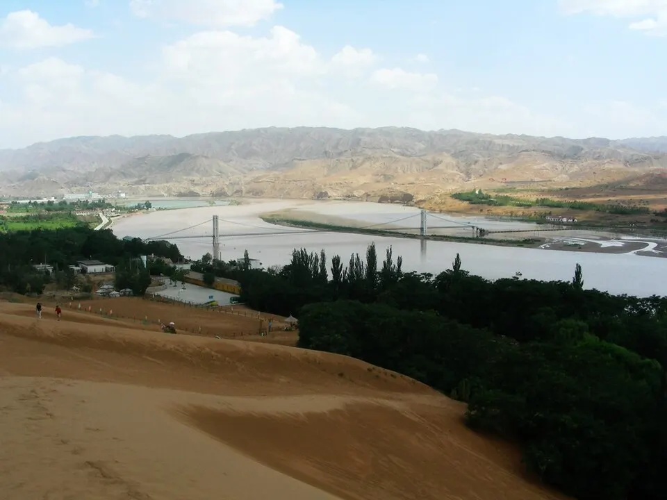
About Zhongwei
Zhongwei lies where the Yellow River begins its great loop north, with the dunes of the Tengger Desert along its northern edge. Most visitors come for Shapotou, where the desert meets the river, and for Gao Temple, which stacks Buddhist, Taoist and Confucian halls on its terraces. Downstream, Zhongning County was named China's 'home of goji' by the State Council, while in the southern hills Haiyuan County was struck by the 1920 earthquake, one of the deadliest in China's history.
What to eat in Zhongwei
- Zhongning sand-sage noodles (中宁蒿子面)
Featured places in Zhongwei
-
Shapotou 沙坡头
Where the dunes of the Tengger Desert tumble down to the Yellow River
Listed sites in Zhongwei
7 sites in Zhongwei are on the official lists. Those with a page of their own link to it; the rest open as cards on the map.
- Sikouzi Scenic Area 寺口子 4A scenic area · on the map
A gorge scenic area of about 18 km² in the hills south of Xuanhe town, known in ancient times as Beihai. - Tengger Desert Wetland – Jinsha Island 腾格里沙漠湿地·金沙岛 4A scenic area · on the map
A wetland leisure area on the south-eastern edge of the Tengger Desert, where a chain of lakes and reed beds meets the dunes, with an island in the main lake. - Damaidi Rock Art 大麦地岩画 National heritage site · on the map
A dense field of rock carvings in the Weining Northern Mountains north of Zhongwei, where thousands of panels with roughly 8,000 individual figures have been recorded in a core area of about 6 km², showing hunting, herding, animals and sun and moon symbols. - Gao Temple, Zhongwei 中卫高庙 National heritage site
A temple complex in central Zhongwei that brings Buddhist, Taoist and Confucian halls together on terraces rising from the gate to a three-storey main tower 29 m high. - Liuzhou City Ruins (Tiandu Fort) 柳州城址 National heritage site · on the map
The rammed-earth walls of Tiandu, a Northern Song frontier fort later taken by the Western Xia, who are thought to have based their Tiandu military command here; it was abandoned in 1749, when a new town was built a few kilometres to the east on the site of present-day Haiyuan. - Mingshazhou Pagoda 鸣沙洲塔 National heritage site · on the map
An eleven-storey octagonal brick pagoda in Anqing Temple at Mingsha town, on the south bank of the Yellow River in Zhongning County. - Qiying Beizui City Ruins 七营北嘴城址 National heritage site · on the map
The rammed-earth walls of a frontier town founded in the Sui dynasty, made the seat of Xiaoguan county under the Tang and garrisoned until the late Ming, at Beizui village near Qiying.
On the map
Open Zhongwei on the illustrated map to see its outline, its places and listed sites together, and to add them to a trip.
Open Zhongwei on the map