 Atlas of China
Changzhi 长治Chángzhì
Rare Five Dynasties timber in the hills and a Taihang canyon of 3,400 ravines
About Changzhi
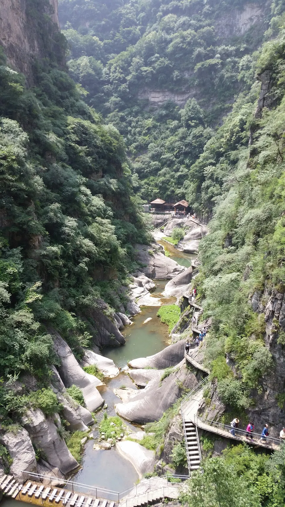
Changzhi, anciently Shangdang, lies in a basin where Shanxi meets Hebei and Henan, and its interest is mostly rural. In the hills of Pingshun County, Dayun Temple keeps a hall and pagoda of the Five Dynasties, a period from which few buildings survive in China, and in the city the Lu'an Prefecture City God Temple is the highest-ranking and best preserved in south-east Shanxi. In eastern Huguan County, the Taihang Grand Canyon, a national geopark, has more than 3,400 ravines and gorges.
What to eat in Changzhi
- Huguan lamb soup (壶关羊汤)
- Zhangzi stir-fried flatbread (长子炒饼)
Featured places in Changzhi
-
Taihang Grand Canyon 太行山大峡谷
Sheer gorges in the Taihang Mountains, explored by boat, cliff path and cable car
Listed sites in Changzhi
87 listed sites are in Changzhi. These are the 16 rated 5A or 4A; see all 87 in the Shanxi list.
- Baolingshan Scenic Area 宝灵山 4A scenic area · on the map
A religious and forest-leisure scenic area at the foot of Longhu Mountain in Qinyuan County, built since 2002 by a local coal and coke group. - Danquan Town, Licheng 丹泉小镇 4A scenic area · on the map
A mountain-valley leisure resort developed since 2021 around Yuanquan village in Xijing town, Licheng County, beside the Taihang Number One scenic road. - Eighth Route Army Cultural Park 八路军文化园 4A scenic area · on the map
A themed park between Phoenix Hill and the Mamu River in Wuxiang, built to recreate the wartime life and campaigns of the Eighth Route Army through hands-on, high-technology displays. - Eighth Route Army Headquarters Sites 八路军总司令部旧址 4A scenic area · National heritage site · on the map
Three former headquarters of the Eighth Route Army in the Taihang Mountains: Beicun in Lucheng District, used from October 1938 to July 1939, and Zhuanbi and Wangjiayu in Wuxiang, used between 1939 and 1942. - Happy Taihang Valley 欢乐太行谷 4A scenic area · on the map
A large leisure complex in Huguan County, east of Changzhi, that combines an amusement park, a water park (Jingwei Water World), an aquarium, a children's area, a hot-spring hotel and a farm. - Huangyadong Arms Factory Site 黄崖洞 4A scenic area · National heritage site · on the map
A gorge in the northern Taihang Mountains where the Eighth Route Army built an arms factory in the early 1940s, which Changzhi Daily calls its earliest and largest; the name comes from a natural cave in the cliff, about 30 m above the valley floor, that was used for storing weapons. - Lu Xun Art School Site at Xiabeizhang 鲁迅艺术学校下北漳旧址 4A scenic area · on the map
A wartime site in Xiabeizhang village, where teachers and students of the Lu Xun Art School's front-line branch and other wartime cultural groups worked in 1940. - Taihang Dragon Cave 太行龙洞 4A scenic area · on the map
A karst cave in Shiquan village in Panlong town, east of Wuxiang, with four levels and more than 2,000 m of passages, of which three levels are open. - Taihang Memorial Museum of the Eighth Route Army 八路军太行纪念馆 4A scenic area
A national first-class museum on the Eighth Route Army's war of resistance against Japan, opened in 1988 at the foot of Phoenix Hill in Wuxiang and enlarged in 2005. - Taihang Water Town (Chibi Xuanliu Gorge) 太行水乡·赤壁悬流 4A scenic area · on the map
A 12 km stretch of the Zhuozhang River gorge in the Taihang foothills of Pingshun County, named after 'Chibi Xuanliu' (red cliffs and hanging streams), one of the old 'eight sights' of the Taihang. - Tianji Mountain 天脊山 4A scenic area · on the map
A mountain scenic area in the Taihang Mountains of eastern Pingshun County, near Yanglaoyan village in Dongsitou township, which borders Henan, with streams, pools and waterfalls running in its valleys through the year. - Tongtian Gorge 通天峡 4A scenic area · on the map
A gorge scenic area of about 65 sq km in south-eastern Pingshun County, in Hongtiguan and Dongsitou townships, which is also a national geopark. - Xi'er River Scenic Area 洗耳河 4A scenic area · on the map
A mountain and river-valley scenic area of about 30 sq km in the Taihang Mountains of northern Licheng County, rising to Wuzhi Mountain at about 1,500 m. - Xiantang Mountain 仙堂山 4A scenic area · on the map
Xiantang Mountain is a scenic area in the hills north-east of Xiangyuan, centred on Xiantang Temple, a Buddhist temple traced to the Eastern Jin whose group of Ming and Qing buildings has been a provincial-level protected monument since 1996. - Zhangze Lake Wetland Park 漳泽湖国家城市湿地公园 4A scenic area · on the map
A landscaped wetland park on the edge of Zhangze Reservoir, which Changzhi promotes as the 'Taihang Heavenly Pond', on the north-western side of the city. - Zhenxing Town, Shangdang 振兴小镇 4A scenic area · on the map
A rural-tourism complex built around Zhenxing village in Shangdang District, mixing family attractions with local folk culture.
On the map
Open Changzhi on the illustrated map to see its outline, its places and listed sites together, and to add them to a trip.
Open Changzhi on the map