 Atlas of China
Nyingchi 林芝Línzhī
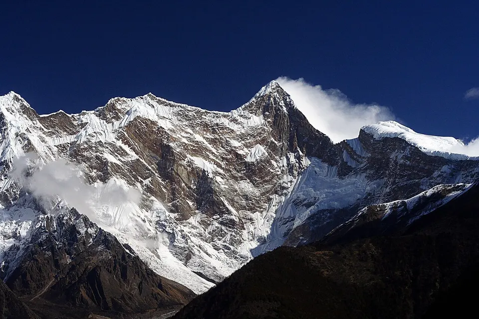
Forested gorges below Namcha Barwa, a mountain lake and spring peach blossom
About Nyingchi
Nyingchi is Tibet's forested south-east, where the Yarlung Tsangpo swings around Namcha Barwa (7,782 metres) into the Yarlung Tsangpo Grand Canyon. Basum Tso, a long lake ringed by snow peaks, has a small temple on an island, and the G318 runs on past the meadows of Lulang to the Midui Glacier, whose tongue reaches almost to the village fields. Downstream at Medog the river loops around the Guoguotang Great Bend, and in spring peach blossom colours the villages around Galang Lake and Pai.
What to eat in Nyingchi
- Lulang stone-pot chicken (鲁朗石锅鸡)
Listed sites in Nyingchi
11 sites in Nyingchi are on the official lists. Those with a page of their own link to it; the rest open as cards on the map.
- Basum Tso 巴松措 5A scenic area
Basum Tso (Draksum Tso in Tibetan) is a long glacier-dammed lake in a deep valley of the upper Ba River in Gongbo'gyamda County, ringed by snow peaks and forest, and was Tibet's first natural-landscape 5A scenic area. - Yarlung Tsangpo Grand Canyon 雅鲁藏布大峡谷 5A scenic area · on the map
The 5A scenic area at Pai, in Mainling, covers the upper entrance of the Yarlung Tsangpo Grand Canyon, where the river turns into the deep gorge that wraps around the peak of Namcha Barwa. - Cuomujiri Lake 措木及日 4A scenic area · on the map
Cuomujiri, whose Tibetan name is usually translated as 'fairy's tears', is an old moraine-dammed lake in a forested valley just north of Bayi, with snow peaks behind it. - Cypress King Garden 世界柏树王园林 4A scenic area · on the map
This park protects a grove of giant Tibetan cypresses (Cupressus gigantea) at Baji village beside the G318, just south-east of Bayi. - Galang Lake 嘎朗湖 4A scenic area · on the map
Galang Lake, about 2 km² in area, lies in the Galang National Wetland Park beside Galang village, at the mouth of the Bodui peach-blossom valley in Bomê County. - Guoguotang Great Bend 果果塘 4A scenic area · on the map
At Guoguotang, about 12 km from Medog town, the Yarlung Tsangpo swings through a tight horseshoe bend around a forested spur, seen from viewing platforms above the river. - Kading Valley 卡定沟 4A scenic area · on the map
Kading Valley is a steep, forested side gorge off the Nyang River valley north-west of Bayi, known for the Tianfo ('Heavenly Buddha') waterfall that drops down its cliffs. - Linze Scenic Area 林则 4A scenic area · on the map
Linze village in Gongbo'gyamda County is home to several thousand wild Tibetan macaques that live in the surrounding forest and come down to meet visitors, who may feed them under staff guidance. - Lulang 鲁朗 4A scenic area · on the map
Lulang is a high valley of meadows, streams and spruce forest at about 3,300 m on the G318 east of the Sejila pass, often wrapped in cloud. - Midui Glacier 米堆冰川 4A scenic area · on the map
Midui Glacier flows down from the mountains above Midui village in Bomê County, where two great icefalls merge with a strip of forest between them, at the meeting of the Nyenchen Tanglha and Boshula ranges. - Red Building of the Zamu Central County Committee 波密红楼 4A scenic area · National heritage site · on the map
Known locally as the Bomê Red Building, this two-storey Soviet-style building of stone and timber in the Bomê county government compound was built in 1953 as an office of the Kham–Tibet Highway administration and from 1955 housed the Zamu Central County Committee of the Communist Party.
On the map
Open Nyingchi on the illustrated map to see its outline, its places and listed sites together, and to add them to a trip.
Open Nyingchi on the map