 Atlas of China
Liulihe Bridge 琉璃河大桥Liúlíhé Dàqiáo
National heritage site · Beijing, Beijing
- Time needed
- Under an hour
- Days to budget
- Half a day
- City
- Beijing
- Region
- Beijing
- Type
- Heritage
- Listed as
- National heritage site
About Liulihe Bridge
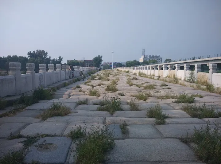
A Ming stone arch bridge over the Liuli River on the old main road south from Beijing, ordered by the Yongle Emperor in 1418 and rebuilt in 1539–1546. Among Beijing's old stone bridges only the Marco Polo Bridge is larger; its eleven arches carry carved beast heads and long rows of stone balustrades, and it has carried no traffic since a new road bridge opened beside it in 1999.
How to get to Liulihe Bridge
On the north side of Liulihe town in southern Fangshan District, about 45 km south-west of central Beijing, roughly an hour by road; the Liulihe Yan capital site is about 3 km away.
Nearby
- Zhoukoudian Peking Man Site 周口店北京人遗址 10 km
Limestone caves on Dragon Bone Hill where the fossils of Peking Man were found - Marco Polo Bridge 卢沟桥 30 km
An 800-year-old stone bridge lined with hundreds of carved lions, by a walled Ming fort - Tanzhe Temple 潭柘寺 30 km
Terraced temple courtyards in the western hills, shaded by ancient ginkgos and cypresses - Temple of Heaven 天坛 50 km
Where emperors prayed for harvests, and where Beijing now dances, sings and plays cards - Fragrant Hills Park 香山公园 50 km
Wooded former imperial hills that turn red with smoke-tree leaves each autumn
Also within 20 km: Liulihe Yan Capital Site 琉璃河遗址 (under 10 km), Xiahuliang Bridge 下胡良桥 (under 10 km), Yongji Bridge, Zhuozhou 永济桥 (10 km), Zhuozhou Twin Pagodas 涿州双塔 (10 km), Yong'an Temple Pagoda 永安寺塔 (10 km), Jinmen Floodgates 金门闸 (20 km).
On the map
Open Liulihe Bridge on the illustrated map to see the terrain around it and what else is close, and to add it to a trip.
Open Liulihe Bridge on the map