
 An illustrated travel map
Mount Dabajian 大霸尖山Dàbàjiān Shān
Hsinchu, Taiwan
- Time needed
- 3 days
- Days to budget
- 3 days
- City
- Hsinchu
- Region
- Taiwan
- Type
- Nature
About Mount Dabajian
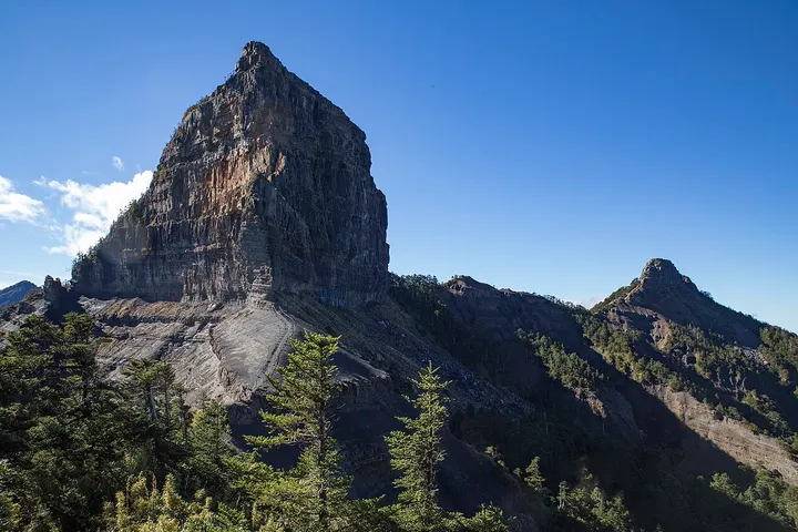
A 3,492 m peak in the northern Snow Mountain Range, inside Shei-Pa National Park, with a sheer, barrel-like summit. It is sacred to the Atayal and Saisiyat peoples and, with Central Range Point and Dafen Peak, counts as one of Taiwan's three pointed peaks. From the trailhead it is a long walk, usually done as a three-day trip there and back.
How to get to Mount Dabajian
Reached from Guanwu, about 16 km east-south-east of it in a straight line: about 20 km of forest road to the Mala River trailhead, then roughly 10 km on foot. A hiking permit is required, and road and trail conditions change after storms, so check before going.
Nearby
- Taroko Gorge 太鲁阁峡谷 50 km
A marble canyon cut by the Liwu River, with many trails still shut after the 2024 quake
Also within 20 km: Shei-Pa National Park 雪霸国家公园 (under 10 km), Taoshan Waterfall 桃山瀑布 (under 10 km), Wuling National Forest Recreation Area 武陵国家森林游乐区 (under 10 km), Siyuan Pass 思源垭口 (10 km), Wuling Farm 武陵农场 (10 km), Guanwu National Forest Recreation Area 观雾国家森林游乐区 (20 km).
On the map
Open Mount Dabajian on the illustrated map to see the terrain around it and what else is close, and to add it to a trip.
Open Mount Dabajian on the map