 Atlas of China
Mount Langshan 崀山Làng Shān
5A scenic area · Shaoyang, Hunan
- Time needed
- 1–2 days
- Days to budget
- 1½ days
- City
- Shaoyang
- Region
- Hunan
- Type
- Nature
- Listed as
- 5A scenic area
About Mount Langshan
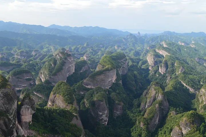
A 108 km² area of red Danxia sandstone in Xinning County, with flat-topped mesas, free-standing pillars and walls of rock, sheer red cliffs and narrow slot canyons above the clear Fuyi River. It is one of the six areas inscribed together as the China Danxia World Heritage Site in 2010, and its zones include Bajiaozhai, Lajiao (Chilli) Peak, the narrow Tianyi Xiang passage, the Fuyi River, Zixiadong and Tianshengqiao.
How to get to Mount Langshan
South of Xinning county town; the northern edge of the area is about 11 km away, with buses and taxis from the town.
Nearby
Also within 20 km: Bajiaozhai 八角寨 (10 km).
On the map
Open Mount Langshan on the illustrated map to see the terrain around it and what else is close, and to add it to a trip.
Open Mount Langshan on the map