 Atlas of China
Nalati Grassland 那拉提草原Nàlātí Cǎoyuán
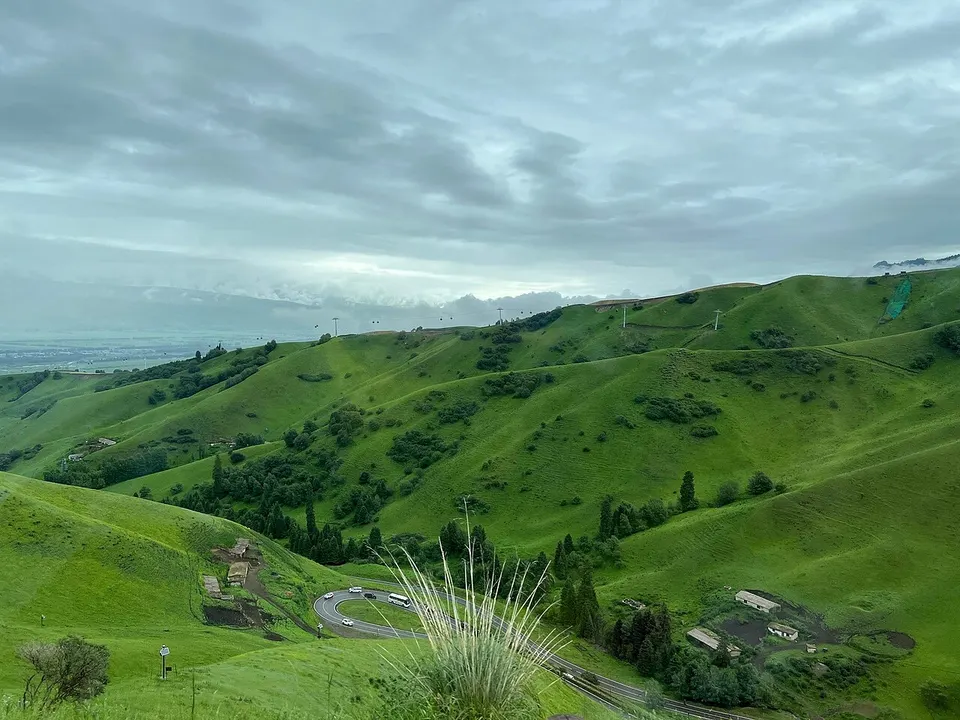
A green plateau meadow where Kazakh herders ride beneath spruce slopes
- Best time
- Jun–Sep
- Time needed
- 1–2 days
- Days to budget
- 1½ days
- Stay in
- Xinyuan
- Region
- Xinjiang
- Type
- Nature
- Listed as
- 5A scenic area
Why go to Nalati Grassland
Mountain grassland, spruce forest and river valleys at the eastern end of the Ili valley in the heart of the Tianshan, with a planned area of about 1,840 km² and an average altitude of about 1,800 m. Tourism here began in the 1980s, and the developed part links some 27 viewpoints by scenic roads, with home visits to herding families, hiking, photography and stargazing camps among the activities. The scenic area lies close to the Duku Highway, a popular mountain drive across the Tianshan.
The story
The name is said to be Mongolian for 'the place where the sun is seen first'. Local legend has Genghis Khan's weary soldiers crossing a cold pass and shouting 'Nalati' when the green meadow opened below them.
What to see at Nalati Grassland
- Tianjietai 天界台: A viewpoint stop at the start of the Sky Grassland line, where a boardwalk climbs for a sweeping outlook over the plateau meadow.
- Nomad Homes 游牧人家: A settlement of Kazakh felt yurts at the end of the Sky Grassland line, where you can visit herding families and ride horses.
- Gongnaisi River valley 巩乃斯河谷: The Valley Grassland line follows the river through meadow and spruce forest and suits easy walks and photography, particularly in autumn.
- Panlong Valley Road 盘龙谷道: A newer mountain-road sightseeing route with its own shuttle line and viewpoints over the valley, quieter than the Sky Grassland.
- Taiwusani 塔吾萨尼: A Kazakh name meaning 'beautiful gorge', listed among the grassland's main sights.
How to visit Nalati Grassland
There are three main routes, each with its own shuttle line from the visitor centre. The Sky Grassland line climbs to the plateau, calling at Tianjietai and ending at Nomad Homes, and takes roughly 40 minutes each way. The Valley Grassland line follows the Gongnaisi River on a shorter ride, and the Panlong Valley Road is a longer mountain loop. A single day covers the Sky Grassland plus the valley; add a second for Panlong Valley Road, a walk or a ride.
How to get to Nalati Grassland
The scenic area is by Nalati town in Xinyuan County, about an hour by road from Xinyuan town; Xinyuan is roughly 2–3 hours by bus or car from Yining. Xinyuan Nalati Airport, about 60 km from the scenic area, mainly serves visitors, so check current flights.
Where to stay
Nalati town beside the scenic area has guesthouses and resorts, and some yurt and camp stays operate on the grassland itself. Xinyuan town is a quieter base about an hour away, and Yining offers the widest choice.
What to eat
- Narin 纳仁: A Kazakh dish of hand-cut noodles in lamb broth, topped with meat and often smoked horse sausage.
- Smoked horse sausage 熏马肠: A Kazakh speciality of cured horse meat, steamed and sliced thin, found in Kazakh restaurants and yurt camps.
- Hand-grabbed lamb 手抓肉: Boiled lamb on the bone, served in yurt camps and restaurants in Nalati and Xinyuan.
Tips for visiting Nalati Grassland
- Self-drivers must reserve a real-name entry pass through the scenic area's official mini-programme, and the daily quota has been replaced by dynamic control, so check what is available before you go; carry your passport.
- Weather swings from hot sun to cold wind in a day, so bring layers, sun protection and a rain jacket; the grassland sits at about 1,800 m and the upper plateau reaches about 2,200 m.
- Sightseeing shuttle lines run mainly in the warm season and some wind down in late autumn, while winter activity centres on skiing, so confirm which lines are running; stay on marked paths and horse trails, as it is easy to get lost off them.
On the map
Open Nalati Grassland on the illustrated map to see the terrain around it, what else is close, and to add it to a trip and plan the days.
Open Nalati Grassland on the map