 Atlas of China
Xinjiang 新疆Xīnjiāng
Desert oases, alpine lakes and Silk Road bazaars in China's far west
- Type
- Autonomous region
- Capital
- Ürümqi
- Featured places
- 7
- Cities and prefectures
- 24
- Listed sites
- 23313 rated 5A · 149 rated 4A · 93 national heritage
About Xinjiang
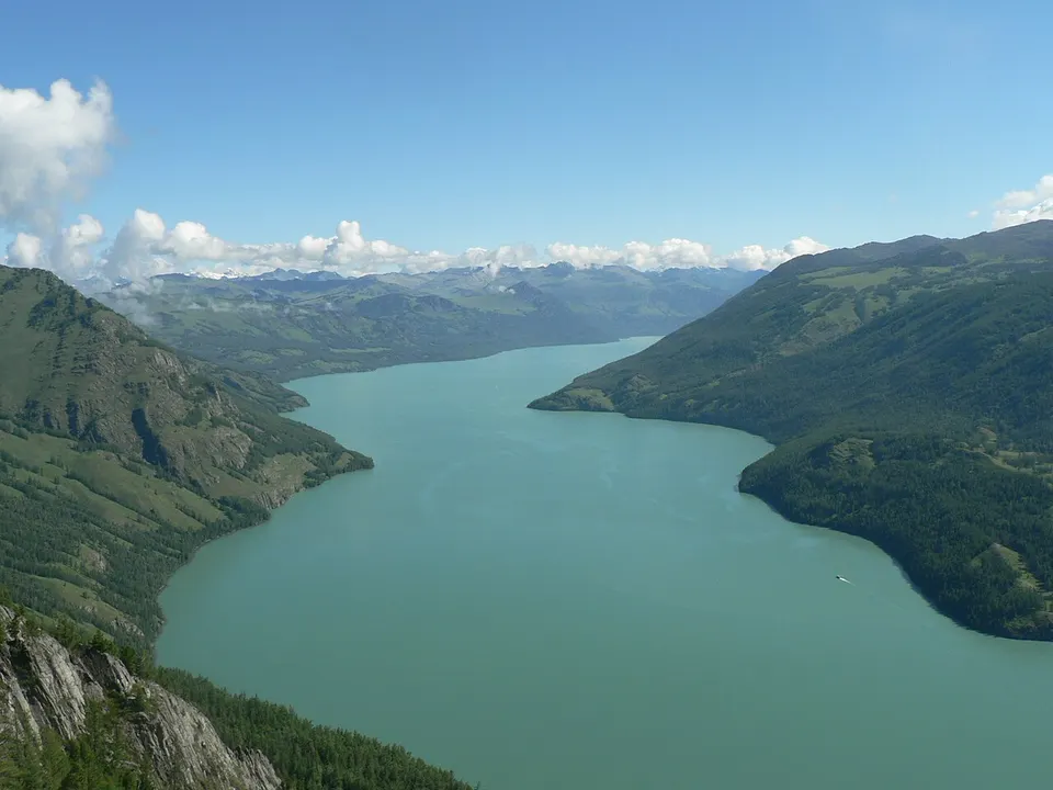
Xinjiang is China's largest region, a land of deserts and oases ringed by the Tian Shan, Kunlun and Altai mountains. Silk Road towns such as Kashgar and Turpan grew up around bazaars, airy grape-drying houses and underground karez channels that carry snowmelt to the fields, and Uyghur, Kazakh, Hui, Kyrgyz and other communities give the region a strongly Central Asian character. In the north, summer wildflower meadows surround alpine lakes such as Sayram and Kanas.
Xinjiang at a glance
- Area
- 1,664,897 km²
- Population
- 25.9 million 2020
- Highest point
- K2 乔戈里峰8,611 m
Area, population and highest point from Wikidata; the population is the latest census or official estimate there.
What to eat in Xinjiang
- Lamb kebabs (羊肉串)
- Polo pilaf (手抓饭)
- Big plate chicken (大盘鸡)
Places to visit in Xinjiang
-
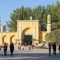
Kashgar Old City 喀什古城
A Silk Road crossroads of mud-brick lanes, bazaars and the Id Kah Mosque
-
Kanas Lake 喀纳斯湖
A milky-turquoise lake in the Altai forests that turns gold each autumn
-
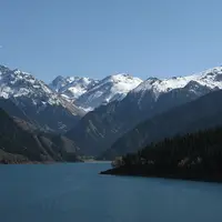
Heavenly Lake of Tianshan 天山天池
An alpine lake beneath snowy Bogda Peak, a day trip from Ürümqi
-
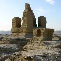
Turpan & Jiaohe Ruins 吐鲁番交河故城
A 2,000-year-old city carved out of a river island, in China's hottest basin
-
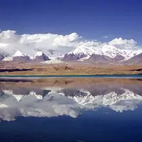
Karakul Lake & Karakoram Highway 喀拉库勒湖
A still, high lake mirroring Muztagh Ata on the road to Pakistan
-
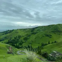
Nalati Grassland 那拉提草原
A green plateau meadow where Kazakh herders ride beneath spruce slopes
-
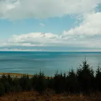
Sayram Lake 赛里木湖
Xinjiang's largest, highest alpine lake, ringed by steppe and ancient tombs
Listed sites in Xinjiang
233 sites in Xinjiang are on the official lists, 13 of them rated 5A and 93 protected as national heritage. They are listed by city, with what each is and how to get there.
All 233 listed sites in XinjiangCities and prefectures of Xinjiang
- Aksu 阿克苏 Prefecture
Kucha's painted caves, red-rock canyons and the Tian Shan's highest peak - Altay 阿勒泰 Prefecture
Birch woods, Kazakh pastures and the young Irtysh below the Altai - Aral 阿拉尔 County-level City
A Bingtuan city where three rivers meet to form the Tarim - Bayingolin 巴音郭楞 Mongol Autonomous Prefecture · Korla
Swan wetlands, Xinjiang's largest lake and the ruins of the Lop desert - Beitun 北屯 County-level City
A Bingtuan town on the Irtysh, the corps' northernmost settlement - Bortala 博尔塔拉 Mongol Autonomous Prefecture · Bole
Sayram Lake high in the Tian Shan, and the windy Dzungarian Gate - Changji 昌吉 Hui Autonomous Prefecture
Heavenly Lake, rolling wheat hills and the ruins of Beiting - Hami 哈密 City
Melons sent as tribute, a princes' mausoleum and grassland over the Tian Shan - Hotan 和田 Prefecture
Kunlun jade, Uyghur courtyards and the desert ruins of ancient Khotan - Huyanghe 胡杨河 County-level City
A new Bingtuan city on the Chepaizi farmland north of Wusu - Ili 伊犁 Kazakh Autonomous Prefecture · Yining
Summer pastures, lavender fields and Xibe towns in a green valley - Karamay 克拉玛依 City
An oil city named after black seeps, beside a wind-carved 'Ghost City' - Kashgar 喀什 Prefecture
Bazaars, mosques and the road over the Pamirs at the Silk Road's western hub - Kizilsu 克孜勒苏 Kyrgyz Autonomous Prefecture · Artux
Kyrgyz yurts below Pamir glaciers, and the fig orchards of Artux - Kokdala 可克达拉 County-level City
Ili valley farmland where the song 'Night on the Grassland' was born - Kunyu 昆玉 County-level City
Bingtuan farms between the Kunlun and the Taklamakan - Shihezi 石河子 County-level City
A tree-lined grid city laid out by army farmers in the 1950s - Shuanghe 双河 County-level City
A Bingtuan farming city named after the Bortala and Jing rivers - Tacheng 塔城 Prefecture
A frontier trading town, spring flowers and the birthplace of big plate chicken - Tiemenguan 铁门关 County-level City
A Bingtuan city named after the Iron Gate Pass above Korla - Tumxuk 图木舒克 County-level City
A young Bingtuan city with desert wetlands and a Tang hill fort - Turpan 吐鲁番 City
Vineyards, underground channels and Silk Road ruins below sea level - Ürümqi 乌鲁木齐 City
Xinjiang's capital, with spruce-forest mountains on its doorstep - Wujiaqu 五家渠 County-level City
A Bingtuan farming city on the plain north of Ürümqi
Before you go
- Visas and visa-free entry Can I visit China without a visa?
- Paying for things How do I pay for things in China without a Chinese bank account?
- Internet and apps Will Google and my other apps work in China?
- Trains and 12306 How do I book train tickets in China with a foreign passport?
- Book popular sights early Which sights in China need booking in advance, and how?
- When to go When is the best time to visit China?
On the map
Open Xinjiang on the illustrated map to see where its places sit, how far apart they are, and to add them to a trip.
Open Xinjiang on the map