 Atlas of China
Bengbu 蚌埠Bèngbù
A railway town on the Huai with signs scratched on pottery over 7,000 years ago
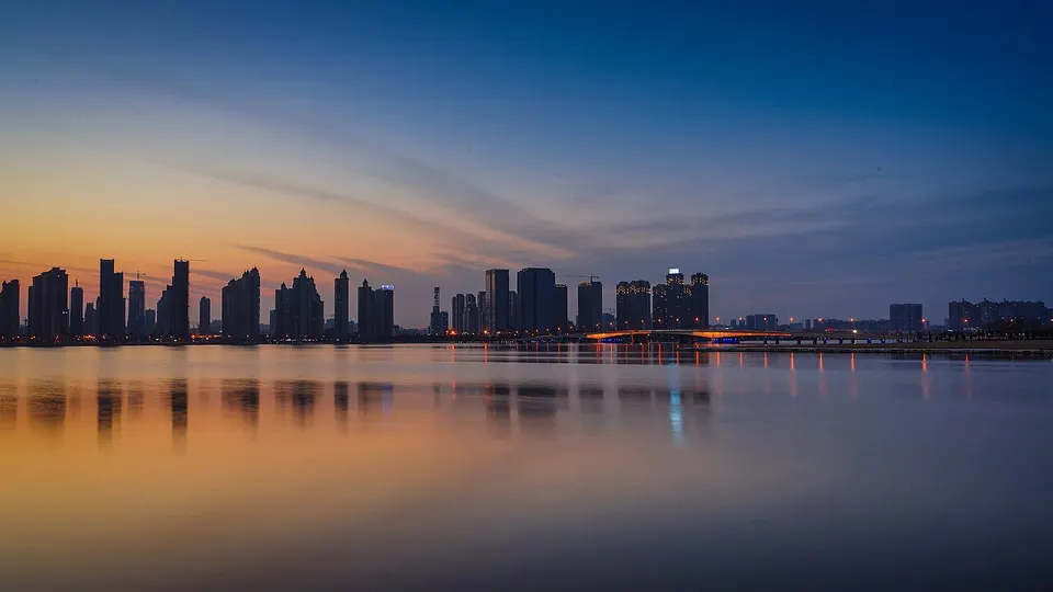
About Bengbu
Bengbu means 'clam wharf', after the pearl-bearing mussels once gathered from the Huai River, and it grew so fast after the Tianjin–Pukou Railway arrived that it is still called 'the city the train brought'. Its deeper past lies just outside town: the Shuangdun Site has yielded more than 600 signs incised on pottery some 7,300 years old, the Yuhui Village Site is linked by tradition to Yu the Great's gathering of the lords at Mount Tu, and the Gaixia Site to Xiang Yu's final defeat.
What to eat in Bengbu
- River mussels with glass noodles (河蚌烧粉丝)
- Shaobing with pork tenderloin (烧饼夹里脊)
Listed sites in Bengbu
9 sites in Bengbu are on the official lists. Those with a page of their own link to it; the rest open as cards on the map.
- Bengbu Museum 蚌埠市博物馆 4A scenic area · on the map
Bengbu's city museum, a national first-grade museum, which moved in 2015 into a large new building on the west side of Citizens' Square whose design evokes Yu the Great cutting through the mountains to channel the Huai. - Gaixia Site 垓下遗址 4A scenic area · National heritage site · on the map
An earth-walled settlement on the south bank of the Tuo River, known locally as Bawang Cheng (the Hegemon-King's City); excavations since 2007 have dated its walls to about 4,600 years ago, in the Dawenkou culture, and the county presents it as the oldest walled town found in Anhui. - Hequan Farm 禾泉农庄 4A scenic area · on the map
A farm-based leisure park on the western outskirts of Bengbu, founded in 2001, that mixes seasonal flower fields and fruit picking with restaurants, a hotel and guesthouses, children's rides and a row of workshops where sesame oil, vinegar and dendrobium liquor are made in front of visitors. - Longzi Lake 龙子湖 4A scenic area · on the map
A long, shallow lake on the eastern side of Bengbu, ringed by low hills and now enclosed by the growing city. - Zhanggong Mountain Park 张公山公园 4A scenic area · on the map
A city park of about 110 hectares in western Bengbu, made up of Zhanggong Shan, a 71-metre hill, and the lake beside it. - Guo River First Bridge, Huaiyuan 涡河一桥 National heritage site · on the map
A granite stone-arch road bridge across the Guo River at the foot of Gui Shan on the western edge of Huaiyuan town, begun in 1959 and, after a pause in construction, opened to traffic at the end of 1964, when it was the longest bridge on the Bengbu–Fuyang road. - Old Bengbu Huai River Railway Bridge 蚌埠淮河铁路老桥 National heritage site
A steel truss railway bridge across the Huai River at Bengbu, completed in May 1911 for the Tianjin–Pukou Railway; its opening turned Bengbu from a small market town into a railway city. - Shuangdun Site 双墩遗址 National heritage site · on the map
A Neolithic settlement of more than 7,000 years ago in Xiaobengbu town north of the Huai River, type site of the Shuangdun culture, whose pottery bears over 600 incised signs showing animals, plants and daily life. - Yuhui Village Site 禹会村遗址 National heritage site · on the map
A Longshan-culture site of 4,400–4,100 years ago at the southern foot of Mount Tu, on the east bank of the Huai River, named after the tradition that Yu the Great gathered the lords at Tushan.
On the map
Open Bengbu on the illustrated map to see its outline, its places and listed sites together, and to add them to a trip.
Open Bengbu on the map