 Atlas of China
Ningde 宁德Níngdé
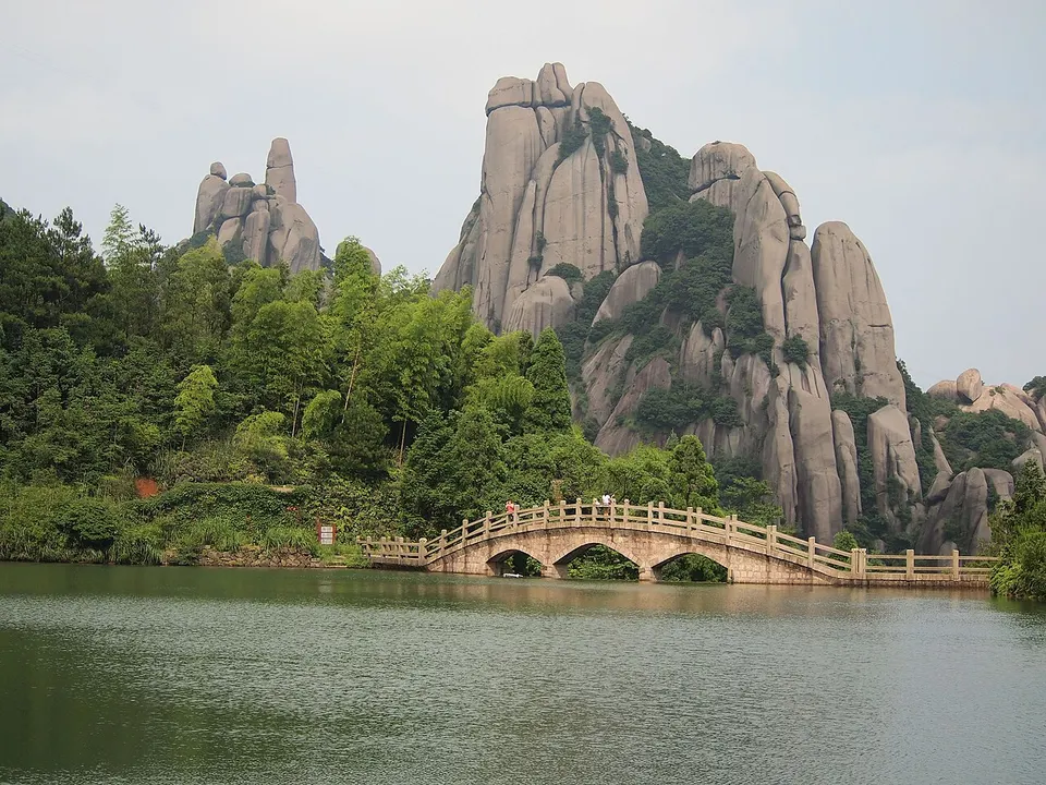
Granite pinnacles above the sea, roofed timber bridges and Fuding white tea
About Ningde
Ningde is Fujian's north-eastern corner, a coast of bays and islands backed by wooded uplands, and one of the main homes of China's She people. South of Fuding, a centre of white tea, the weathered granite peaks of Mount Taimu rise above the sea; inland at Pingnan, visitors wade across Baishuiyang, where a stream spreads thinly over a flat bedrock riverbed. Timber arch bridges roofed with galleries span mountain streams, among them the rebuilt Wan'an Bridge, and Xiapu's tidal flats draw photographers.
What to eat in Ningde
- Fuding meat slices (福鼎肉片)
- Silver Needle white tea (白毫银针)
Listed sites in Ningde
18 sites in Ningde are on the official lists. Those with a page of their own link to it; the rest open as cards on the map.
- Baishuiyang and Yuanyang Stream 白水洋·鸳鸯溪 5A scenic area
A crescent-shaped scenic area of about 66 km² in Pingnan county, built around volcanic-rock gorges and the Baishuiyang 'shallow-water square', a flat bedrock riverbed across which the stream spreads in an even sheet that visitors can wade through. - Mount Taimu 太姥山 5A scenic area
A granite mountain rising above the sea south of Fuding, long the sanctuary of the local goddess Taimu Niangniang and, from the Tang dynasty on, a centre of Buddhism with many temples on and around it. - Baiyun Mountain, Fu'an 福安白云山 4A scenic area · on the map
A mountain scenic area of about 67 km² north-west of Fu'an and part of the Ningde UNESCO Global Geopark, known for its volcanic-rock mountain scenery. - Cuiping Lake 翠屏湖 4A scenic area · on the map
The reservoir of the Gutian River hydropower scheme, formed when the dam's sluices closed in June 1959, drowning the old county town of Gutian, which had been the county seat for more than a thousand years, and displacing more than 36,000 people. - Jiulongji Waterfalls and Carp Stream 鲤鱼溪·九龙漈 4A scenic area · on the map
This 4A area joins two places near Zhouning town that together form a 13.5 km² national scenic area within the Ningde UNESCO Global Geopark. - Niulanggang Coast 牛郎岗 4A scenic area · on the map
A seaside scenic area on the Fuding coast south-east of Mount Taimu, with a flat, clean sandy beach backed by green hills and sea-worn rocks given names such as Mandarin Duck Reef, the Weaving Maid's Cave and a narrow sea cleft. - Yuanyang Meadow 鸳鸯草场 4A scenic area · on the map
An upland grassland on the hills of Dongyuan township, Zherong, promoted as 'the Hulunbuir of the south' for its rolling open meadows, and rated 4A in 2022. - Baiheling Ancient Road 白鹤岭古道 National heritage site · on the map
A stone-stepped official road built in 1225–27 under Ding Daquan, then registrar of Ningde county, as part of the overland route between Fuzhou and Wenzhou; it climbs from the old west gate of Ningde over the hills towards Luoyuan. - Baofeng Silver Mine Site 宝丰银矿遗址 National heritage site · on the map
Remains of a state silver mine worked from the 1080s until it was finally closed in 1510, at its height among the largest silver mines of Song China, around Shengyinlou Mountain in south-western Zhouning. - Fengqi Wu Family Mansion 凤岐吴氏大宅 National heritage site · on the map
The largest old house in Zherong county and the only building in the hamlet of Fengqi in Zhayang township, so that the house and the village are one: a Wu family mansion of the Qianlong and Jiaqing reigns (1736–1820) whose walled core, outbuildings and terraces cover some 14,000 m². - Guanyinting Fort 观音亭寨 National heritage site
A Buddhist shrine on the old post road at Banling, a She ethnic village in Shuimen township, first built in 1369, restored in 1791 and enclosed by a wall in 1863 against the Golden Coin Society uprising, which turned it into a small fort whose gate examination candidates bound for the capital passed through. - Huang Ancestral Hall, Fu'an 福安黄氏祠堂 National heritage site · on the map
The ancestral hall of the Huang clan in Huangcuo Lane, Yangxia village, now on the edge of Fu'an city, founded in the late Song and rebuilt in 1694 on a plot of about 2,500 m². - Huotong (Huang Ju) Irrigation System 霍童灌溉工程 National heritage site
An irrigation system on both banks of the Huotong Stream at Huotong town, begun by the Sui official Huang Ju around 618 and still watering farmland today. - Jixia Village 漈下村 National heritage site · on the map
An old village in a mountain basin in Gantang township, Pingnan, where two streams meet below rows of timber houses built along the water; it is the ancestral home of the Qing general Gan Guobao and a national historic and cultural village. - Lingong Zhongping Wang Ancestral Temple 林公忠平王祖殿 National heritage site
The ancestral temple of Lin Gong (Lin Zugen), a Song-dynasty healer from Fu'an who was deified after ridding the district of wild animals and epidemics, in Shanyang village, Makeng township. - Linshui Palace, Gutian 古田临水宫 National heritage site
The founding temple of Chen Jinggu, Lady Linshui, a protective goddess of women, children and childbirth worshipped across Fujian, Taiwan and South-East Asia, in Daqiao town, Gutian. - Shifeng Temple 狮峰寺 National heritage site · on the map
A Buddhist temple at the foot of Lion Peak in Baizhuyang village, Xibing town, founded in 892 and moved down from the summit in the Yongle reign of the Ming. - Wan'an Bridge 万安桥 National heritage site · on the map
Pingnan's Wan'an Bridge, 98.2 m long and described as the longest timber-arch covered bridge in China, is the best known of the covered bridges of north-eastern Fujian listed together as a national heritage unit.
On the map
Open Ningde on the illustrated map to see its outline, its places and listed sites together, and to add them to a trip.
Open Ningde on the map