 Atlas of China
Wuwei 武威Wǔwēi
The Flying Horse's tomb, a Ming Confucian temple and a bilingual Tangut stele
About Wuwei
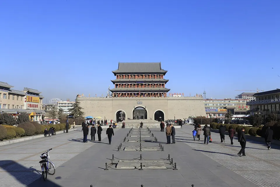
Wuwei, the old Liangzhou at the eastern end of the Hexi Corridor, was capital of several Liang kingdoms in the 4th and 5th centuries, and in 1969 a Han tomb at Leitai yielded the Bronze Galloping Horse, later China's tourism emblem. Facing one of north-west China's largest Confucian temples, a museum holds the Western Xia Stele of 1094, and Baita Temple marks Sakya Pandita's meeting with the Mongol prince Köden in 1247. Tiantishan's early Buddhist caves overlook a reservoir in the Qilian foothills.
What to eat in Wuwei
- Wuwei mianpizi (武威面皮子)
Listed sites in Wuwei
14 sites in Wuwei are on the official lists. Those with a page of their own link to it; the rest open as cards on the map.
- Baita Temple Site and Liangzhou Assembly Memorial Hall 凉州白塔寺 4A scenic area · National heritage site · on the map
The site of a Yuan-period Buddhist monastery at Wunan, south-east of Wuwei, where in 1247 Sakya Pandita, head of the Sakya school of Tibetan Buddhism, met the Mongol prince Köden (Godan), a grandson of Genghis Khan who held Liangzhou as his appanage. - Binggou River Scenic Area 冰沟河 4A scenic area · on the map
A mountain valley at the eastern end of the Qilian range in the Tianzhu Tibetan Autonomous County, named after its glacier-fed river, with alpine meadows grazed by white yaks, conifer forest and wild iris grassland. - Gulang Battle Memorial Hall 古浪战役纪念馆 4A scenic area · on the map
A memorial park in the south-west of Gulang town on the battlefield of November 1936, when the Western Route Army of the Chinese Red Army fought the forces of the Ma clique around Gulang during its advance west along the Hexi Corridor. - Leitai Han Tomb 雷台汉墓 4A scenic area · National heritage site
A brick tomb of the late Eastern Han with front, middle and rear chambers, found in 1969 under Leitai, an earthen terrace topped by a Ming Taoist temple in northern Wuwei; it yielded more than 230 objects, among them a procession of bronze horses, chariots and figures and the Bronze Galloping Horse (Flying Horse of Gansu), later chosen as China's tourism emblem. - Shajing Culture Folk Museum and Village 沙井文化民俗旅游区 4A scenic area · on the map
A village folk-culture centre in a former school at Xintao, Sanlei, built around a museum set up by local villagers, said to be the largest privately run folk museum in Gansu, with thousands of objects of rural life and several hundred pottery, stone and bone finds of the Shajing culture, the early first-millennium BC culture named after a site in Minqin. - Shenzhou Desert Wildlife Park 神州荒漠野生动物园 4A scenic area · on the map
A wildlife park on the desert edge east of Wuwei that specialises in desert animals of north-west China, notably Przewalski's horses, Tibetan wild asses and wild Bactrian camels, alongside zoo species such as golden snub-nosed monkeys, African lions, brown bears and Amur tigers. - Suwu Desert Scenic Area 苏武沙漠 4A scenic area · on the map
A desert leisure area on the southern edge of the Tengger Desert near Minqin, named after Su Wu, the Han envoy of the famous sheep-herding exile story, whom local tradition links with Minqin. - Tiantishan Caves 天梯山石窟 4A scenic area · National heritage site
Among the earliest Buddhist cave temples in China, cut into cliffs above the Huangyang River in the Qilian foothills from the time of the Northern Liang ruler Juqu Mengxun in the early fifth century and reworked up to the Qing; 19 caves survive in three tiers. - Wuwei Confucius Temple 武威文庙 4A scenic area · National heritage site
Built in 1437–1439 and enlarged up to the Republican era, this is one of the largest Confucian temples in north-west China, laid out in three courts side by side: the Wenchang Palace to the east, the temple proper with its semicircular pool, Lingxing Gate, Dacheng Hall and Zunjing Library in the middle, and the old Confucian school to the west, with more than 30 steles from the Tang to the Qing. - Wuwei Desert Park 武威沙漠公园 4A scenic area · on the map
A desert-themed park on the desert edge east of Wuwei, billed as the first in China built around desert scenery, that mixes sand dunes with planted woodland, grassland and landscaped gardens across more than 530 hectares. - Dongda Monastery, Tianzhu 东大寺 National heritage site · on the map
A Tibetan Buddhist monastery at Saishisi in southern Tianzhu, nearly 400 years old, whose Tibetan name means 'great monastery of the Datong'; its buildings blend Han Chinese and Tibetan styles and it was once a leading monastery of the Tibetan Huarui area. - Haizang Temple 海藏寺 National heritage site · on the map
A Buddhist temple on the north-western edge of Wuwei whose surviving halls and painted beams date from the Ming to the Republican era, set among pines and cypresses several centuries old, many of them protected trees. - Ruian Fort 瑞安堡 National heritage site
A fortified manor begun in 1938 at Santao village south-west of Minqin, where a landowner's family compound sits inside high rammed-earth walls with honeycomb battlements; it is one of the best-preserved fortified farmsteads in north-west China, nicknamed the 'Palace Museum beyond the frontier'. - Shengrong Temple, Minqin 圣容寺 National heritage site · on the map
A Buddhist temple in Minqin whose surviving buildings date from the Ming dynasty to the Republican period, listed as a national heritage site in 2013.
On the map
Open Wuwei on the illustrated map to see its outline, its places and listed sites together, and to add them to a trip.
Open Wuwei on the map