 Atlas of China
Guilin 桂林Guìlín
Limestone towers, slow river boats and hillsides carved into rice terraces
- Type
- City
- Region
- Guangxi
- Featured places
- 2
- Listed sites
- 532 rated 5A · 39 rated 4A · 16 national heritage
About Guilin
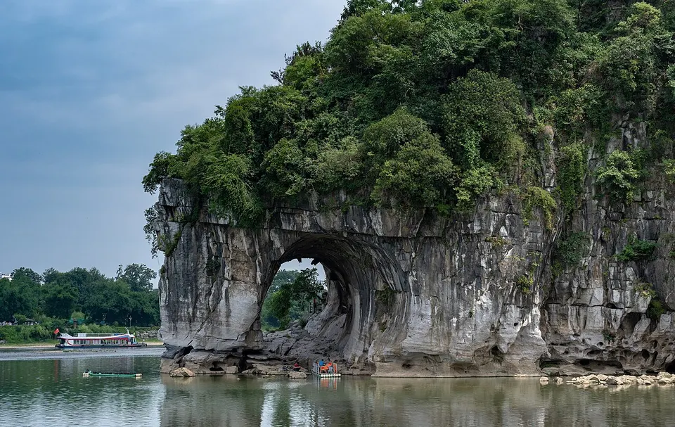
Guilin's karst peaks, praised by poets since the Tang dynasty, line the Li River for 83 km downstream to Yangshuo, a town ringed by limestone towers. In the city, Elephant Trunk Hill seems to drink from the river, and a Ming princes' palace, begun in 1372, stands beneath Solitary Beauty Peak. Farther north, Zhuang and Yao villages look over the Longji Rice Terraces, and the Lingqu Canal, completed in 214 BC, links the Yangtze and Pearl river systems.
What to eat in Guilin
- Guilin rice noodles (桂林米粉)
- Yangshuo beer fish (阳朔啤酒鱼)
- Gongcheng oil tea (恭城油茶)
Featured places in Guilin
-
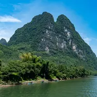
Li River & Yangshuo 漓江与阳朔
Limestone peaks, bamboo rafts and bike rides through rice paddies
-
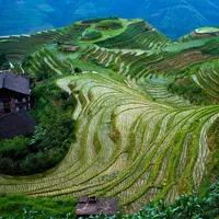
Longji Rice Terraces 龙脊梯田
Rice paddies stacked up the mountains like the scales on a dragon's back
Listed sites in Guilin
53 listed sites are in Guilin. These are the 41 rated 5A or 4A; see all 53 in the Guangxi list.
- Jingjiang Princes' Palace & Solitary Beauty Peak 靖江王城·独秀峰 5A scenic area · National heritage site
The walled seat of the Ming-dynasty Princes of Jingjiang, begun in 1372 in the heart of Guilin; its stone walls, gates and hall terraces survive, and the grounds now hold a campus of Guangxi Normal University and an exhibition on the imperial examinations once held here. - Two Rivers and Four Lakes & Elephant Trunk Hill 两江四湖·象山 5A scenic area
Central Guilin's ring of waterways, which links the Li and Taohua rivers with Ronghu, Shanhu, Guihu and Mulong lakes and was dredged and joined into one loop around 2001, with lakeside parks, bridges and the Sun and Moon Pagodas on Shanhu Lake. - Bajiaozhai 八角寨 4A scenic area · on the map
A massif of Danxia red-sandstone peaks in Meixi town on the Guangxi–Hunan border, named after the eight upturned corners of its 818 m main peak; its Hunan side belongs to the Langshan scenic area. - Butterfly Spring 蝴蝶泉 4A scenic area · on the map
A park built around two steep karst hills beside National Road 321 south of Yangshuo town, on the stretch of countryside known as the Ten-Mile Gallery. - Dabitou International Tourist Resort 大碧头国际旅游度假区 4A scenic area · on the map
A countryside resort at Dabitou, a traditional village of the Bin clan in Miaotou town, north-eastern Quanzhou County, set among karst hills near the Xiang River. - Daxu Ancient Town 大圩古镇 4A scenic area · on the map
A historic market town on the Li River south-east of Guilin, with more than a thousand years of history, whose 2 km main street, paved with bluestone, is lined with old shop-houses. - Dongli Ancient Village 东漓古村 4A scenic area · on the map
A village resort on the Chaotian River near Daxu, set among houses in the traditional northern-Guangxi style, with craft and intangible-heritage workshops, farmland and guesthouses. - Fengyu Cave 丰鱼岩 4A scenic area · on the map
A show cave about 16 km south-west of Lipu town that runs for 5.3 km through nine hills, named after the fish that live in its underground river. - Gongcheng Temples and Guild Halls 恭城古建筑群 4A scenic area · National heritage site
A group of Ming and Qing buildings in Gongcheng town. - Guanyan Cave 冠岩 4A scenic area · on the map
A cave system with an underground river, about 12 km long, that emerges on the east bank of the Li River at Caoping and is named after the crown-like shape of the hill above. - Gudong Waterfall 古东瀑布 4A scenic area · on the map
A spring-fed waterfall in a wooded valley near Daxu on the east side of the Li River. - Guihai Qinglan Park 桂海晴岚 4A scenic area · on the map
A landscaped park on the eastern edge of Guilin laid out on a former golf course, with wide lawns, lakes and pine woods ringed by karst peaks. - Guilin Merryland Resort 乐满地度假世界 4A scenic area · on the map
A large resort on the southern edge of Xing'an town, opened in December 2000 and covering about 4 km², with a theme park of family rides, a 27-hole golf course and a resort hotel beside a lake. - Guilin Tourism University Campus 桂林旅苑 4A scenic area · on the map
The main campus of Guilin Tourism University in Yanshan District, a college founded in 1985 to train staff for the tourism industry, whose landscaped grounds, crossed by the Xiangsi River, are run as a scenic area. - Hongxi Canyon 红溪大峡谷 4A scenic area · on the map
A forested canyon in the hills of northern Lingui, named after the reddish rocks of its stream bed, with a waterfall as its main sight. - Hongyan Village 红岩村 4A scenic area · on the map
A village in Lianhua town in southern Gongcheng County, rebuilt by its villagers to a single plan as a model new village and now run as a rural scenic area among persimmon orchards. - Jinzhongshan Resort 金钟山度假区 4A scenic area · on the map
A resort area in the karst hills of Luojin town, eastern Yongfu County, built around Yongfu Cave, a show cave with golden-coloured formations, and a large karst sinkhole that can be entered on foot from the bottom, where it meets an underground river. - Kitten Mountain (Mao'er Shan) 猫儿山 4A scenic area · on the map
At 2,141.5 m, Kitten Mountain is the highest peak in Guangxi and is often called the highest in South China; it rises on the border of Xing'an and Ziyuan counties. - Laoshanjie Longtanjiang Canyon 老山界龙潭江 4A scenic area · on the map
A forested river canyon in the Yuecheng range, known locally as Laoshanjie, in Huajiang Yao township, opened as a scenic area in 2021; it joins the Longtanjiang gorge with sites linked to the Red Army's crossing of Laoshanjie during the Long March in 1934. - Lijiang (Lipu River) National Wetland Park 荔江国家湿地公园 4A scenic area · on the map
A national wetland park along the Lipu River and its tributaries, spread over several townships around Lipu town. - Lijiang Bay 荔江湾 4A scenic area · on the map
A scenic area on the Lipu River in Qingshan town, south-west of Lipu, where visitors take boat trips along the river among karst peaks and walk through Tiangong Cave, a show cave. - Lijiang Houhai, Guilin Sunac Resort 融创漓江后海 4A scenic area · on the map
The shopping and leisure quarter of the Guilin Sunac International Tourism Resort, a large resort in Yanshan District that opened in June 2021. - Lingqu Canal 灵渠 4A scenic area · National heritage site
A canal dug on the First Emperor's orders between 219 and 214 BC to move troops and supplies south, linking the Xiang River, which flows to the Yangtze, with the Li River and the Pearl River system across a low watershed. - Liu Sanjie Grand View Garden 刘三姐大观园 4A scenic area · on the map
A theme park on the Taohua River at the foot of West Hill, named after Liu Sanjie, the singing heroine of Zhuang folk legend. - Nanxi Hill Park 南溪山公园 4A scenic area · on the map
A park around Nanxi Hill in southern Guilin, a twin-peaked limestone hill rising about 140 m above the Nanxi stream, which winds along its northern foot to the Li River. - Osmanthus Commune 桂花公社 4A scenic area · on the map
An osmanthus-themed attraction among the fields of the Taohua River valley on the western edge of Guilin, a city whose name means 'forest of sweet osmanthus'. - Qianjiadong Cultural Tourism Resort 千家洞文旅度假区 4A scenic area · on the map
A resort opened in June 2023 in the traditional villages of Xiaolong and Sudong between Guanyang and Xinxu towns, built around the Yao tradition that Qianjiadong is the ancestral homeland of the Yao people, a place many Yao visit to trace their roots. - Reed Flute Cave 芦笛岩 4A scenic area
A show cave in Guangming Hill on the north-western edge of Guilin, named after the reeds at its mouth that were used to make flutes, with a path of about 500 m through chambers of stalactites, stalagmites and columns lit in bright colours. - Sanqianli Resort, Xingping 三千漓 4A scenic area · on the map
A modern resort and leisure district built on the north-eastern edge of Xingping, with a street of shops and restaurants, holiday housing and hotels set among fields and karst peaks along the Dayuan River. - Seven Star Park 七星公园 4A scenic area · National heritage site
Guilin's largest park, about 137 hectares on the east bank of the Li River, named after its seven hills; paths lead past the Flower Bridge to Seven Star Cave, a large show cave with lit formations. - Shiwaitaoyuan (Land of Idyllic Beauty) 世外桃源 4A scenic area · on the map
A landscaped theme park beside the Guilin–Yangshuo road near Baisha, laid out to evoke Tao Yuanming's fable of the Peach Blossom Spring. - Silver Cave 银子岩 4A scenic area · on the map
A show cave in Maling town, Lipu, that runs through twelve hills on three levels. - West Hill Park 西山公园 4A scenic area · on the map
Guilin's second-largest park, made up of the West Hill peaks, Yin Hill with its caves, and West Lake. - Xiang River Battle Memorial Park (Quanzhou) 红军长征湘江战役纪念园 4A scenic area · on the map
A memorial park completed in September 2019 beside the Jiaoshanpu battlefield in Caiwan town, commemorating the Battle of the Xiang River of late 1934, when the Central Red Army fought its way across the river between Xing'an and Quanzhou during the Long March at heavy cost. - Xiang River Breakthrough Martyrs Monument Park 红军长征突破湘江烈士纪念碑园 4A scenic area · on the map
A memorial park in Xing'an town, built in 1995 in memory of the Red Army soldiers killed in the Battle of the Xiang River in late 1934, during the Long March. - Xiaoyao Lake 逍遥湖 4A scenic area · on the map
A lake park in Daxu town on the east side of the Li River, where paths follow the shore against a backdrop of karst hills. - Xinxu Battle Memorial Park (Jiuhaijing) 新圩阻击战酒海井红军纪念园 4A scenic area · on the map
A memorial park completed in 2016 in Xinxu town, Guanyang County, where Red Army units fought a blocking action at Xinxu during the Battle of the Xiang River in late 1934, part of the Long March. - Yao Mountain 尧山 4A scenic area · on the map
At 909 m, Yao Mountain on the north-eastern edge of Guilin is the highest peak in the city area and, unlike the limestone towers around it, a soil-covered mountain. - Yuzi Paradise 愚自乐园 4A scenic area · on the map
A landscape sculpture park among karst hills south of Guilin, founded in the late 1990s by the Taiwanese entrepreneur Cao Rizhang. - Zhuangyuan Nahehai Street District 状元哪嗬嗨 4A scenic area · on the map
A redeveloped street district in the centre of Yongfu town, on the former site of the home of Wang Shize, the first person from Guangxi to take first place (zhuangyuan) in the imperial examinations. - Zijiang River & Tianmen Mountain 资江·天门山 4A scenic area · on the map
A scenic area on the upper Zi River north of Ziyuan town, where boat and raft trips run past red-sandstone (Danxia) cliffs to a landing below Tianmen Mountain.
Getting to Guilin
Train, flight and driving times from the cities most visitors come from, with stations, fares and how many run a day; each opens the full comparison.
- Guangzhou 广州 high-speed train 2 h 4 min, 62 a day, from ¥223
- Hong Kong 香港 high-speed train 3 h 2 min, 3 a day, from ¥438
- Chongqing 重庆 high-speed train 3 h 43 min, 20 a day, from ¥321; a nonstop route is listed
- Kunming 昆明 high-speed train 4 h 28 min, 8 a day, from ¥425
- Chengdu 成都 high-speed train 4 h 58 min, 17 a day, from ¥482; 3 nonstop flights a day, 1 h 50 min in the air
Trips with Guilin
- Two weeks in China: Beijing, Xi’an, Chengdu, Guilin and Shanghai 14 days · Beijing, Xi'an, Chengdu, Leshan, Guilin and Shanghai
- Guilin, Yangshuo and the Longji terraces in four days 4 days · Guilin
On the map
Open Guilin on the illustrated map to see its outline, its places and listed sites together, and to add them to a trip.
Open Guilin on the map