 Atlas of China
Laibin 来宾Láibīn
Yao mountain villages and the Ming-era hall of a chieftain clan
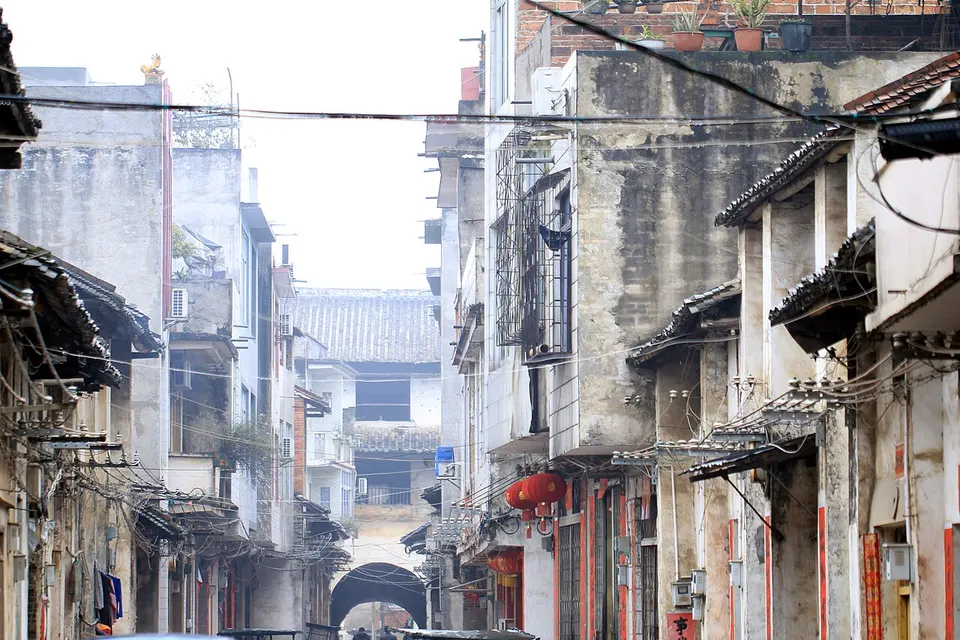
About Laibin
Laibin sits in the low hills of central Guangxi, where the Hongshui and Liu rivers meet in Xiangzhou to form the Qian. To the east rise the Dayao Mountains of Jinxiu, a Yao autonomous county, where in 1935 the young anthropologist Fei Xiaotong and his wife Wang Tonghui studied Yao society and where she died in a mountain accident. In Xincheng, the Mo Chieftain's Office, begun in 1582 and used until 1906, is one of the best-preserved chieftains' compounds in southwest China.
Listed sites in Laibin
16 sites in Laibin are on the official lists. Those with a page of their own link to it; the rest open as cards on the map.
- Baiya Grand Canyon 百崖大峡谷 4A scenic area · on the map
A 10 km red-rock (Danxia-type) canyon in the hills of north-eastern Wuxuan, 5–40 m wide, with 37 bends, ten waterfalls and hundreds of steep side gorges that give it the name 'hundred cliffs'. - Baxian Tianchi (Eight Immortals Lake) 八仙天池 4A scenic area · on the map
A lake about 150 m long and 100 m wide lying more than 100 m up a hillside south of Wuxuan, ringed by eight small peaks that gave it the name 'Eight Immortals'. - Dayaoshan Panwangjie (Lianhua Mountain) 大瑶山盘王界 4A scenic area · on the map
Formerly the Lianhua (Lotus) Mountain scenic area, a 23 km² area of quartz-sandstone peaks north-west of Jinxiu whose main summit rises to 1,350 m and whose cluster of pinnacles resembles a lotus bud. - Gushagou 古沙沟 4A scenic area · on the map
A mountain area in north-eastern Jinxiu, largely inside the Dayao Mountains national nature reserve, combining rafting on the Changliu River gorge, the Lingzu canyon with its clear stream and coloured pebbles, the old village of Lingzu, red maple woods on Niulingding and the high Yao village of Bale. - Guxiang Hot Springs (Xiangzhou Hot Springs) 古象温泉 4A scenic area · on the map
A hot-spring resort at Reshui ('hot water') village east of Xiangzhou town, built around the Xiangzhou hot springs, with bathing pools set among green hills, fields and village houses. - Heshan National Mine Park 合山国家矿山公园 4A scenic area · on the map
An industrial heritage park on about 27 hectares of the former east mine of the Heshan Mining Bureau, Guangxi's first coal-mining enterprise, beside national road 322. - Mo Chieftain's Office (Mo Tusi Yamen) 莫土司衙署 4A scenic area · National heritage site · on the map
The administrative seat and residence of the Mo family, hereditary local chieftains (tusi) who governed Xincheng under the Ming and Qing, begun in 1582 and used until the chieftain system was abolished in 1906. - Shanshui Yaocheng (Jinxiu Town) 山水瑶城 4A scenic area · on the map
Jinxiu county town, at about 775 m in the Jinxiu River valley in the heart of the Dayao Mountains, is described by the county as the highest county town in Guangxi; it has been rebuilt in Yao style and made a 4A scenic area as a whole. - Shengtang Lake 圣堂湖 4A scenic area · on the map
A reservoir and river gorge at the foot of Shengtang Mountain in south-eastern Jinxiu, where the river winds between peaks and cliffs of red sandstone. - Shengtang Mountain 圣堂山 4A scenic area · on the map
The main peak of the Dayao Mountains and, at 1,979 m, the highest summit in central Guangxi, revered by the Yao as a holy mountain. - Time Island Resort, Penglaizhou 蓬莱洲时光岛 4A scenic area · on the map
A resort on Penglaizhou, an island of about 27 hectares in the Hongshui River east of Laibin, with steep karst banks, rocky outcrops and thick vegetation. - Xialiantang Village 下莲塘 4A scenic area · National heritage site · on the map
A village of the Liu family in eastern Wuxuan, set among ponds and old longan groves, with two notable buildings: the General's Mansion, a walled Qing courtyard compound begun in 1801 with 175 rooms where about a hundred people still live, and the Liu Bingyu Manor of 1908. - Xincheng Lavender Manor 忻城薰衣草庄园 4A scenic area · on the map
A flower farm on the southern edge of Xincheng town, billed as the largest lavender estate in Guangxi, with fields of lavender, verbena and other flowering plants laid out for strolling and photography. - Yinshan (Cathaya) Forest Park 银杉森林公园 4A scenic area · on the map
A forest park in the Dayao Mountains national nature reserve north-east of Jinxiu town, named after the Cathaya (yinshan), a rare conifer found only in China, which grows here with southern yew and Bretschneidera. - Guo Songnian Manor 武宣郭氏庄园 National heritage site · on the map
A manor house begun in 1920 by Guo Songnian, a late-Qing scholar-graduate, in Yagang village in southern Wuxuan, covering about 2,800 m² and combining Chinese and Western architectural styles. - Wenhui Pagoda 来宾文辉塔 National heritage site · on the map
A Ming-dynasty pagoda in Fuji village near Qianjiang in western Laibin, built in the Wanli reign by the garrison commander Huang Wenhui, after whom it is named.
On the map
Open Laibin on the illustrated map to see its outline, its places and listed sites together, and to add them to a trip.
Open Laibin on the map