 Atlas of China
Enshi 恩施Ēnshī
Limestone canyons, a cave that swallows a river, and Tujia stilt houses
- Type
- Tujia and Miao Autonomous Prefecture
- Region
- Hubei
- Featured places
- 1
- Listed sites
- 332 rated 5A · 27 rated 4A · 9 national heritage
About Enshi
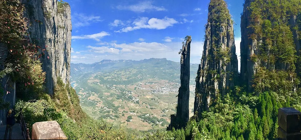
Enshi Tujia and Miao Autonomous Prefecture fills Hubei's mountainous south-west, where about half the people are Tujia and the Miao are a smaller community. The Enshi Grand Canyon is lined with sheer cliffs and stone pillars, and near Lichuan the Qingjiang River disappears into Tenglong Cave, whose entrance is some 70 m high. Tangya Tusi City, a World Heritage site, recalls the hereditary Tujia chiefs, and villages such as Pengjiazhai keep their timber stilt houses.
What to eat in Enshi
- Enshi pan-roasted potatoes (恩施炕土豆)
Featured places in Enshi
-
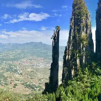
Enshi Grand Canyon 恩施大峡谷
A limestone canyon with a 150 m rock pillar, a cliff plank road and a waterfall floor
Listed sites in Enshi
33 sites in Enshi are on the official lists. Those with a page of their own link to it; the rest open as cards on the map.
- Shennong Stream 神农溪 5A scenic area
A Yangtze tributary running about 60 km from the Shennongjia mountains through four gorges (Shennong, Mianzhu, Parrot and Longchang) to meet the river opposite Badong town. - Tenglong Cave 腾龙洞 5A scenic area
A cave system on the Qing River with about 59.8 km of passages on five levels, where the river drops more than 30 m at the entrance and flows on underground. - Baren River Gorge, Badong 巴人河 4A scenic area · on the map
A karst river gorge in Chadianzi town, Badong County, also called the Three Gorges Women's Valley, where the scenic area climbs from about 350 to 1,650 metres above sea level. - Daqingjiang Scenic Area, Enshi 大清江 4A scenic area · on the map
A boat-based scenic area on the Qing River in Enshi, spread across Sancha, Shadi and Xintang townships, where large passenger boats run along about 87 km of river between karst cliffs and villages. - Dashuijing Old Buildings 大水井古建筑群 4A scenic area · National heritage site · on the map
A group of buildings in the mountains of Lichuan, mostly Qing-dynasty and Republican-era, that the Li family built up from the former residence of the Huang tusi (local chiefs). - Dixin Valley, Jianshi 地心谷 4A scenic area · National heritage site · on the map
A deep limestone gorge in Gaoping town, Jianshi County, with cliff-hugging plank walkways, a glass bridge more than 200 metres above the valley floor and more than a thousand river-scoured potholes in the stream bed. - Enshi Tusi City 恩施土司城 4A scenic area · on the map
A replica tusi (hereditary chieftain) manor complex on a hillside in the city of Enshi, opened in 2002, combining Tujia, Miao and Dong architecture, carving and painting. - Fobao Mountain, Lichuan 佛宝山 4A scenic area · on the map
A mountain scenic area in the hills of Lichuan, with forest cover of more than 95 per cent. - Hefeng Manshanhong Martyrs' Cemetery 鹤峰满山红烈士陵园 4A scenic area · on the map
A memorial cemetery on a wooded hillside on the south side of Hefeng town, begun in 1959 and expanded in 1978 as the cemetery of the Hunan-Hubei border soviet area. - Longchuan Shuixiang 龙船水乡 4A scenic area · on the map
A riverside scenic area on the Qing River in Liangwu township, built as a tourism project by Hubei Communications Investment Group on the theme of the Longchuan Diao, a Lichuan folk song listed as national intangible heritage. - Luyuanping 鹿院坪 4A scenic area · on the map
A cliff-ringed hollow in Banqiao town, about 1,700 metres above sea level and more than 500 metres deep, with a farming hamlet, streams, waterfall groups and karst crevices on its floor. - Maodong Cave 卯洞 4A scenic area · on the map
A river cave on the Youshui River at Baifusi in Laifeng County, close to where Hubei meets Hunan and Chongqing, where the river flows through an opening about 58 metres wide and 36 metres high and runs underground for some 215 metres. - Pengjiazhai Stilt-House Village 彭家寨 4A scenic area · National heritage site · on the map
A Tujia village of Qing-dynasty timber stilt houses (diaojiaolou) on a hillside beside the Longtan River in Lianghekou village, jointed by mortise and tenon with almost no nails. - Pingbaying National Forest Park 坪坝营国家森林公园 4A scenic area · on the map
A forest park of about 154 km² in the mountains of south-western Xianfeng County, close to the Chongqing border, with forest cover of over 90 per cent. - Pingshan Canyon and Rongmei Tusi Site 屏山·容美土司遗址 4A scenic area · National heritage site · on the map
A village inside a cliff-ringed canyon, the site of the Jue Fu, the main seat of the Rongmei tusi (hereditary chieftains of the Tian family), built from the late Ming dynasty and abandoned after the Qing ended the tusi system in 1735. - Shiziguan Gorge, Xuan'en 狮子关 4A scenic area · on the map
A river-gorge scenic area just east of Xuan'en town, about 9.6 km long, with steep rock walls and narrow passes such as the Lion's Mouth. - Suobuya Stone Forest 梭布垭石林 4A scenic area · on the map
A karst stone forest of about 21 square kilometres in the north-west of Enshi, formed in the Ordovician period around 460 million years ago, with limestone pinnacles, narrow slot canyons and visible fossils. - Tangya River Scenic Area, Xianfeng 唐崖河景区 4A scenic area · on the map
A scenic area on the upper Tangya River at Huangjindong in the north of Xianfeng County, centred on Huangjin Cave, a large river cave that the Tangya River flows through. - Tujia Daughters' City, Enshi 土家女儿城 4A scenic area · on the map
A shopping and leisure district in Enshi, built in the style of a Tujia old town and opened as a street quarter in 2013, with stilt-house lanes, shops, restaurants, inns, a Tujia folk museum and a theatre. - Wujiatai Tribute Tea Village, Xuan'en 伍家台 4A scenic area · on the map
A tea-growing village in Xuan'en County whose tea was presented to the Qianlong emperor in the 1780s, earning it the label 'tribute tea' and an imperial plaque. - Wuxiakou (Wu Gorge Mouth), Badong 巫峡口 4A scenic area · on the map
A scenic area on Damian Mountain above the Yangtze at the eastern mouth of the Wu Gorge, the middle gorge of the Three Gorges, just upriver of Badong county town. - Xianfo Temple Grottoes 仙佛寺石窟 4A scenic area · National heritage site · on the map
A cliff-carving site on the west bank of the Youshui River in Xiangfeng town, facing Hunan's Longshan County across the water. - Xuan'en Town and Gongshui River 浪漫宣恩旅游区 4A scenic area · on the map
The county town of Xuan'en, run as a scenic area in its own right and built around the Gongshui River that flows through it. - Yangmei Ancient Village, Laifeng 杨梅古寨 4A scenic area · on the map
A scenic area made up of two villages, Huangbaiyuan and Shiqiao, in Sanhu township, known for its groves of old Chinese bayberry (yangmei) trees, some of them more than 300 years old. - Yaotianyan Sinkhole, Xuan'en 矅天眼 4A scenic area · on the map
A natural sinkhole (tiankeng) more than 290 m deep in Luoquanyan village, Jiaoyuan township, Xuan'en County, set among karst pinnacles and developed as a scenic area. - Yesanguan Forest Flower Sea 野三关森林花海 4A scenic area · on the map
A flower-field attraction in the Tiechanghuang forest park on a plateau above Yesanguan town in Badong County, at more than 1,700 m. - Yesanxia (Wild Three Gorges), Jianshi 野三峡 4A scenic area · on the map
A mountain and river scenic region in Jianshi County, built around the Jingyang stretch of the Qing River and the neighbouring Yesan River. - Yulong Cave, Lichuan 玉龙洞 4A scenic area · on the map
A show cave in Tuanbao township with passages on three levels, found in 1992 when villagers searching for water in a drought came across it. - Yuxian Valley (Wuyuan Cave), Badong 雨仙谷 4A scenic area · on the map
A scenic area in the hills just outside Badong town, built around Wuyuan Cave, a large cave with a flowing spring and stalactites, and the gorge outside it, where the air stays around 20 °C. The grounds hold Three Gorges stone inscriptions, pavilions and a stele garden recalling the statesman Kou Zhun, as well as the Night Rain Pool, a constant-temperature outdoor pool on the Yangtze bank named after a poem by Li Shangyin. - Shizhou Old City Walls, Enshi 施州城址 National heritage site · on the map
The surviving walls and gates of Shizhou, the old walled city of Enshi, in the Liujiaoting area of the present city. - Tangya Tusi Fortress 唐崖土司城址 National heritage site · on the map
The remains of the seat of the Qin family, hereditary Tujia chiefs (some scholars say Mongol in origin) of Tangya, who ruled the district under the Yuan, Ming and Qing dynasties until the Qing replaced hereditary chiefs with appointed officials in 1735. - Wuliping Revolutionary Sites 五里坪革命旧址 National heritage site · on the map
A small basin town in Hefeng County that was the centre of the Hunan–Hubei border soviet area in 1929–33, when He Long led the Red Fourth Army and Second Army Corps to build a base in the region. - Yumuzhai 鱼木寨 National heritage site · on the map
A fortified Tujia village on a hilltop ringed by cliffs, founded in the Hongwu reign (1368–98) by the Ma family of local chiefs and described as the best-preserved Tujia fort.
On the map
Open Enshi on the illustrated map to see its outline, its places and listed sites together, and to add them to a trip.
Open Enshi on the map