 Atlas of China
Xuzhou 徐州Xúzhōu
Han dynasty kings' tombs and ranks of painted clay soldiers
About Xuzhou
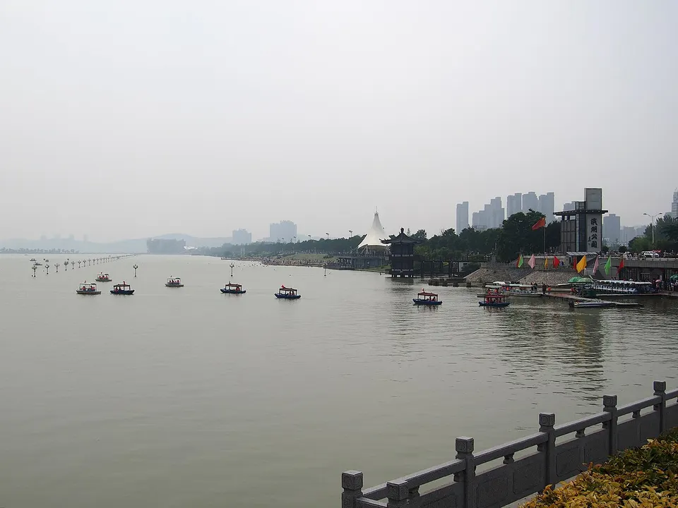
Xuzhou, the ancient Pengcheng, lies where Jiangsu meets Shandong, Henan and Anhui, and as the home region of Liu Bang, founder of the Han dynasty, it is rich in Han remains. Tombs of the Han kings of Chu are cut deep into its hills, and pits beside the Shizishan tomb have yielded more than 2,300 painted pottery soldiers. Once a coal-mining city, it now centres on Yunlong Lake, with hills and parks around its shores.
What to eat in Xuzhou
- Sha soup (sha汤)
- Pot-side chicken with flatbread (地锅鸡)
Listed sites in Xuzhou
21 sites in Xuzhou are on the official lists. Those with a page of their own link to it; the rest open as cards on the map.
- Yunlong Lake 云龙湖 5A scenic area
A lake on the south-western edge of central Xuzhou, enlarged from low-lying ground into a reservoir and now the heart of a 5A scenic area, framed by green hills on three sides with Yunlong Mountain to the east. - Aishan Scenic Area, Pizhou 艾山 4A scenic area · on the map
A hill scenic area of about 15 km² in Tiefu, northern Pizhou, that mixes woodland scenery with restored historic sites. - Baolian Temple, Pantao Hill 蟠桃山宝莲寺 4A scenic area · on the map
A Buddhist temple complex on Pantao Hill in the Xuzhou Economic and Technological Development Zone, east of the city, centred on Baolian Temple, rebuilt from 2009 on the site of an older monastery that had fallen into ruin by the mid-20th century. - Dadong Mountain 大洞山 4A scenic area · on the map
At 361 m the highest hill in the Xuzhou area, rising on the southern edge of Jiawang district centre and managed as a wooded scenic area. - Dashahe Wetland Park, Feng County 大沙河湿地公园 4A scenic area · on the map
A wetland park along the Dasha River in Feng County, in the far north-west of Jiangsu, where long riverside sandbanks, reed beds and ponds are laid out with birdwatching platforms and waterside paths. - Dugong Lake 督公湖 4A scenic area · on the map
A reservoir east of Jiawang's district centre, built in 1958 and now a lakeside scenic area with waterside paths. - Fengminghai Park, Jiawang 凤鸣海 4A scenic area · on the map
A park on the eastern side of Jiawang, the former coal-mining district north-east of Xuzhou, which the district promotes as one of its scenic areas alongside Pan'an Lake and Dadong Mountain. - Guishan Han Tombs 龟山汉墓 4A scenic area · National heritage site
The joint tomb of Liu Zhu, sixth king of Chu in the Western Han dynasty, and his queen, cut side by side into the west face of Guishan hill on Xuzhou's north-western edge and identified in 1985 from the king's silver seal. - Huaihai Campaign Martyrs Memorial Park 淮海战役烈士纪念塔 4A scenic area
A memorial park on the southern side of central Xuzhou honouring soldiers of the People's Liberation Army killed in the Huaihai Campaign of November 1948 to January 1949, one of the decisive campaigns of the Chinese Civil War. - Hubu Hill Historic Buildings 户部山古建筑群 4A scenic area · National heritage site · on the map
A low hill in the heart of Xuzhou named after the Ming Ministry of Revenue branch office that moved up here when the Yellow River flooded the city in 1624, after which wealthy families crowded its slopes with courtyard houses. - Liu Bang's Hometown Cultural Area, Feng County 刘邦故里文化景区 4A scenic area · on the map
A Han-dynasty theme park in Feng County, which the ancient histories give as the birthplace of Liu Bang, founder of the Han dynasty. - Maling Mountain 马陵山 4A scenic area · National heritage site · on the map
A range of low red-sandstone hills south of Xinyi city, with Danxia-type cliffs and rock formations, caves, small lakes and pine woods, which local tradition identifies as the site of the Warring States Battle of Maling and where the Qianlong Emperor stayed on his southern tours. - Pan'an Lake National Wetland Park 潘安湖湿地公园 4A scenic area · on the map
A national wetland park in Jiawang district made from what was the largest and most damaged area of subsided ground over old coal mines around Xuzhou, flooded and landscaped since the late 2000s into lakes, reed beds and stands of pond cypress. - Pengzu Park 彭祖园 4A scenic area · on the map
A large wooded city park on the southern side of central Xuzhou dedicated to Peng Zu, the legendary sage said to have lived some 800 years, whom tradition makes lord of the ancient state of Dapeng at Xuzhou. - Shuiyue Temple, Suining 水月禅寺 4A scenic area · on the map
A large Buddhist temple in Suining County, built in recent years on the site of the county's former Dizang Temple inside the Baitang River wetland park. - Xuzhou Amusement Park 徐州乐园 4A scenic area · on the map
A theme-park complex west of Yunlong Lake made up of a water park and two themed ride parks, with a resort hotel and a shopping street attached. - Xuzhou Han Culture Scenic Area (Shizishan) 徐州汉文化景区 4A scenic area · National heritage site
A park in Xuzhou's eastern suburbs built around Shizishan, where a Western Han king of Chu was buried in the 2nd century BC in a tomb cut 117 m into the hillside; visitors walk through its passages and a dozen rock-hewn chambers, found in 1991 and excavated in 1994–95. - Xuzhou Han Stone Relief Art Museum 徐州汉画像石艺术馆 4A scenic area · on the map
A museum on the eastern shore of Yunlong Lake devoted to the carved stone panels that lined Eastern Han tombs, shrines and gate towers around Xuzhou. - Xuzhou Museum 徐州博物馆 4A scenic area · National heritage site
Xuzhou's main history museum, a national first-class museum at the northern foot of Yunlong Mountain, best known for finds from the rock-cut tombs of the Western Han kings of Chu, among them a jade burial suit sewn with gold thread. - Yaowan Ancient Town 窑湾古镇 4A scenic area · on the map
A canal town on the Grand Canal where it meets Luoma Lake, in the south-west of Xinyi, with some 1,300 years of history; it grew into a busy trading port in the Ming and Qing dynasties. - Ruins of the Ancient City of Xiapi 下邳故城遗址 National heritage site · on the map
The buried remains of Xiapi at Gupi in northern Suining County, a walled city for well over a thousand years and the place where the warlord Lü Bu was captured and put to death at the end of the 2nd century, an episode retold in Romance of the Three Kingdoms.
On the map
Open Xuzhou on the illustrated map to see its outline, its places and listed sites together, and to add them to a trip.
Open Xuzhou on the map