 Atlas of China
Panjin 盘锦Pánjǐn
Reed marsh, rice fields and red seepweed where the Liao River meets the sea
About Panjin
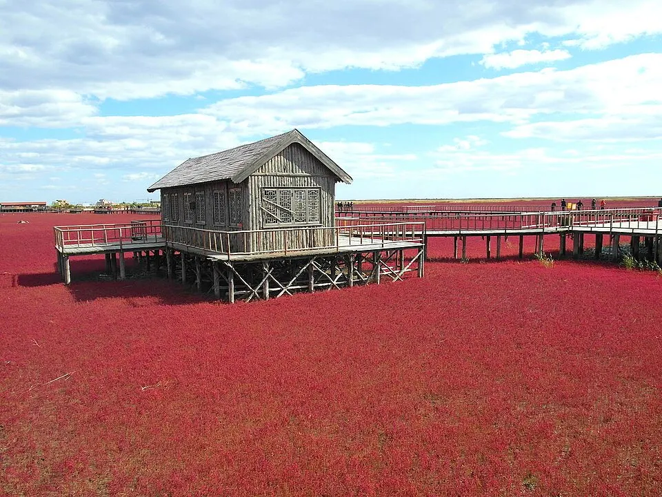
Panjin covers the flat delta of the Liao River, a landscape of rice paddies, oil wells and reed marsh known in China for its rice and river crabs. The Red Beach scenic corridor follows about 18 km of coast where seepweed carpets the tidal flats, turning deep red by autumn, and the wetlands are a breeding ground for red-crowned cranes and Saunders's gulls. Tianzhuangtai saw the last land battle of the First Sino-Japanese War in 1895.
What to eat in Panjin
- River crab tofu (河蟹豆腐)
- Seepweed steamed dumplings (碱蓬蒸饺)
- Stir-fried cattail shoots with pork (蒲笋炒肉)
Featured places in Panjin
-
Panjin Red Beach 红海滩风景廊道
Tidal flats turned crimson by seepweed, crossed by boardwalks through the Liaohe delta
Listed sites in Panjin
9 sites in Panjin are on the official lists. Those with a page of their own link to it; the rest open as cards on the map.
- Beilü Tianyuan Great Tang Cultural Tourism Area 北旅田园大唐文化旅游区 4A scenic area · on the map
Beilü Tianyuan, also called Heifengguan Ancient Town, is a leisure complex in Xinli town, Dawa District, themed on Tang-dynasty culture, with a town in Tang style that has market streets, a 'granary' zone and costumed street performances. - Guangsha Art Street, Panjin 广厦艺术街 4A scenic area · on the map
Guangsha Art Street is a modern arts and leisure street at the centre of the Liaohe International Art Zone in Panjin's Xinglongtai District. - Jinbo Beach, Panjin 金帛滩 4A scenic area · on the map
Jinbo Beach is a 1.6 km sandy beach on the Liaodong Bay coast in Panjin's Liaobin coastal development zone, promoted as the northernmost beach in China. - Liaohe Stele Forest 辽河碑林 4A scenic area · on the map
Liaohe Stele Forest Park is an oval island of land and water of about 167 ha in the middle of Panjin, laid out from 1985 around a collection of carved stone steles and antique-style halls. - Panjin Specialty Products Museum Park 盘锦特产博物园 4A scenic area · on the map
The Panjin Specialty Products Museum Park combines four museums devoted to local products (rice, river crab, barbecue and reed weaving), in buildings that mix Chinese and foreign, old and modern styles. - Weihai Dingxiang Reed Sea Resort, Panjin 盘锦苇海●鼎翔生态旅游度假区 4A scenic area · on the map
This 72 km² wetland resort on the western edge of Panjin, where the Liao and Raoyang rivers meet, has three areas: the Taiping River scenic belt, a 'reed sea and crab flat' reached by boat through the reed beds, and a bird park with an observation gallery. - Zhongyao Colourful Manor 中尧七彩庄园 4A scenic area · on the map
Zhongyao Colourful Manor is an agri-tourism park in Dawa District built around local farm produce, with a shopping street themed on Panjin's history, a modern-agriculture exhibition, an animal ranch park, fishing and herding experiences, a tomato theme park, defence-education and farm study programmes, and a water park. - Former Kwantung Army Panshan Railway Guard Detachment Site 侵华日本关东军护路守备队盘山分队旧址 National heritage site · on the map
This red-brick, blockhouse-style building was put up by the Japanese Kwantung Army in April 1932 as the headquarters and barracks of the Panshan detachment of its railway guard corps, in front of the old Panshan railway station. - Tianzhuangtai Site of the First Sino-Japanese War 甲午战争田庄台遗址 National heritage site · on the map
Tianzhuangtai was a river port on the lower Liao River where, from 7 to 9 March 1895, Qing and Japanese forces fought the last and largest land battle of the First Sino-Japanese War; the Qing side lost, and the Treaty of Shimonoseki followed in April.
On the map
Open Panjin on the illustrated map to see its outline, its places and listed sites together, and to add them to a trip.
Open Panjin on the map