 Atlas of China
Hanzhong 汉中Hànzhōng
Spring rapeseed, Three Kingdoms tombs and crested ibises south of the Qinling
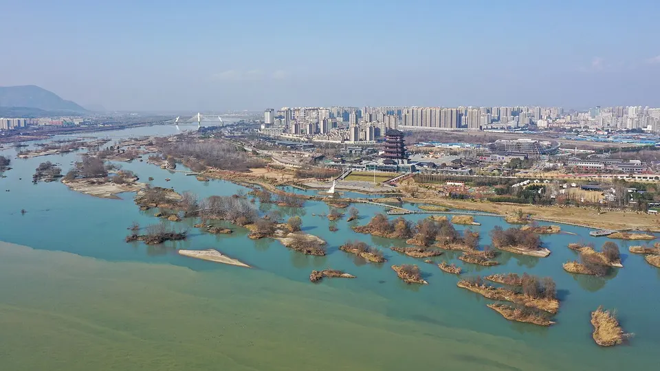
About Hanzhong
Hanzhong lies in a mild, rice-growing basin on the upper Han River, sheltered to the north by the Qinling Mountains, and it gave its name to the Han dynasty and so to the Han Chinese. In March, rapeseed fields turn the basin gold. Beyond the city are the Tomb of Zhuge Liang below Mount Dingjun, the Tomb of Zhang Qian, part of the Silk Roads World Heritage Site since 2014, and Yang County, where crested ibises, thought extinct in China, were rediscovered in 1981.
What to eat in Hanzhong
- Hanzhong mianpi rice noodles (汉中面皮)
- Hanzhong Xianhao tea (汉中仙毫)
Featured places in Hanzhong
-
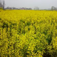
Hanzhong Rapeseed Fields 汉中油菜花
Spring rapeseed turning the Han River basin gold beneath the Qinling foothills
-
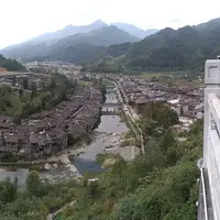
Qingmuchuan Ancient Town 青木川古镇
A curving market street of timber shophouses where Shaanxi, Gansu and Sichuan meet
Listed sites in Hanzhong
24 sites in Hanzhong are on the official lists. Those with a page of their own link to it; the rest open as cards on the map.
- Changqing Huayang Scenic Area 长青华阳 4A scenic area · on the map
A mountain scenic area around Huayang, an old post town on the Tangluo road across the Qinling that keeps Ming- and Qing-era buildings, beside the Changqing National Nature Reserve at an average altitude of about 1,700 m. - Crested Ibis Pear Garden 朱鹮梨园 4A scenic area · on the map
A scenic area on the edge of Yang County town that combines pear orchards with the Crested Ibis Ecological Park, a rescue and breeding centre for the endangered crested ibis. - Foping Panda Valley 佛坪熊猫谷 4A scenic area · on the map
A wildlife park in a forested valley north of Foping town, on a corridor used by the Qinling giant panda population and close to the Foping National Nature Reserve. - Hanjiang Source Scenic Area 汉江源 4A scenic area · on the map
A forested valley in Ningqiang County where the Yudai River, regarded as the source of the Han River, rises among wooded hills and streams, with mist and ice in winter. - Liping National Forest Park 黎坪国家森林公园 4A scenic area · on the map
A national forest park in the Daba and Micang mountains near the Sichuan border south of Hanzhong, with primeval forest, gorges and waterfalls along the Yudai and Xiliu rivers and extensive stands of Bashan pine. - Longtou Mountain 龙头山 4A scenic area · on the map
A mountain resort in the Micang range on the Sichuan border south of Hanzhong, on limestone riddled with caves and sinkholes, with viewpoints and sights such as Hanwang Terrace, Fairy Cave and the Longtou waterfall. - Luojiaba Old Town 骆家坝古镇 4A scenic area · on the map
A small market town at the head of the Muma River, at the northern foot of the Micang Mountains, whose old riverside street has been rebuilt in traditional style. - Shimen Plank Road Scenic Area 石门栈道 4A scenic area · on the map
A scenic area at the mouth of the Bao valley, where the Baoxie road, the oldest of the plank roads across the Qinling to Sichuan, came out onto the Hanzhong plain and where the Eastern Han cut the Shimen ('Stone Gate') tunnel through the cliff. - Tomb of Zhang Qian 张骞墓 4A scenic area · National heritage site · on the map
The tomb of Zhang Qian, the Han envoy whose journeys to Central Asia in the 2nd century BC opened the routes later called the Silk Road, and since 2014 part of the UNESCO World Heritage site 'Silk Roads: the Routes Network of Chang'an-Tianshan Corridor'. - Tomb of Zhuge Liang 武侯墓 4A scenic area · National heritage site
The tomb of Zhuge Liang, chancellor of the Shu Han kingdom in the Three Kingdoms period, who asked to be buried below Mount Dingjun after he died on campaign in 234. - Wuhou Temple, Mian County 勉县武侯祠 4A scenic area · National heritage site
The oldest of China's many temples to Zhuge Liang, founded in 263 on the order of the last Shu Han emperor, Liu Shan, near the strategist's burial place below Mount Dingjun. - Wulongdong National Forest Park 五龙洞国家森林公园 4A scenic area · on the map
A national forest park of forested mountains and valleys in Wulongdong town, northern Lueyang County, made up of the Wulong Valley, the Qinglong and Bailong gullies, the Sanfo Temple area and a Di-Qiang folk village. - Wuzi Mountain 午子山 4A scenic area · on the map
A wooded hill a little over 10 km south-east of Xixiang town, covered by some 200 hectares of lacebark pine, a rare tree with mottled pale bark. - Xinghan Shengjing 兴汉胜境 4A scenic area · on the map
A modern culture park built in Han-dynasty style around Hanyuan Lake in Hanzhong's Xinghan New Area, with a large Han Culture Museum, the Han Yuefu hall of Han-style music and banquets, a city planning exhibition hall and two streets of shops and restaurants. - Zhandao Water World 栈道水世界 4A scenic area · on the map
A hillside water park at Daoshuiwan in Wuguanyi town, in the Qinling valleys of Liuba County, with a wave pool, large water slides, a lazy river and children's water play areas, themed on the ancient plank roads of the area. - Zhang Liang Temple and Zibai Mountain 张良庙·紫柏山 4A scenic area · National heritage site · on the map
A large Ming and Qing temple complex at the south-eastern foot of Zibai Mountain in the Qinling, dedicated to Zhang Liang, the strategist who helped Liu Bang found the Han dynasty and who, by tradition, retired here as a recluse. - Former Site of National Northwest Associated University 国立西北联合大学旧址 National heritage site · on the map
Three wartime sites of the National Northwest Associated University, which was formed in 1938 from universities that had moved west from Beiping and Tianjin and whose colleges taught in Chenggu County until 1946. - Hanzhong Museum (Gu Hantai) 汉中市博物馆 National heritage site · on the map
Hanzhong's city museum occupies Gu Hantai, the raised terrace where Liu Bang is said to have lived as King of Han before founding the Han dynasty, crowned by the Wangjiang Tower. - Juehuang Hall, Liangma Temple 良马寺觉皇殿 National heritage site · on the map
The Juehuang Hall of Liangma Temple, a five-bay brick-and-timber hall with a hip-and-gable roof and double tiers of bracket sets, built in 1261 under the Yuan dynasty. - Kaiming Temple Pagoda 开明寺塔 National heritage site
A 13-storey brick pagoda about 27 m tall in Yang County town, built in the Tang dynasty in the early 8th century and repaired under the Southern Song, and regarded as the oldest brick pagoda in southern Shaanxi. - Lingyan Temple, Lueyang 灵岩寺 National heritage site · on the map
A temple of Tang origin on Yuwen Hill above the east bank of the Jialing River just south of Lueyang town, with halls built into two natural caves, now a museum of more than 140 inscribed steles and cliff carvings. - Tomb and Temple of Cai Lun 蔡伦墓祠 National heritage site · on the map
The burial place of Cai Lun, the Eastern Han court official who presented an improved method of papermaking to the emperor in 105 and was later made Marquis of Longting, the town where his tomb lies. - Wumen Weir 五门堰 National heritage site · on the map
A working irrigation weir on the Xu River north of Chenggu, said to date back to the Han and named after the five gated intakes at its head; its rock-cut channel through Doushan hill was made under the Yuan and widened under the Ming by heating the stone with fire and cracking it with water. - Zhiguo Temple 智果寺 National heritage site · on the map
A temple west of Yang County town whose surviving building is a two-storey Ming sutra library roofed in yellow and green glazed tiles.
Getting to Hanzhong
Train, flight and driving times from the cities most visitors come from, with stations, fares and how many run a day; each opens the full comparison.
On the map
Open Hanzhong on the illustrated map to see its outline, its places and listed sites together, and to add them to a trip.
Open Hanzhong on the map