 Atlas of China
Hotan 和田Hétián
Kunlun jade, Uyghur courtyards and the desert ruins of ancient Khotan
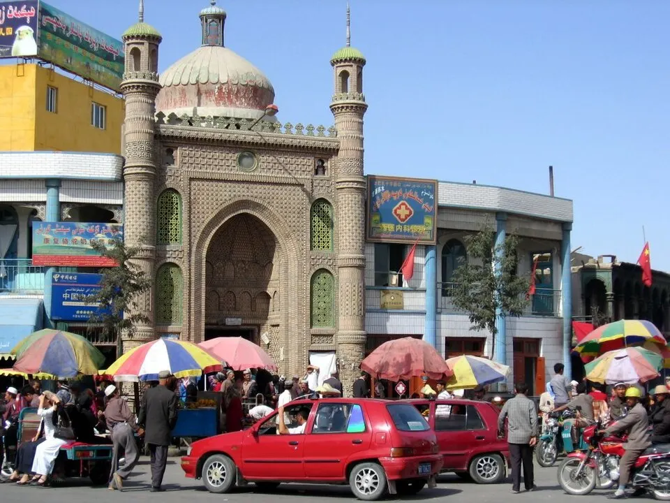
About Hotan
Hotan grew from the Buddhist kingdom of Khotan on the southern Silk Road, and it is still known for the jade that the Yurungkax and Karakax rivers carry down from the Kunlun Mountains, as well as for silk and carpets. The Hotan Museum shows finds from desert sites such as Niya, and in the city the lanes of the Tuancheng quarter keep Uyghur courtyard houses. On the Taklamakan's edge stand the ruined stupa of Rawak and the small Buddhist shrines of Damagou.
Listed sites in Hotan
15 sites in Hotan are on the official lists. Those with a page of their own link to it; the rest open as cards on the map.
- Damagou Buddhist Temple Ruins 达玛沟佛寺遗址 4A scenic area · National heritage site · on the map
A group of Buddhist temples of the Khotan kingdom found in 2000 in the scrub desert of Toplukdong, Damagou township, now shown in a heritage park. - Hotan Museum 和田博物馆 4A scenic area · on the map
The prefecture's main museum, which opened in its present form in May 2020. - Kurban Tulum Memorial Hall 库尔班·吐鲁木纪念馆 4A scenic area · on the map
A memorial hall in the home village of Kurban Tulum, the Uyghur farmer known as 'Uncle Kurban', built in 2003 and enlarged several times since. - Lalikun National Wetland Park 拉里昆国家湿地公园 4A scenic area · on the map
Lakes and reed beds about 20 km north-west of Moyu town, where the oasis farmland meets the desert, designated a national wetland park in 2012. - Longhu Lake, Yutian 龙湖 4A scenic area · on the map
A reed-fringed lake on the edge of the Taklamakan near Xiwule township, reached through a belt of desert poplar woodland west of Yutian town. - Moyu Old Town (Karakax) 墨玉老城 4A scenic area · on the map
The old quarter of Moyu (Karakax) county town, rated a 4A scenic area in 2020. - Tuancheng Old Quarter, Hotan 和田团城 4A scenic area · on the map
A renovated old quarter of Hotan city around Gezi Xiang (Pigeon Lane), where traditional Uyghur courtyard houses with aiwan halls have been kept and the lanes turned into a garden-like district of homes, workshops, cafés and restaurants. - Wuluwati Scenic Area 乌鲁瓦提 4A scenic area · on the map
A large mountain reservoir at the point where the Karakax River leaves the Kunlun Mountains, formed by the Wuluwati dam, which was built between 1993 and 2001 for irrigation, flood control and hydropower. - Xinjiang Kunlun Mountain Scenic Area 新疆昆仑山景区 4A scenic area · on the map
A large mountain scenic area in the central Kunlun above Ulughsay township, south of Qira, covering more than 596 km² of high grassland, valleys and snow peaks; it grew out of the Banlange summer pasture and was rated 4A in 2021 as 'Kunlun Shengjing'. - Yotkan Ancient City 约特干故城 4A scenic area · on the map
A walled tourist town opened in 2022 at Bagqi, about 5 km from the buried site of Yotkan, which scholars regard as the probable capital of the ancient kingdom of Khotan. - Yulongwan Desert Park 玉龙湾沙漠乐园 4A scenic area · on the map
A desert recreation area in Duolu township on the edge of the Taklamakan, where visitors slide down the dunes and try other sand activities, and school groups learn about the shelter belts planted to hold back the sand. - Aitika Mosque, Yutian 于田艾提卡清真寺 National heritage site · on the map
A mosque in Yutian (Keriya) town, also known as the Yutian Grand Mosque, whose origins are traced to the 13th century. - Niya ruins 尼雅遗址 National heritage site
The ruins of Jingjue (Cadota), an oasis kingdom on the southern Silk Road that flourished from the Western Han to the Western Jin, scattered along the dried lower course of the Niya River deep in the Taklamakan. - Rawak Stupa 热瓦克佛寺遗址 National heritage site
The ruins of a Buddhist temple of the ancient Khotan kingdom on the sandy edge of the Taklamakan north-east of Hotan, centred on a large domed stupa on a cross-shaped base inside a walled courtyard. - Xaidulla Outpost Ruins 赛图拉哨卡遗址 National heritage site · on the map
The ruins of a high-altitude garrison post at about 3,800 m, on a river terrace where the Karakax River meets a tributary beside the Xinjiang–Tibet highway.
On the map
Open Hotan on the illustrated map to see its outline, its places and listed sites together, and to add them to a trip.
Open Hotan on the map