 Atlas of China
Shidu 十渡Shídù
4A scenic area · Beijing, Beijing
- Time needed
- 1 day
- Days to budget
- 1 day
- City
- Beijing
- Region
- Beijing
- Type
- Nature
- Listed as
- 4A scenic area
About Shidu
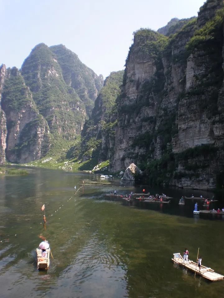
A long valley where the Juma River has cut through the northern end of the Taihang Mountains, leaving limestone peaks and cliffs above the water; it is one of the largest karst landscapes in northern China and part of the Fangshan UNESCO Global Geopark. The name, 'Tenth Ferry', comes from the river crossings along the old road, and today the valley is a busy weekend resort with rafting, boating and other outdoor activities, while the river attracts wintering birds.
How to get to Shidu
Around Shidu town in far south-western Fangshan District near the Hebei border, about 75 km south-west of central Beijing, roughly 2 hours by road; the Beijing–Yuanping railway also has a station at Shidu.
Nearby
- Zhoukoudian Peking Man Site 周口店北京人遗址 30 km
Limestone caves on Dragon Bone Hill where the fossils of Peking Man were found - Cuandixia Village 爨底下村 40 km
Ming and Qing courtyard houses stacked in tiers up a hillside in the western mountains - Tanzhe Temple 潭柘寺 50 km
Terraced temple courtyards in the western hills, shaded by ancient ginkgos and cypresses - Marco Polo Bridge 卢沟桥 60 km
An 800-year-old stone bridge lined with hundreds of carved lions, by a walled Ming fort
Also within 20 km: Jinshan Temple Relic Pagoda 金山寺舍利塔 (10 km), Yunju Temple 云居寺 (20 km), Yesanpo National Park 野三坡 (20 km), Flower Pagoda of Qinghua Temple 庆化寺花塔 (20 km), Tomb of Prince Yi, Laishui 怡贤亲王墓 (20 km), Longyan Temple Pagoda, Laishui 涞水龙严寺塔 (20 km).
On the map
Open Shidu on the illustrated map to see the terrain around it and what else is close, and to add it to a trip.
Open Shidu on the map