
 An illustrated travel map
Mount Meng (Yimengshan) Scenic Area 沂蒙山景区Yíméngshān Jǐngqū
Shandong's second-highest peak, with granite ridges, cloud seas and turtle-shaped rocks
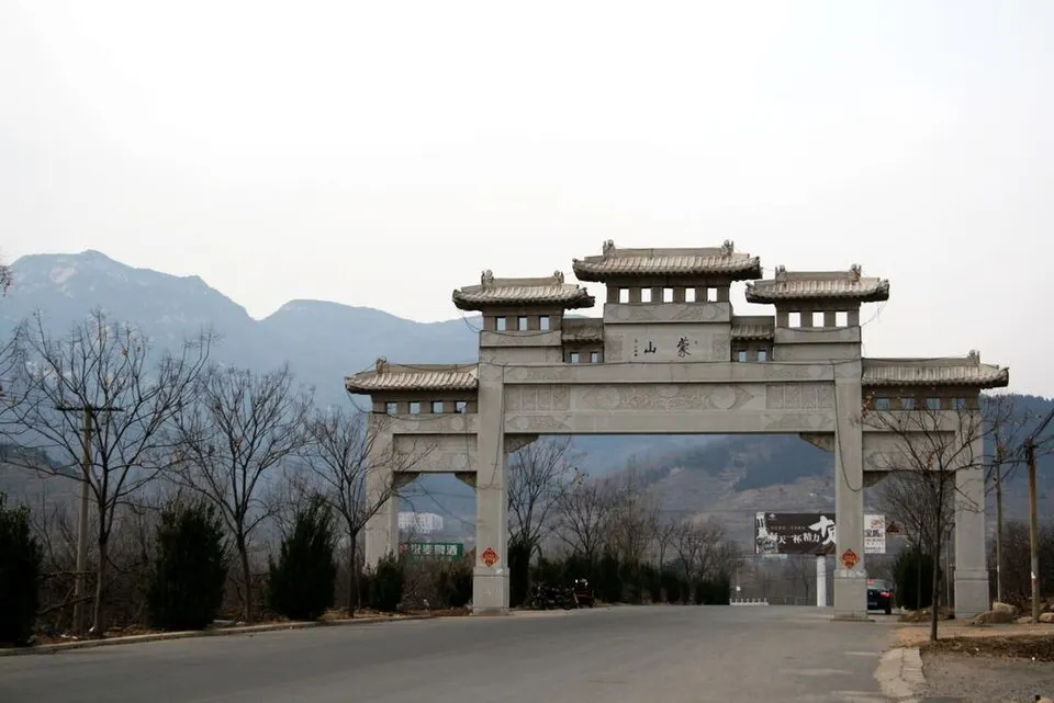
- Best time
- Apr–May, Sep–Oct
- Time needed
- Half a day to a full day
- Days to budget
- 1 day
- Stay in
- Linyi
- Region
- Shandong
- Type
- Nature
- Listed as
- 5A scenic area
Why go to Mount Meng (Yimengshan) Scenic Area
Mount Meng (Mengshan) is a granite range in the Yimeng hills, topped by Guimeng Peak at 1,156 m, the second-highest summit in Shandong. Forested slopes, steep cliffs, waterfalls and rocks eroded into animal shapes make it the province's finest mountain scenery away from the coast, with misty cloud seas in the right weather. The area is rated 5A as the Yimengshan scenic area and is the Mengshan part of the Linyi Yimengshan UNESCO Global Geopark.
The story
The rocks of Mount Meng are among the oldest in the region, formed about 2.5 to 2.7 billion years ago, and it was known in ancient times as Dongmeng, the 'Eastern Meng'. Locals prize its turtle-shaped boulders as symbols of long life, and the forested valleys have long supplied medicinal herbs, notably honeysuckle.
What to see at Mount Meng (Yimengshan) Scenic Area
- Guimeng Summit 龟蒙顶: At 1,156 m, the highest point of Mount Meng and the second-highest peak in Shandong after Mount Tai, with views over ridges and, on good mornings, a sea of cloud.
- Yingwo Peak cliff walkway 鹰窝峰: A plank walkway clings to steep cliffs beneath Yingwo Peak, giving close views of rock formations that resemble animals and figures.
- Turtle-shaped rocks 龟形石: Weathered granite boulders in the shape of tortoises, the signature sight of Mengshan and a symbol of longevity.
- Yunmeng Peak 云蒙峰: A cluster of three small peaks whose outline echoes the Chinese character for 'mountain', set in steep valleys with forest cover of around 85 percent.
- China Waterfall and Rain God Temple 中国瀑布与雨王庙: Yunmeng has a three-stepped waterfall called China Waterfall and a temple traditionally visited to pray for rain.
How to visit Mount Meng (Yimengshan) Scenic Area
Choose one gate for the day. At Guimeng, climb toward the summit and the Yingwo Peak boardwalk, then drop back through the forest; at Yunmeng, follow the valley path past the pools and waterfalls. Half a day covers the main viewpoints at a steady pace; a full day suits hikers who want the summit, boardwalks and a slow descent. Tourism listings mention cable cars at both Guimeng and Yunmeng; check on arrival which services are running.
How to get to Mount Meng (Yimengshan) Scenic Area
The Guimeng area (pinned) is about 19 km east of Pingyi county town and 65 km north-west of Linyi, reached by taxi, ride-hailing or car; Linyi North is the high-speed rail station. The Yunmeng area is about 17 km south of Mengyin county town.
Where to stay
Stay in Linyi city for the widest choice of hotels, or in Pingyi or Mengyin county towns for an early start at the gate.
What to eat
- Linyi stir-fried chicken 临沂炒鸡: A local speciality of chicken fried and then braised with spices, served hot and hearty.
- Linyi sa soup 临沂糁: A thick, peppery chicken-and-wheat soup eaten for breakfast across the Linyi area.
- Honeysuckle tea 金银花茶: An infusion of dried honeysuckle flowers, a herbal tea linked to Pingyi and the Meng hills.
Tips for visiting Mount Meng (Yimengshan) Scenic Area
- Guimeng (Pingyi) and Yunmeng (Mengyin) have separate entrances in different counties, so most visitors choose one rather than both in a day.
- Paths include long stairways and cliff-side boardwalks; wear shoes with grip and allow extra time on wet days, when mist can hide the views.
- The Tianmeng area in Fei County, with a suspension bridge and cliff walkway, is run separately and is not covered by the same entrance.
Nearby
- Firefly Water Cave and Underground Grand Canyon 萤火虫水洞·地下大峡谷 60 km
Boats through a dark underground lake and a lit river-cave canyon in the Yimeng hills - Qufu, Hometown of Confucius 曲阜三孔 80 km
The temple, mansion and forest cemetery of Confucius and his descendants - Temple and Mansion of Mencius, Zoucheng 孟庙孟府 80 km
The Second Sage's temple, family mansion and forest tomb, a quieter partner to Qufu - Mount Tai 泰山 110 km
China's most sacred peak, climbed by emperors and by night hikers chasing sunrise - Taierzhuang Ancient Town 台儿庄古城 110 km
A Grand Canal port town rebuilt as a lantern-lit maze of lanes, wharves and boats
Also within 30 km: Han Que Gate Towers, Pingyi County Museum 皇圣卿阙、功曹阙 (20 km), Tianyu Natural Museum 天宇自然博物馆 (20 km), Yimeng Yunpu Dongtian, Fei County 沂蒙云瀑洞天 (20 km), Jiujianpeng Village Scenic Area 九间棚 (20 km).
On the map
Open Mount Meng (Yimengshan) Scenic Area on the illustrated map to see the terrain around it, what else is close, and to add it to a trip and plan the days.
Open Mount Meng (Yimengshan) Scenic Area on the map