 Atlas of China
Xingtai 邢台Xíngtái
Where white Xing ware was fired, below the Taihang's sandstone canyons
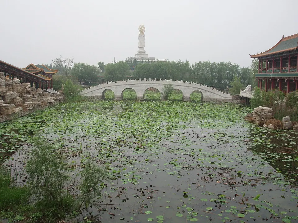
About Xingtai
Xingtai is an industrial city of coal and steel on the plain below the Taihang Mountains, yet its history reaches back some 3,500 years and its name comes from the Zhou-era state of Xing. Its kilns made Xing ware, the white porcelain that peaked under the Tang, and the Xingyao Kiln Site preserves their remains. Kaiyuan Temple and Qingfeng Tower stand in the old centre, Bian Que Temple honours the Warring States physician, and Xingtai Grand Canyon opens in the mountains to the west.
Listed sites in Xingtai
27 sites in Xingtai are on the official lists. Those with a page of their own link to it; the rest open as cards on the map.
- Bian Que Temple 扁鹊庙 4A scenic area · National heritage site · on the map
A large temple complex at the foot of Que Mountain in Shentou village, dedicated to the physician Bian Que; tradition dates it to the Warring States period, though the present buildings are Ming and Qing rebuilds. - Delong Steel Culture Park 德龙钢铁文化园 4A scenic area · on the map
An industrial-tourism park inside the working Xingtai plant of Delong Steel, a private steelmaker, in Xindu District. - Jiulong Gorge 九龙峡 4A scenic area · on the map
A sandstone gorge area in the Taihang Mountains of Xindu District, named for its nine gorges and nine valleys and planned to cover about 64 square km, with 1,800-metre Wangmao Mountain as its main peak. - Kongshan Baiyun Cave 崆山白云洞 4A scenic area · on the map
A karst cave in the Taihang foothills of Lincheng, formed in the Cambrian period and found in 1988 by quarrymen, which opened to visitors in 1990. - Nanhe Agricultural Carnival 南和农业嘉年华 4A scenic area · on the map
A modern-agriculture leisure park in the north of Nanhe District, built around large greenhouse halls. - Nikeng Liquor Culture Park 泥坑酒文化旅游产业园 4A scenic area · on the map
A liquor-culture tourism park in Ningjin built around Nikeng baijiu, a strong grain spirit that traces back to a distillery founded in 1916. - Qiannanyu 前南峪 4A scenic area · on the map
A wooded valley in the Taihang Mountains that was the headquarters of the Anti-Japanese Military and Political University (known as Kangda) from November 1940, the school the Chinese Communist Party ran to train military and political cadres. - Qinghe Cashmere Town 羊绒小镇 4A scenic area · on the map
A purpose-built cashmere trading and tourism town in Qinghe, with a planned area of about 3.2 sq km, grown from the Qinghe Cashmere Products Market, which began operating in September 2008. - Qishan Lake 岐山湖 4A scenic area · on the map
A large reservoir on the Zhi River in Lincheng County, officially the Lincheng Reservoir and first called the Sanqi Reservoir, built in 1958–60 and later also called Qishan Lake. - Tianhe Mountain, Xingtai 天河山 4A scenic area · on the map
A scenic mountain area of about 30 square km on the Hebei–Shanxi border, with ravines, streams and waterfalls below a high meadow and a main peak of 1,780 m. - Tiantai Mountain, Lincheng 天台山 4A scenic area · on the map
A mountain scenic area in the Taihang foothills north-west of Lincheng, in the same hills as Kongshan Baiyun Cave and Qishan Lake. - Tianti Mountain, Xingtai 天梯山 4A scenic area · on the map
A hill scenic area in Xindu District, the nearest of the district's mountain 4A sites to Xingtai, known for the red autumn foliage of wild smoke trees growing on its cliffs. - Xingtai Grand Canyon 邢台大峡谷 4A scenic area · on the map
A cluster of 24 sandstone canyons in the Taihang Mountains at Luluo town, near the Shanxi border, eight of them more than a kilometre long; it is a national key scenic area and a national geopark. - Xingyao Kiln Site 邢窑遗址 4A scenic area · National heritage site · on the map
The site museum in Neiqiu county town protects 11 kiln furnaces uncovered in 2012 in a dig named one of China's ten major archaeological discoveries of that year, and visitors look down on them from an elevated walkway. - Yunmeng Mountain, Xingtai 云梦山 4A scenic area · on the map
A mountain gorge area on the Hebei–Shanxi border in Xindu District, laid out in four tiers called the 'pot-heaven' levels, with a main peak of about 1,300 m and a clear stream running through it. - Zijin Mountain, Xingtai 紫金山 4A scenic area · on the map
A high mountain area in Baian township, Xindu District, averaging more than 1,300 m above sea level, with Motianling as its highest peak at about 1,750 m. - Assembly Hall of the Boxer Movement 义和拳议事厅 National heritage site · on the map
A traditional northern-style house of five rooms in Shaliuzhai village, where Zhao Sanduo and other leaders of the Yihequan ('Boxer') movement are recorded as meeting to plan the 1898 uprising. - Kaiyuan Temple, Xingtai 邢台开元寺 National heritage site
A Buddhist temple in the north-east corner of Xingtai's old city, known as the East Temple, which takes its name from the Kaiyuan era (713–741) of the Tang dynasty and became an imperial temple under the Yuan. - Nanjia Village Stone Pagoda 南贾乡石塔 National heritage site · on the map
A lone stone pagoda standing in the countryside just south of Nanjia village, in Nanshimen town in the hills west of Xingtai. - Pingxiang Confucian Temple 平乡文庙 National heritage site · on the map
The main hall of the Confucian temple of Pingxiang County, first built between 1008 and 1016 under the Northern Song and repaired seven times between the Song and the Qing. - Puli Temple Pagoda 普利寺塔 National heritage site · on the map
A square, eight-storey brick pagoda 33 m high, built in 1052 under the Northern Song in imitation of timber construction, with closely spaced eaves. - Putong Pagoda 普彤塔 National heritage site
A Ming-dynasty pagoda in the rebuilt Putong Temple on the western side of Nangong, added to the national heritage list in 2013. - Qingfeng Tower, Xingtai 清风楼 National heritage site · on the map
A two-storey, double-eaved timber tower on a brick platform about six metres high, with a vaulted passage running through its base. - Song Jing Stele 宋璟碑 National heritage site · on the map
A Tang-dynasty memorial stele for the chancellor Song Jing (died 737), standing at Donghu village in Shahe. - Tang Ancestors Mausoleum, Longyao 隆尧唐祖陵 National heritage site · on the map
Two joined tombs, the Jianchu and Qiyun mausolea, mark the burial place of two ancestors of Li Yuan, founder of the Tang dynasty, to whom he gave imperial titles after taking the throne in 618. - Tao Te Ching Pillar, Xingtai 道德经幢 National heritage site
An eight-sided stone pillar 6.89 metres tall, carved with the text of the Tao Te Ching and the Tang emperor Xuanzong's commentary on it. - Tianning Temple, Xingtai 天宁寺 National heritage site · on the map
Tianning Temple, known locally as the West Temple, was founded in the Tang dynasty and rebuilt under the Yuan, and only its Yuan-era front hall survived the Cultural Revolution, when the work units that had taken the site over pulled down the other buildings.
On the map
Open Xingtai on the illustrated map to see its outline, its places and listed sites together, and to add them to a trip.
Open Xingtai on the map