
 An illustrated travel map
Dujiangyan 都江堰Dūjiāngyàn
Irrigation works begun 2,250 years ago that split a river, and a Taoist mountain
- Type
- County-level City
- City
- Chengdu
- Region
- Sichuan
- Featured places
- 2
- Listed sites
- 42 rated 4A · 2 national heritage
- Intangible heritage
- 2 items on the national list
About Dujiangyan
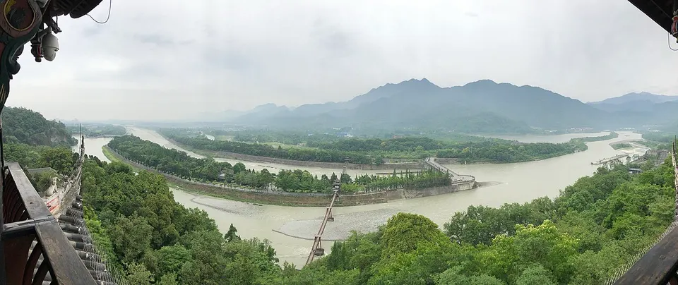
Dujiangyan stands where the Min River leaves the mountains for the Chengdu Plain. Begun around 256 BC under the State of Qin, the Dujiangyan irrigation works divide the river's flow rather than dam it, and they still water the plain. Mount Qingcheng, one of the birthplaces of Taoism, rises behind the city with Taoist temples on its slopes, and the two are listed together as a World Heritage Site. The old town of Guanxian, Lingyan Temple and a giant panda centre are also close.
Featured places in Dujiangyan
-
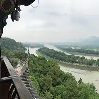
Dujiangyan Irrigation System 都江堰
A 2,200-year-old waterworks that tamed the Min River without a dam and still runs today
-
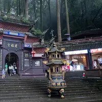
Mount Qingcheng 青城山
A cradle of Taoism, where forest stairways climb past temples and cave shrines
Listed sites in Dujiangyan
4 sites in Dujiangyan are on the official lists. Those with a page of their own link to it; the rest open as cards on the map.
- Guanxian Old Town, Dujiangyan 灌县古城 4A scenic area
The historic core of Dujiangyan, a city known as Guan County until 1988, lying beside the ancient irrigation scheme. - Hongkou Scenic Area 虹口 4A scenic area · on the map
A forested valley along the Baisha River in the mountains north of Dujiangyan, bordering the Longxi–Hongkou National Nature Reserve, a habitat of giant pandas and golden monkeys. - Kuiguang Pagoda 奎光塔 National heritage site
A hexagonal brick pagoda in Dujiangyan city, rebuilt in 1831 on a Ming predecessor by a county magistrate to promote local scholarship. - Lingyan Temple and Thousand Buddha Pagoda 灵岩寺 National heritage site
A temple on the southern slope of Lingyan Mountain just north of Dujiangyan city, rebuilt in the Ming and Qing; only its Qing main hall and bell tower survive.
Intangible heritage in Dujiangyan
2 items on China's national list of intangible cultural heritage are filed for Dujiangyan.
- Traditional sports, games and acrobatics: Qingcheng martial arts
- Folk customs: Dujiangyan Water-Releasing festival
Getting to Chengdu
Train, flight and driving times from the cities most visitors come from, with stations, fares and how many run a day; each opens the full comparison.
- Leshan 乐山 high-speed train 41 min, 59 a day, from ¥51
- Emeishan 峨眉山 high-speed train 1 h 5 min, 28 a day, from ¥63
- Kangding 康定 a nonstop route is listed
- Songpan 松潘 high-speed train 1 h 33 min, 26 a day, from ¥135; a nonstop route is listed
- Chongqing 重庆 high-speed train 1 h 2 min, 131 a day, from ¥156
- Xi'an 西安 high-speed train 3 h 5 min, 67 a day, from ¥300; one nonstop flight a day, 1 h 35 min in the air
- Kunming 昆明 high-speed train 5 h 51 min, 24 a day, from ¥527; 21 nonstop flights a day, 1 h 25 min in the air
- Zhangjiajie 张家界 high-speed train 3 h 58 min, 7 a day, from ¥398; one nonstop flight a day, 1 h 20 min in the air
- Xining 西宁 high-speed train 8 h 59 min, 7 a day, from ¥317; 5 nonstop flights a day, 1 h 35 min in the air
- Guilin 桂林 high-speed train 4 h 58 min, 17 a day, from ¥482; 3 nonstop flights a day, 1 h 50 min in the air
- Lhasa 拉萨 train 34 h 38 min, 1 a day, from ¥303; 27 nonstop flights a day, 2 h 35 min in the air
- Hong Kong 香港 high-speed train 8 h 19 min, 1 a day, from ¥881; 6 nonstop flights a day, 2 h 50 min in the air
- Beijing 北京 high-speed train 7 h 28 min, 12 a day, from ¥872; 53 nonstop flights a day, 3 h in the air
- Shanghai 上海 high-speed train 10 h 31 min, 16 a day, from ¥1074; 49 nonstop flights a day, 3 h 25 min in the air
On the map
Open Dujiangyan on the illustrated map to see its outline, its places and listed sites together, and to add them to a trip.
Open Dujiangyan on the map