 Atlas of China
Hami 哈密Hāmì
Melons sent as tribute, a princes' mausoleum and grassland over the Tian Shan
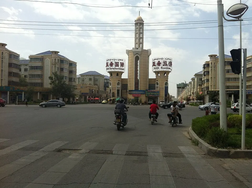
About Hami
Hami is Xinjiang's eastern gateway from Gansu, and its sweet melons have carried its name across China since they were first sent as tribute to the Qing court under the Kangxi Emperor. In the city, the domed tombs of the Hami princes, who ruled under the Qing for more than two centuries, stand opposite the Hami Museum. North across the Tian Shan lie the Barkol grassland and its Qing garrison town, and to the south-west the wind has carved the yardangs of Dahaidao.
What to eat in Hami
- Hami melon (哈密瓜)
Listed sites in Hami
12 sites in Hami are on the official lists. Those with a page of their own link to it; the rest open as cards on the map.
- Barkol Lake 巴里坤湖 4A scenic area
Barkol Lake, known in Han times as the Pulei Sea, is a salt lake at about 1,585 m in the western Barkol grassland, ringed by the Barkol and Moqin Ula mountains. - Barkol Old City 巴里坤古城 4A scenic area · National heritage site · on the map
Barkol was a Qing garrison town on the grassland north of the Tian Shan, one of the four great military cities of northern Xinjiang, with a Han city built in 1731 and a Manchu city in 1772. - East Tianshan Scenic Area, Hami 哈密东天山 4A scenic area · on the map
This mountain scenic area north of Hami links four spots in the eastern Tian Shan: Mingsha Shan, a singing sand dune; the alpine meadows of Baishitou, named after a lone white boulder; Songshutang, cool in summer and snowy in winter; and Tianshan Temple, a viewpoint whose temple is said to date back to the Tang. - Gaojiahu Wetland, Barkol 高家湖湿地 4A scenic area · on the map
Gaojiahu is a spring-fed wetland of ponds, marsh and winding streams on the Barkol grassland, listed among China's important wetlands and home to water birds, with the snowy Tian Shan as a backdrop. - Hami Dahaidao Yardang Scenic Area 哈密雅丹大海道 4A scenic area · on the map
South-west of Hami, wind has carved the Gobi into a vast field of yardangs, ridges and mesas of clay and sandstone in shapes given names such as the Starship and the Horse's Head, along the line of the Dahaidao, an ancient short cut between Turpan and Dunhuang. - Hami Kings' Mausoleum 哈密回王墓 4A scenic area · National heritage site · on the map
For more than two centuries Hami was ruled under the Qing by a line of nine local Uyghur princes, and their burial ground in the south of the city mixes Islamic, Chinese and Mongol architecture. - Hami Museum 哈密市博物馆 4A scenic area · on the map
The Hami Museum, a national first-grade museum, holds the main collection of the Hami region, with stone tools, bronzes, painted pottery, woodwork, woollen textiles and naturally preserved mummies from prehistory to the Ming and Qing. - Yiwu Desert Poplar Forest 伊吾胡杨林 4A scenic area · on the map
A large forest of desert poplar (Populus euphratica) on the edge of the Naomaohu basin in Yiwu County, run as a national desert park and scenic area since 2004. - Baiyanggou Buddhist Temple Ruins 白杨沟佛寺遗址 National heritage site · on the map
These are the ruins of a large Tang-dynasty Buddhist monastery strung for more than 10 km along both banks of the Baiyang River west of Hami. - Dahe Tang City Ruins, Barkol 大河古城 National heritage site · on the map
Dahe is a Tang-dynasty town site of two adjoining walled enclosures on the flat floor of the Barkol basin. - Huancaigou Stone Inscriptions 焕彩沟石刻 National heritage site · on the map
A lone boulder at the mouth of Huancaigou gorge, beside the old road over the Tian Shan from Hami to Barkol, carries inscriptions from three dynasties. - Lafuqueke Ancient City Ruins 拉甫却克古城遗址 National heritage site · on the map
Lafuqueke is a Tang-dynasty walled town on the east bank of the Baiyang River at Wubao, split into northern and southern halves by flood erosion.
On the map
Open Hami on the illustrated map to see its outline, its places and listed sites together, and to add them to a trip.
Open Hami on the map