 Atlas of China
Lishui 丽水Lìshuǐ
Celadon kilns, sword-smiths and terraced hills in Zhejiang's far south-west
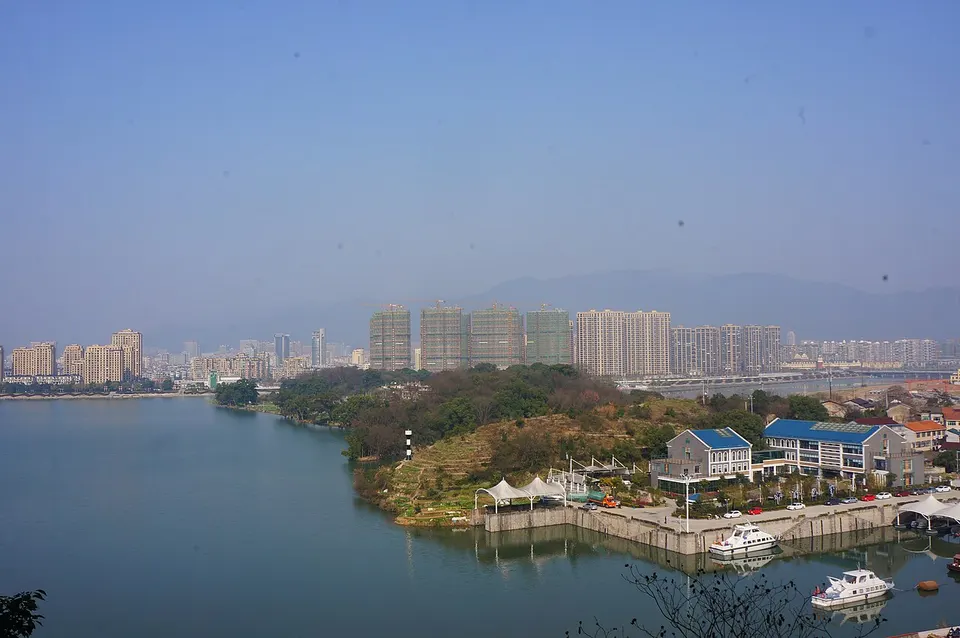
About Lishui
Lishui, whose name means 'beautiful waters', is almost nine-tenths mountain, and Zhejiang's highest peak, Huangmaojian, stands in its forests. Longquan made green-glazed celadon that was exported for over five centuries and is still known for its swords, while Qingtian carves its local stone and has sent many emigrants to Europe, especially Spain. Visitors come for Dinghu Peak, a 170-metre stone pillar at Xiandu, the Yunhe Rice Terraces, and Jingning, the only She autonomous county in China.
What to eat in Lishui
- Jinyun shaobing, oven-baked pork pastries (缙云烧饼)
Listed sites in Lishui
34 sites in Lishui are on the official lists. Those with a page of their own link to it; the rest open as cards on the map.
- Xiandu Scenic Area 仙都 5A scenic area · National heritage site
A valley of rock peaks along the Lianxi stretch of the Haoxi River north-east of Jinyun town, named "capital of immortals" by the Tang emperor Xuanzong; its emblem is Dinghu Peak, a 170.8 m stone pillar shaped like a bamboo shoot, from which the Yellow Emperor is said to have ascended to heaven. - Yunhe Rice Terraces 云和梯田 5A scenic area · on the map
Rice terraces climbing from about 200 m to over 1,400 m above sea level in Chongtou town, begun in the Tang dynasty and greatly extended in the Yuan and Ming when silver mining brought settlers; in 2024 they became China's first terraced-landscape 5A scenic area. - Baishanzu 百山祖 4A scenic area · on the map
At 1,856.7 m, Baishanzu is the second-highest peak in Zhejiang and the core of a nature reserve of about 109 km² in Qingyuan county, within the area proposed for the Qianjiangyuan–Baishanzu National Park. - Baoxi and Xitou Village 宝溪 4A scenic area · on the map
A mountain township in western Longquan whose village of Xitou has made celadon for centuries and was named one of UN Tourism's Best Tourism Villages in 2024. - China Celadon Town and Piyun Celadon Culture Park 中国青瓷小镇·披云青瓷文化园 4A scenic area · on the map
Shangyang town is where modern Longquan celadon began: the state-owned Longquan Porcelain Factory was set up here in 1954, gathering leading craftsmen to revive the ware. - Dongxi Rock Scenic Area 东西岩 4A scenic area · on the map
A 2.5 km² area of Danxia-type sedimentary rock in Laozhu She Ethnic Town, named after two great rocks that face each other from east and west. - Guyan Huaxiang (Ancient Weir Painting Village) 古堰画乡 4A scenic area · on the map
A riverside scenic area on the Ou River about 25 km south-west of Lishui, taking in the old river port of Dagangtou, Yantou village by the 6th-century Tongji Weir, and the Baoding celadon kiln sites. - Heyang Ancient Village 河阳古民居 4A scenic area · National heritage site
A village of the Zhu clan in Xinjian town, founded in the Five Dynasties period and replanned in the Yuan, whose lanes and water channels still follow that plan. - Jinzi Peak (Qingyuan National Forest Park) 巾子峰 4A scenic area · on the map
A forested mountain area a few kilometres north-west of Qingyuan town, centred on Jinzi Peak and run as a state-owned scenic area. - Longquan Mountain (Fengyang Mountain) 龙泉山 4A scenic area · on the map
A mountain resort area on Fengyang Mountain inside the Fengyangshan–Baishanzu National Nature Reserve, crowned by Huangmao Peak, at 1,929 m the highest point in Zhejiang. - Nanjian Rock Scenic Area 南尖岩 4A scenic area · on the map
A 6 km² mountain area in south-west Suichang county with craggy peaks, odd-shaped rocks, streams and mountain views. - Qianfo Mountain, Suichang 千佛山 4A scenic area · on the map
A privately run mountain park in Shilian town in western Suichang, named for rock formations said to resemble a thousand Buddhas. - Qingtian Stone Carving Cultural Area 青田中国石雕文化旅游区 4A scenic area · on the map
Qingtian's showcase for its soft, many-coloured local stone, carved for at least 1,500 years into seals, figures and landscapes and listed as national intangible heritage in 2006. - Ruoliao Primeval Forest 箬寮原始林 4A scenic area · on the map
A privately developed forest area in Anmin township in south-west Songyang, opened up for visitors from 2000, with forest cover put at about 95 per cent. - Shimen Cave, Qingtian 石门洞 4A scenic area · National heritage site · on the map
A scenic area at Gaoshi on the Ou River that Tang-dynasty Taoists counted among the 36 lesser grotto-heavens. - Songyin River 松阴溪 4A scenic area · on the map
The Songyin is a 119 km tributary of the Ou River that rises in the hills of Suichang and flows east across the Songyang basin, past Songyang town, to join the main stream at the Tongji Weir in Liandu. - Suichang Gold Mine National Mine Park 遂昌金矿国家矿山公园 4A scenic area · on the map
A former polluted gold-mining district east of Suichang town that was cleaned up and opened to visitors as a national mine park in 2007. - Window of She Culture, Dajun 畲乡之窗 4A scenic area · on the map
A village scenic area at Dajun in Jingning, the only She autonomous county in China, set up to present the culture of the She people. - Yunzhong Daji Scenic Area 云中大漈 4A scenic area · on the map
A high mountain basin in north-west Jingning, more than 1,000 m above sea level, where villages and terraced fields are ringed by steep peaks. - Zhulong Town 住龙 4A scenic area · on the map
A mountain town on the upper Wuxi River in north-west Longquan that lay at the heart of the Communist base area in south-west Zhejiang in the 1930s and is promoted as "Zhejiang's little Jinggangshan". - Dayao Longquan Kiln Sites 大窑龙泉窑遗址 National heritage site · on the map
The heartland of Longquan celadon, where 126 kiln sites lie in a 5.2 km² protected area around Dayao village. - Dushan Stone Archway 独山石牌坊 National heritage site · on the map
A granite memorial archway of three bays and five roofs at the south-east edge of Dushan village, built in 1569 by the county magistrate Chi Yude for Ye Yifan, an official of the Ministry of Works born in the village. - Former Site of Zhejiang University Longquan Branch 浙江大学龙泉分校旧址 National heritage site · on the map
When Zhejiang University moved inland during the war with Japan, it opened a branch in 1939 in the Zeng family mansion at Fangye on the edge of Longquan so that students from the south-east could keep studying; it became the Longquan Branch in 1940. - Haochuan Site 好川遗址 National heritage site · on the map
A late Neolithic cemetery of about 4,300 to 3,700 years ago on a low hilltop in Haochuan village, where 80 graves were excavated, the richer burials at the centre and poorer ones on the slopes. - Lingjiu Temple Stone Pagodas 灵鹫寺石塔 National heritage site
Four small stone stupas about 4 m high, carved in 1216 and 1218 under the Southern Song for Lingjiu Temple in Lishui's eastern outskirts, surviving from a set of seven that stood for the Seven Buddhas. - Nanming Mountain Cliff Inscriptions 南明山摩崖题刻 National heritage site
Fifty-eight inscriptions carved on the rocks of Nanming Mountain, now a park on the southern edge of Lishui city, grouped at the Stone Beam, Gaoyang Cave and Yunge Cliff. - Rulong Bridge 如龙桥 National heritage site
A timber-arch covered bridge in Yueshan village, rebuilt in 1625 according to an inscription on its ridge beam, which makes it the oldest known timber-arch covered bridge in China with a precisely dated rebuilding. - Shisi Temple 时思寺 National heritage site
A temple complex in the Daji basin whose oldest buildings date from the Yuan dynasty, with additions of the late Ming and early Qing. - Tongji Weir 通济堰 National heritage site
An irrigation system begun in 505 at Yantou village, where a curved weir diverts the Songyin River onto the Bihu plain; the timber dam was rebuilt in stone in 1205, and the surviving 275 m arch weir is described as the world's earliest arch dam. - Wu Wenjian Ancestral Hall 吴文简祠 National heritage site
A memorial hall in Yueshan village founded in 1522, laid out as gate tower, main hall and rear hall around courtyards; the national listing dates the surviving buildings to the Qing dynasty. - Xiyang Hall (Temple of Wu Sangong) 西洋殿 National heritage site
A temple beside the Songyuan River in Xiyang village dedicated to Wu Sangong, revered locally as the founder of shiitake mushroom growing; it was first built in 1265 and rebuilt in 1875. - Yanqing Temple Pagoda 松阳延庆寺塔 National heritage site
A six-sided, seven-storey brick pagoda with timber eaves, built between 999 and 1002 to hold relics brought back by the monk Xingda, and the only surviving part of Yanqing Temple. - Yunhe Silver Mine Site 云和银矿遗址 National heritage site · on the map
Remains of the Ming-dynasty silver mines whose working helped prompt the founding of Yunhe county in 1452, centred on Huangjiashe, a village at about 980 m reached through the Yunhe terraces. - Zhan Bao Jinshi Archway 詹宝兄弟牌坊 National heritage site
A bluestone memorial archway on Xiama Street in eastern Songyang town, raised for Zhan Bao, who passed the highest imperial examination in 1496, and inscribed "brothers both jinshi" on one face and "father and son both successful" on the other.
On the map
Open Lishui on the illustrated map to see its outline, its places and listed sites together, and to add them to a trip.
Open Lishui on the map