 Atlas of China
Dandong 丹东Dāndōng
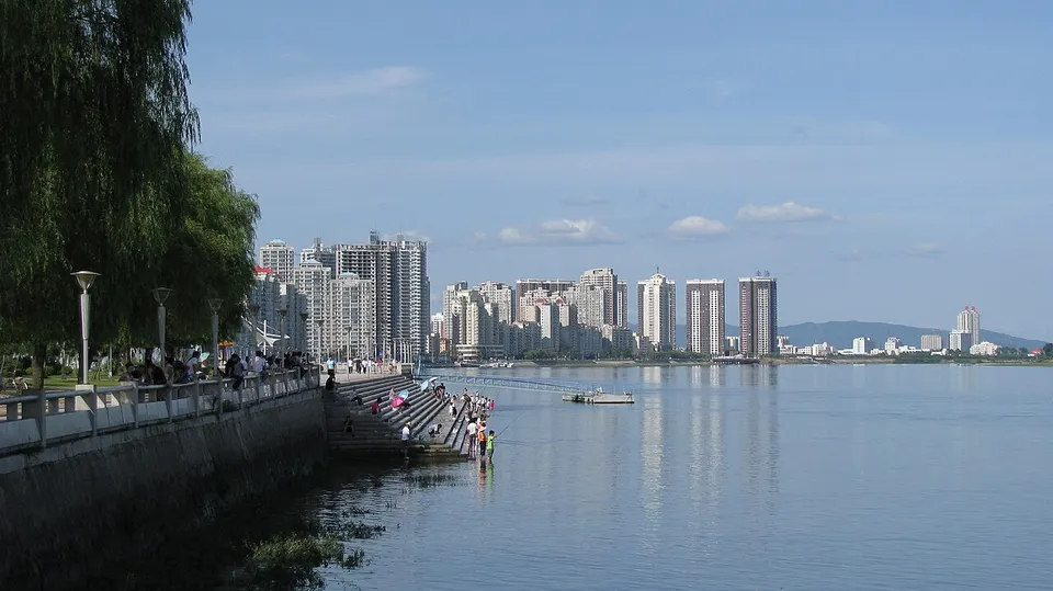
A riverside city looking across the Yalu to North Korea
About Dandong
Dandong lies where the Yalu River nears the sea, facing the North Korean city of Sinuiju across the water. Its riverfront is the main draw: the Yalu River Broken Bridge, bombed in 1950 during the Korean War, ends in mid-stream beside the Sino-Korean Friendship Bridge. Upstream, the Hushan Great Wall climbs a hill at what surveys identified as the eastern end of the Ming wall, and Phoenix Mountain near Fengcheng has cliff paths and temples.
What to eat in Dandong
- Chaochazi, stir-fried fermented-corn noodles (丹东炒叉子)
Listed sites in Dandong
11 sites in Dandong are on the official lists. Those with a page of their own link to it; the rest open as cards on the map.
- Dalishu Agricultural Tourism Area 大梨树生态农业观光旅游区 4A scenic area · on the map
The Dalishu tourism area is a rural-tourism complex in and around Dalishu village, south-west of Fengcheng, which the provincial tourism department counts among the first national agricultural-tourism demonstration sites. - Dalu Island 大鹿岛 4A scenic area · on the map
Dalu Island lies at the mouth of the Yalu, about 4 km long, with a fishing and tourism village and a bathing beach. - Memorial of the War to Resist US Aggression and Aid Korea 抗美援朝纪念馆 4A scenic area
This national first-grade museum on Yinghua Mountain in Dandong is devoted to the Korean War, which China calls the War to Resist US Aggression and Aid Korea, and to the campaign in China to support it. - Phoenix Mountain, Fengcheng 凤凰山 4A scenic area · National heritage site
Phoenix Mountain is a rocky mountain area south-east of Fengcheng, divided into West Mountain, East Mountain and Ancient City sections, with cliff-side boardwalks, a glass-floored walkway, a glass suspension bridge and several temples. - Tianhuashan Forest Park 天华山森林公园 4A scenic area · on the map
Tianhuashan is a provincial scenic area and forest park in the mountains of Guanshui town in northern Kuandian County, made a provincial forest park in January 2001. - Tianqiaogou 天桥沟 4A scenic area · on the map
Tianqiaogou is a forest park in the mountains of northern Kuandian County, close to the boundaries with Huanren and Benxi counties, and is best known for its autumn maple colour. - Yalu River Scenic Area 鸭绿江风景名胜区 4A scenic area · on the map
The Yalu River Scenic Area is a national-level scenic and historic area that follows the river from the Hun River mouth, at the Liaoning–Jilin boundary, down to the sea; the provincial tourism department lists six sections: Jiangkou, Daqiao (the bridges at Dandong), Hushan, Taipingwan, Shuifeng and Lüjiang. - Zhangdao Island 獐岛 4A scenic area · on the map
Zhangdao, also called Xiaoludao (Little Deer Island), is a small island village in the Yellow Sea off Beijingzi town in Donggang. - Hekou Broken Bridge, Kuandian 河口断桥 National heritage site · on the map
The Hekou Broken Bridge is the surviving part of a road bridge across the Yalu built in 1942, originally about 700 m long with 23 spans. - Hushan Great Wall 虎山长城 National heritage site
Hushan Great Wall is a restored stretch of Ming-era wall, about 1.2 km long, that climbs Hushan hill (146 m) beside the Yalu where the Ai River joins it. - Yalu River Broken Bridge 鸭绿江断桥 National heritage site
The Broken Bridge is what remains of the first bridge built across the Yalu, a 12-span steel railway bridge that Japan began in 1909 to link Korea with the Eurasian rail network and that later carried road traffic.
On the map
Open Dandong on the illustrated map to see its outline, its places and listed sites together, and to add them to a trip.
Open Dandong on the map