 Atlas of China
Qinghai 青海Qīnghǎi
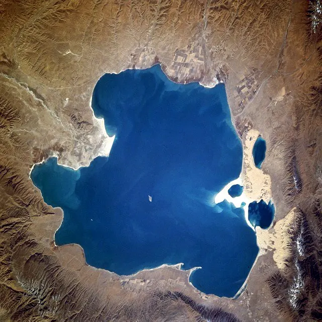
Qinghai Lake, mirror-like salt flats and the headwaters of great rivers
- Type
- Province
- Capital
- Xining
- Featured places
- 3
- Cities and prefectures
- 8
- Listed sites
- 772 rated 5A · 44 rated 4A · 39 national heritage
About Qinghai
Qinghai covers the northeastern Tibetan Plateau, a high, open land of grasslands, salt lakes and snow ranges where the Yangtze, Yellow and Mekong rivers begin. Qinghai Lake, China's largest lake, is edged with yellow rapeseed in summer, while the Chaka and Qarhan salt flats reflect the sky like mirrors. Xining, the capital, is a meeting place of Tibetan, Hui, Tu, Salar and Han communities, with the great Kumbum Monastery just outside the city.
Qinghai at a glance
- Area
- 696,700 km²
- Population
- 5.9 million 2020
- Highest point
- Bukadaban Feng 布喀达坂峰6,860 m
Area, population and highest point from Wikidata; the population is the latest census or official estimate there.
What to eat in Qinghai
- Niangpi cold noodles (酿皮)
- Qinghai yoghurt (老酸奶)
- Highland barley liquor (青稞酒)
Places to visit in Qinghai
-
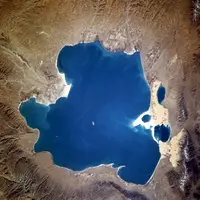
Qinghai Lake 青海湖
China's largest lake: a high-altitude inland sea edged with yellow rapeseed
-
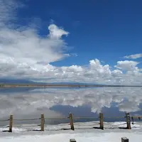
Chaka Salt Lake 茶卡盐湖
A salt flat so still it turns into a mirror for the sky
-
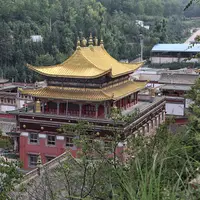
Kumbum Monastery 塔尔寺
Golden roofs and butter sculptures at the birthplace of Tsongkhapa
Listed sites in Qinghai
77 sites in Qinghai are on the official lists, 2 of them rated 5A and 39 protected as national heritage. They are listed by city, with what each is and how to get there.
All 77 listed sites in QinghaiCities and prefectures of Qinghai
- Golog 果洛 Tibetan Autonomous Prefecture · Dawu
Sacred peaks and a great bend of the Yellow River on the high grasslands - Haibei 海北 Tibetan Autonomous Prefecture · Xihai
Lakeside pastures, July rapeseed gold and the Qilian snow peaks - Haidong 海东 City · Ledu
Painted pottery, 4,000-year-old noodles and the Tu and Salar homelands - Hainan 海南 Tibetan Autonomous Prefecture · Gonghe
A clear stretch of the Yellow River, red cliffs and a lost Tuyuhun capital - Haixi 海西 Mongol and Tibetan Autonomous Prefecture · Delingha
Mirror-flat salt lakes, wind-carved ridges and the road to Lhasa - Huangnan 黄南 Tibetan Autonomous Prefecture · Tongren
Rebgong, the 'golden valley' of Tibetan thangka painters - Xining 西宁 City
Gateway to the plateau: a Gelug monastery, a Hui mosque and thick sour yoghurt - Yushu 玉树 Tibetan Autonomous Prefecture
Kham highlands where the Yangtze, Yellow River and Mekong all begin
Before you go
- Visas and visa-free entry Can I visit China without a visa?
- Paying for things How do I pay for things in China without a Chinese bank account?
- Internet and apps Will Google and my other apps work in China?
- Trains and 12306 How do I book train tickets in China with a foreign passport?
- Book popular sights early Which sights in China need booking in advance, and how?
- When to go When is the best time to visit China?
On the map
Open Qinghai on the illustrated map to see where its places sit, how far apart they are, and to add them to a trip.
Open Qinghai on the map