 Atlas of China
Taizhou 台州Táizhōu
Tiantai's Buddhist mountain, a walled river city and cliff walks at Shenxianju
About Taizhou
Taizhou takes its name from Tiantai Mountain, where the monk Zhiyi founded the Tiantai school of Buddhism in the 6th century; Guoqing Temple, first built in 598, is still its ancestral temple for Chinese and Japanese followers alike. In Linhai, the Walled City of Taizhou Fu keeps walls said to have been a model for the Ming Great Wall, and the peaks of Shenxianju are crossed by cliff walkways. Taizhou is also a cradle of private enterprise; the carmaker Geely began here.
What to eat in Taizhou
- Shibingtong, filled pancake rolls (食饼筒)
- Danqing yangwei, egg-white and bean-paste 'sheep's tails' (蛋清羊尾)
Listed sites in Taizhou
31 sites in Taizhou are on the official lists. Those with a page of their own link to it; the rest open as cards on the map.
- Shenxianju 神仙居 5A scenic area
A 5A mountain scenic area in western Xianju county and the core of Xianju National Park, known for sheer cliffs, rock pillars and peaks of volcanic rhyolite that are often wrapped in cloud. - Tiantai Mountain 天台山 5A scenic area
The forested granite range north of Tiantai town that gave its name to the Tiantai school of Buddhism, a 5A scenic area whose two main parts are Guoqing Temple at its foot (separate card) and the Shiliang area high on the mountain. - Walled City of Taizhou Fu 台州府城 5A scenic area · National heritage site
Linhai's old walled town, seat of Taizhou prefecture from 591 until 1993, is now a 5A scenic area of 3.12 km² taking in the city wall, Ziyang Street, East Lake and Jinshan Hill. - Changyu Dongtian Quarry Caves 长屿硐天 4A scenic area · on the map
A hill near Xinhe in Wenling honeycombed with man-made caverns left by some 1,500 years of quarrying stone slabs, now a national mine park and, with nearby Fangshan, a national scenic area. - Dachen Islands 大陈岛 4A scenic area · on the map
A group of 29 islands and islets about 52 km off Taizhou, with Upper and Lower Dachen the two inhabited main islands, wooded hills that form a provincial forest park, sea-worn rocks, beaches and fishing harbours. - Fangshan, Wenling 方山 4A scenic area
A flat-topped mountain of volcanic rhyolite in Daxi town, western Wenling, on the border with Yueqing, ringed by sheer cliffs but open on top, where lakes and ponds dot the summit plateau and wild azaleas flower in spring; the Taizhou government describes it as the largest Mesozoic rhyolite volcanic platform in Asia. - Hou'an Village 后岸村 4A scenic area · on the map
A village of farm-stay guesthouses in Jietou town, western Tiantai, beside the Shifeng stream below a long wall of cliffs known as the 'Ten-li Iron-Armoured Dragon'. - Huangyan Museum 黄岩博物馆 4A scenic area · on the map
The district museum of Huangyan, founded in 1984, with more than 8,000 objects ranging from Western Zhou proto-celadon and Tang and Song celadon to Buddhist relics of the Song dynasty. - Jiufeng Park 九峰公园 4A scenic area · National heritage site · on the map
A wooded hillside park on the eastern edge of Huangyan, named after the nine peaks that enclose its valley, opened in 1959 on the site of a Song-era monastery and a Qing academy and now covering about 106 hectares. - Linghu Lake Park 灵湖 4A scenic area · on the map
A lake park in Linhai's newer eastern district, about 5 km east of the walled old town, laid out around a broad lake with an island, willow-lined causeways and waterside paths. - Rouchuan Scenic Area 柔川 4A scenic area · on the map
A rural scenic area in Yutou township in the forested hills of western Huangyan (Rouchuan is the township's old name), following the Rouji stream, a tributary of the Yongning River, for about 20 km through the valleys. - Shenxian Oxygen Bar Town 神仙氧吧小镇 4A scenic area · on the map
A tourism district of about 3.8 km² spanning 20 villages in Baita town, at the approach to Shenxianju, developed as one of Zhejiang's provincial 'characteristic towns' around the area's clean mountain air and its closeness to the 5A scenic area. - Shepan Island 蛇蟠岛 4A scenic area · on the map
An island in Sanmen Bay, joined to the mainland on its Ninghai side by land reclamation in 2008, known as the 'Island of a Thousand Caves' for the roughly 1,300 caverns left by quarrying its red Shepan stone from the Song dynasty onwards. - Taizhou Ocean World 台州海洋世界 4A scenic area · on the map
An aquarium beside Taizhou Civic Square in Jiaojiang, opened in 2005 in a five-storey building that is toured from the top floor downwards. - Tiantai Mountain Great Waterfall and Qiongtai Valley 天台山大瀑布(琼台仙谷) 4A scenic area · on the map
A scenic area on the western slope of Tongbai Mountain, about 7 km north-west of Tiantai town, that joins the Tiantai Mountain Great Waterfall to Qiongtai Valley, a gorge of oddly shaped cliffs and rocks with plank walkways. - Xuanmen Bay Agricultural Sightseeing Park 漩门湾观光农业园 4A scenic area · on the map
A large agri-tourism park of nearly 10,000 mu (about 670 hectares) on the western edge of Qinggang town, Yuhuan, beside the Xuanmen Bay wetland and looking across Yueqing Bay to the Yandang mountains. - Xuanmen Bay National Wetland Park 漩门湾国家湿地公园 4A scenic area · on the map
A national wetland park of 31.48 km² in northern Yuhuan, where Yuhuan island meets the Chumen peninsula, made up of tidal flats, open water, freshwater marsh, islets and wooded hills. - Yong'an River Greenway 永安溪绿道 4A scenic area · on the map
A riverside route for cycling and walking along the Yong'an River, the 'mother river' of Xianju, which crosses the county's farmland basin from west to east. - Former Enze Hospital 恩泽医局旧址 National heritage site
Three two-storey Western-style buildings joined by covered bridges on the slope of Beigu Mountain in Linhai, the remains of the first Western-medicine hospital in Taizhou, opened by the British Anglican mission in 1901. - Guoqing Temple 国清寺 National heritage site
The temple at the southern foot of Tiantai Mountain where the Tiantai school of Buddhism began, founded in 598 under the Sui dynasty in fulfilment of the last wish of the school's founder Zhiyi and rebuilt under the Yongzheng Emperor in the 1730s. - Jiangxia Tidal Power Station 江厦潮汐试验电站 National heritage site
China's first two-way tidal power station, built across the Jiangxia inlet at the northern end of Yueqing Bay, where the tidal range reaches 8.39 m; its first turbine began generating in May 1980 and the plant now has about 4.1 MW installed. - Jinqing Great Bridge 金清大桥 National heritage site · on the map
A five-arch stone bridge 64 m long over the Jinqing waterway below Piyun Hill in Xinhe town, built in the early Jiaqing reign (around 1800) when an older flat bridge was rebuilt with arches. - Jinshan Pagodas, Linhai 巾山塔群 National heritage site · on the map
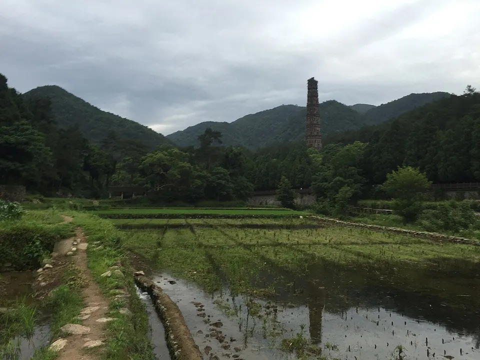
A group of old brick pagodas on and around Jinshan, the small twin-peaked hill in the south-east corner of Linhai's walled town, long the landmark of the former prefectural city. - Kanmen Tide Station 坎门验潮所 National heritage site · on the map
The first tide-gauge station in China to be sited, designed and built by Chinese surveyors, set up in 1929–1930 in a rocky cove at Kanmen on the south-east coast of Yuhuan and still recording tides today. - Lin Yingqi Memorial Arch 林应麒功德牌坊 National heritage site · on the map
A Ming-dynasty memorial archway (paifang) in Fuying subdistrict north-east of Xianju town, honouring Lin Yingqi (1506–1583), a native of the area who passed the imperial jinshi examination in 1535 and served as a county magistrate and prefectural official. - Nanfeng Pagoda 南峰塔 National heritage site · on the map
A hexagonal, seven-storey brick pagoda 23.8 m tall on Nanfeng Hill on the south side of Xianju town, built in 1032–1033 under the Northern Song and repaired in the Ming dynasty. - Qi Jiguang Memorial Temple, Jiaojiang 椒江戚继光祠 National heritage site
A temple complex in Jiaojiang's old quarter, the former Haimen garrison town, that combines the garrison's City God temple with a shrine to the Ming general Qi Jiguang, who was stationed here in the mid-16th century to fight the wokou pirates. - Taozhu Fortress Town 桃渚城 National heritage site
A Ming coastal fort town near the East China Sea in south-east Linhai, built in 1443 as one of the garrison posts raised against wokou pirates; Qi Jiguang wiped out a pirate band here in 1560. - Xianju Ancient Yue Rock Carvings 仙居古越族岩画群 National heritage site
Rock carvings attributed to the ancient Yue people of the Spring and Autumn and Warring States periods, found at seven sites in the hills of Xianju county, with more than 220 motifs over about 1,400 m² of rock. - Xinhe Lock Bridges 新河闸桥群 National heritage site
Four old stone sluice-bridges on the canals around Xinhe town in eastern Wenling, the Zhongzha, Maci, Beizha and Xialu sluices, which served both as river crossings and as water gates. - Yijiangshan Islands Battle Site 一江山岛战役遗址 National heritage site · on the map
Two small, steep islands about 30 km off Jiaojiang where the People's Liberation Army took the islands from Republic of China forces on 18 January 1955, its first combined operation of land, sea and air forces; the loss led the ROC to evacuate the nearby Dachen Islands the following month.
On the map
Open Taizhou on the illustrated map to see its outline, its places and listed sites together, and to add them to a trip.
Open Taizhou on the map