
 An illustrated travel map
Mountains and hiking in China
China's famous mountains are climbed on stone stairs, often past temples, with cable cars for those who want them: Huangshan, Mount Tai, Huashan and Emei among them. Further west the hiking is wilder, on trails through the gorges and snow peaks of Yunnan and western Sichuan, and on stretches of unrestored Great Wall north of Beijing.
- Places
- 572
- Regions
- 34
- Featured
- 117
- Group
- Nature
Show them on the interactive map
Featured places
-
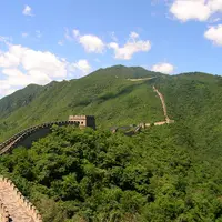
Great Wall at Mutianyu 慕田峪长城
Restored Ming watchtowers riding a wooded ridge, with a toboggan run back down
-
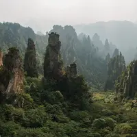
Zhangjiajie National Forest Park 张家界国家森林公园
Thousands of sandstone pillars rising out of the mist like a stone forest
-
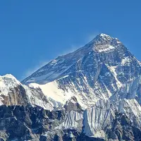
Everest (Qomolangma) Base Camp 珠峰大本营
Face the full north wall of Everest from around 5,000 metres
-
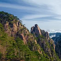
Huangshan (Yellow Mountain) 黄山
Granite spires, wind-bent pines and a sea of clouds straight out of an ink painting
-
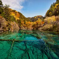
Jiuzhaigou Valley 九寨沟
Lakes so clear you can count the fallen trees lying on their beds
-
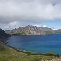
Changbai Mountain & Heaven Lake 长白山天池
A volcanic crater lake on the China–North Korea border, often wrapped in cloud
-
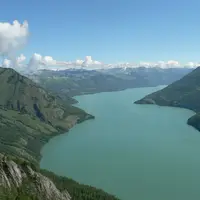
Kanas Lake 喀纳斯湖
A milky-turquoise lake in the Altai forests that turns gold each autumn
-
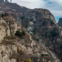
Mount Tai 泰山
China's most sacred peak, climbed by emperors and by night hikers chasing sunrise
-
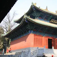
Shaolin Temple 少林寺
The cradle of Chan Buddhism and kung fu, at the foot of Mount Song
-
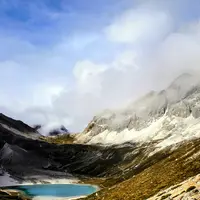
Daocheng Yading 稻城亚丁
Three sacred snow peaks, glacial lakes and Tibetan meadows high on the plateau
-
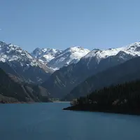
Heavenly Lake of Tianshan 天山天池
An alpine lake beneath snowy Bogda Peak, a day trip from Ürümqi
-
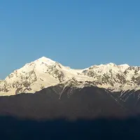
Meili Snow Mountain & Yubeng 梅里雪山与雨崩
Yunnan's highest peak, sacred and unclimbed, with a trek to a village beneath its glaciers
-
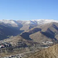
Mount Wutai 五台山
Temples, a towering white stupa and yellow-tiled roofs below five flat-topped holy peaks
-
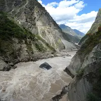
Tiger Leaping Gorge 虎跳峡
A classic two-day trail high above one of the world's deepest gorges
-
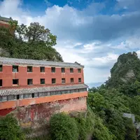
Wudang Mountains 武当山
Taoist palaces strung along forested ridges, and the legendary birthplace of tai chi
-
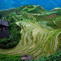
Longji Rice Terraces 龙脊梯田
Rice paddies stacked up the mountains like the scales on a dragon's back
-
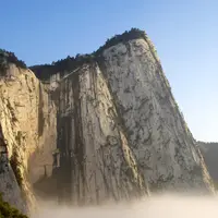
Mount Hua 华山
Sheer granite peaks, stairways cut into cliffs and a notorious plank walk
-
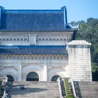
Purple Mountain & Sun Yat-sen Mausoleum 南京钟山风景区
A forested mountain on Nanjing's edge, crowned by a blue-roofed hilltop tomb
-
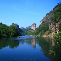
Wuyi Mountains 武夷山
Bamboo rafts, red sandstone cliffs and the birthplace of Da Hong Pao tea
-
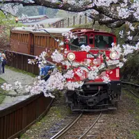
Alishan 阿里山
Giant cypresses, a sunrise over Jade Mountain and a narrow-gauge forest railway
-

Fanjingshan 梵净山
A Buddhist 'pure land' above the clouds, with temples on two rock pinnacles
-
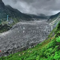
Hailuogou Glacier 海螺沟
A glacier spilling down into fir forest beneath Mount Gongga, Sichuan's highest peak
-
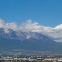
Jade Dragon Snow Mountain 玉龙雪山
A glacier-hung massif on Lijiang's doorstep, with a cable car to over 4,500 metres
-
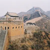
Jinshanling Great Wall 金山岭长城
A Ming ridge-top wall of 67 towers, restored at one end and wild towards Simatai
-
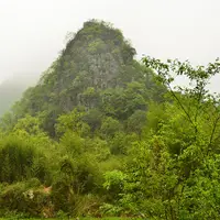
Libo Zhangjiang Scenic Area (Xiaoqikong and Daqikong) 荔波樟江景区
Emerald pools, stepped waterfalls and trees growing from water in a karst forest
-
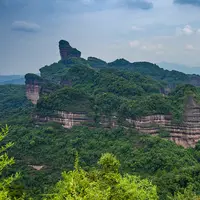
Mount Danxia 丹霞山
Red sandstone cliffs and flat-topped peaks that gave the 'Danxia' landform its name
-
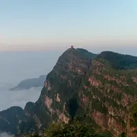
Mount Emei 峨眉山
A sacred Buddhist mountain of mist, monasteries and a golden summit above the clouds
-
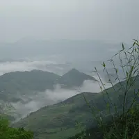
Mount Jiuhua 九华山
A Buddhist sacred mountain where 99 temples cling to granite peaks and mist
-
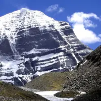
Mount Kailash and Lake Manasarovar 冈仁波齐—玛旁雍错
A holy mountain and lake sacred to four faiths, walked round on a three-day pilgrim kora
-
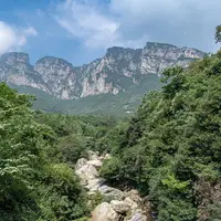
Mount Lushan 庐山
Misty peaks, waterfalls and a hill station of stone villas above the Yangtze
-
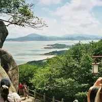
Mount Putuo 普陀山
A Buddhist island in the East China Sea, home of Guanyin, the bodhisattva of compassion
-
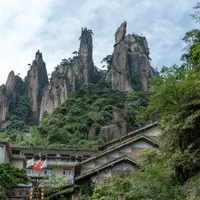
Mount Sanqing 三清山
Granite pillars in cloud and pine, and cliffside plank walks to a Taoist palace
-
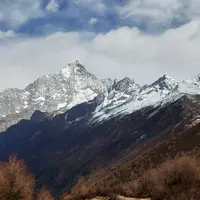
Mount Siguniang 四姑娘山
Four 'sister' snow peaks above three alpine valleys of forest, meadow and lakes
-
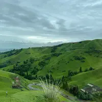
Nalati Grassland 那拉提草原
A green plateau meadow where Kazakh herders ride beneath spruce slopes
-
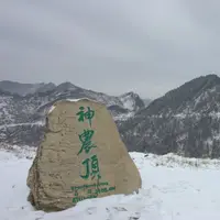
Shennongjia 神农架生态旅游区
Primeval forest and alpine meadow on the roof of central China, a UNESCO forest reserve
-
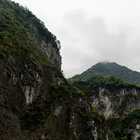
Taroko Gorge 太鲁阁峡谷
A marble canyon cut by the Liwu River, with many trails still shut after the 2024 quake
-
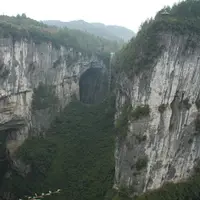
Wulong Karst 武隆喀斯特
Three colossal natural bridges, a sinkhole canyon and a cave in the hills of Wulong
-
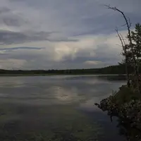
Arxan–Chaihe Scenic Area 阿尔山—柴河
Crater lakes, lava forest and hot springs in the Greater Khingan Mountains
-
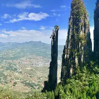
Enshi Grand Canyon 恩施大峡谷
A limestone canyon with a 150 m rock pillar, a cliff plank road and a waterfall floor
-
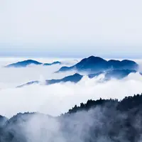
Mount Heng 南岳衡山
The Southern Peak of the Five Great Mountains, with Daoist and Buddhist temples
-
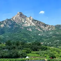
Mount Lao (Laoshan) 崂山
A granite Taoist mountain rising straight from the Yellow Sea, east of Qingdao
-
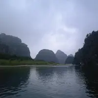
Mount Longhu 龙虎山
Red cliffs over a quiet river, the cradle of the Celestial Masters and Yue cliff coffins
-
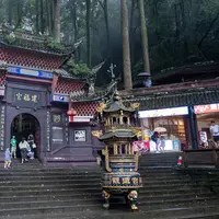
Mount Qingcheng 青城山
A cradle of Taoism, where forest stairways climb past temples and cave shrines
-
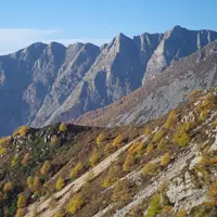
Mount Taibai 太白山
Forest roads and a cable car climb to 3,511 metres on the Qinling range's highest peak
-
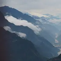
Nujiang Grand Canyon & Bingzhongluo 怒江大峡谷与丙中洛
A deep, remote river canyon of Lisu and Nu villages, mission churches and a horseshoe bend
-
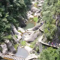
Taihang Grand Canyon 太行山大峡谷
Sheer gorges in the Taihang Mountains, explored by boat, cliff path and cable car
-
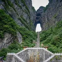
Tianmen Mountain 天门山
A cliff-top walk to a natural arch known as Heaven's Gate, above the city
-
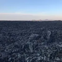
Wudalianchi Volcanic Field 五大连池
Fourteen young volcanoes, black lava fields, a chain of lakes and cold mineral springs
-
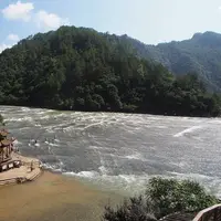
Baishuiyang and Yuanyang Stream 白水洋·鸳鸯溪
Wade across a flat bedrock riverbed, then walk a mandarin-duck gorge
-
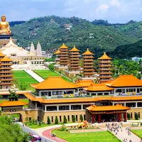
Fo Guang Shan 佛光山
A great Buddhist monastery, eight pagodas and a vast seated Buddha near Kaohsiung
-
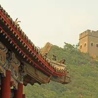
Huangyaguan Great Wall 黄崖关长城
A walled pass, water gate and 'Eight Trigrams' town on a restored Great Wall ridge
-
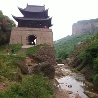
Jianmen Pass 剑门关
The cliff-walled gate on the old road to Shu that Li Bai said one man could hold
-
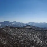
Jilin ski resorts: Beidahu & Songhua Lake 北大湖与松花湖滑雪场
Two big ski mountains within an hour of Jilin City, one with Asian Winter Games history
-
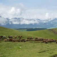
Kalajun Grassland 喀拉峻草原
Rolling alpine meadows, flower terraces and snow peaks above Tekes
-
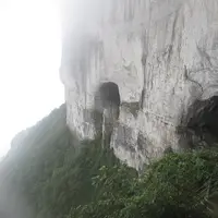
Mount Jinfo 金佛山
A cliff-ringed karst table mountain with cable cars, caves and a winter snow season
-
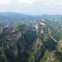
Mount Langshan 崀山
Red sandstone towers and a slot canyon above the Fuyi River, part of China Danxia
-
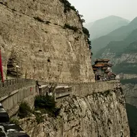
Mount Mian 绵山
Cliff temples, plank walkways and gorges on the mountain of the Cold Food legend
-
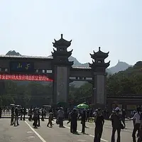
Mount Qian 千山
Granite peaks, old pines and a hillside where temples of two faiths stand side by side
-
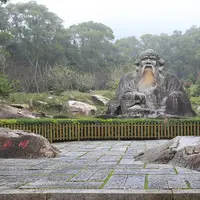
Mount Qingyuan 清源山
Quanzhou's hill of Song–Yuan cliff carvings, with a giant stone Laozi at its foot
-
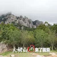
Mount Taimu 太姥山
Granite pinnacles, cave passages and sea mist above Fujian's north coast
-
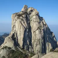
Mount Tianzhu 天柱山
A granite pillar among fifty peaks, with boulder caves and a mountain lake
-
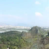
Seven Star Crags & Dinghu Mountain (Star Lake) 七星岩·鼎湖山
Seven limestone peaks in a city lake, plus China's first nature reserve in the hills
-
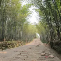
Shunan Bamboo Sea 蜀南竹海
Ridge upon ridge of feathery bamboo, laced with misty trails, waterfalls and cliff shrines
-
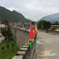
Songpan Ancient Town 松潘古城
A walled market town of the old tea-and-horse trade, and a base for horse treks
-
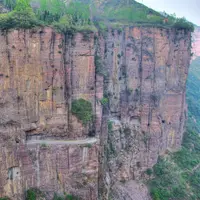
Wanxian Mountain (Guoliang) 万仙山
A village that hand-cut a road through the cliff face
-
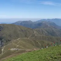
Wugong Shan Scenic Area (Luxi side) 武功山
High alpine meadows on a granite ridge, climbed for sunrise and sea of cloud
-
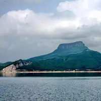
Wunü Mountain 五女山
A cliff-ringed plateau crowned by the first capital of the Koguryo kingdom
-
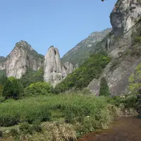
Yandang Mountains 雁荡山
Volcanic cliffs, cave temples and a 197 m waterfall, with rock silhouettes lit at night
-
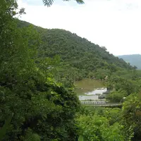
Yanoda Rainforest Cultural Tourism Zone 呀诺达雨林文化旅游区
Wade up rainforest streams, climb a waterfall and ride a zip-line above the canopy
-
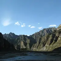
Yesanpo National Park 野三坡
Karst gorges, a rafting river and a Great Wall pass, about two hours south-west of Beijing
-
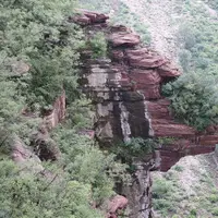
Yuntai Mountain 云台山
Red-rock gorges, pools and waterfalls on the southern Taihang
-
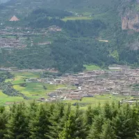
Zhagana 扎尕那
Tibetan villages and barley terraces under a limestone amphitheatre of peaks
-
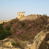
Baishi Mountain 白石山
White marble peaks, cliff-hung walkways and glass skywalks in the Taihang range
-
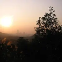
Baiyun Mountain 白云山
Guangzhou's green lung: forest trails, a cable car and city views from the summit
-
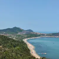
Changdao: South and North Changshan Islands 长岛南北长山
Linked Bohai Strait islands of sea cliffs, a crescent beach and fishermen's seafood
-
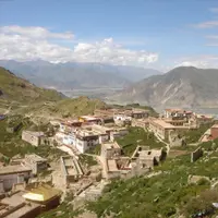
Ganden Monastery 甘丹寺
The first great Gelug monastery, high above the Lhasa valley with a hilltop kora
-
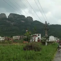
Guanzhai Mountain 冠豸山
Sheer red cliffs and rock pillars rising from the plain beside Liancheng
-
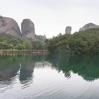
Guifeng 龟峰
Thirty-six red Danxia peaks stacked like turtles, praised by Xu Xiake
-
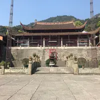
Gushan (Drum Mountain) 鼓山
Fuzhou's forested hill of Song carvings, pottery pagodas and a hillside Chan temple
-
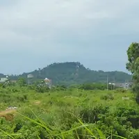
Haikou Volcanic Cluster Global Geopark 海口火山口公园
Climb a young volcanic cone and walk lava tubes just south of Haikou
-
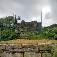
Hailongtun 海龙屯
A cliff-ringed Song–Ming hill fortress of stone gates, part of the Tusi Sites
-

Jingjiang Princes' Palace & Solitary Beauty Peak 靖江王城·独秀峰
A Ming princes' walled seat in central Guilin, with a limestone peak and exam hall
-
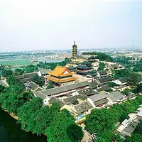
Jinshan, Jiaoshan and Beigushan 金山·焦山·北固山
Zhenjiang's three Yangtze hills: temples, pagodas and the White Snake legend
-
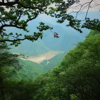
Kongtong Mountains 崆峒山
A sacred Taoist mountain of forested crags and Ming-era temples west of Pingliang
-
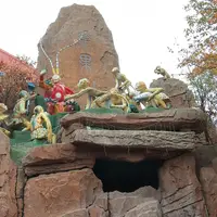
Mount Huaguo 花果山
The mountain that the Monkey King of Journey to the West calls home
-
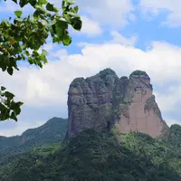
Mount Jianglang & Nianbadu 江郎山·廿八都
Three red cliffs, a sky-thin gorge and a border-road town of 140-plus surnames
-
Mount Langya 琅琊山
The wooded hills behind Ouyang Xiu's Old Drunkard's Pavilion
-
Mount Luofu 罗浮山
A Daoist grotto-heaven with 432 peaks, alchemist's relics and Su Dongpo's lychees
-
Mount Meng (Yimengshan) Scenic Area 沂蒙山景区
Shandong's second-highest peak, with granite ridges, cloud seas and turtle-shaped rocks
-
Mount Mengding 蒙顶山
Misty tea terraces and an imperial tea garden where tea growing is said to have begun
-
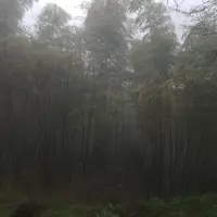
Mount Mogan 莫干山
Bamboo-clad hills and century-old summer villas, a cool escape from Hangzhou and Shanghai
-
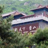
Mount Pan (Panshan) 盘山
The 'first mountain east of the capital': pines, odd rocks and imperial temple ruins
-
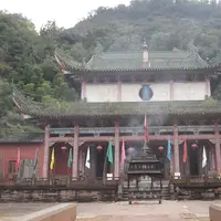
Mount Qiyun 齐云山
Red sandstone cliffs, cave shrines and over a thousand years of Taoist worship
-
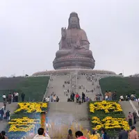
Mount Xiqiao 西樵山
An extinct volcano of 72 peaks with springs, caves, a huge Guanyin and an ancient quarry
-
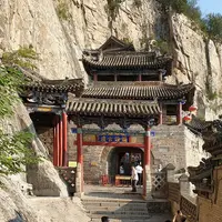
Nüwa Palace 娲皇宫
Cliffside temple halls to the legendary goddess who mended the sky
-
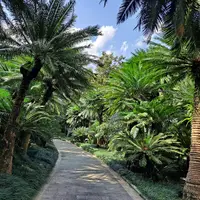
Qingxiu Mountain 青秀山
Nanning's green hill park of cycads, orchids, a temple and a hilltop pagoda
-
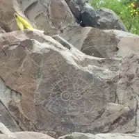
Rock Paintings of Helan Mountains (Helankou) 贺兰山岩画
Thousands of ancient carved faces and animals on a Helan Mountains gorge
-
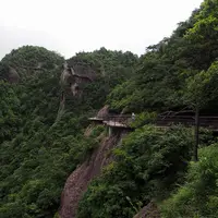
Shenxianju 神仙居
Sheer volcanic cliffs, cloud-wrapped pinnacles and a glass footbridge over a gorge
-
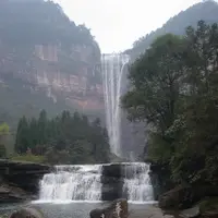
Simian Mountain 四面山
Forest, red cliffs, lakes and over a hundred waterfalls, a cool retreat from Chongqing
-
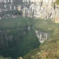
Tiankeng Difeng (Xiaozhai Tiankeng & Tianjing Gorge) 天坑地缝
A 600 m-deep sinkhole and a slot canyon above an underground river
-
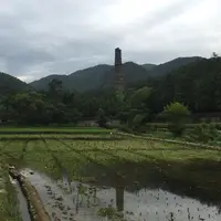
Tiantai Mountain 天台山
Cradle of Tiantai Buddhism: a Sui-dynasty temple, a stone-beam waterfall, a high peak
-
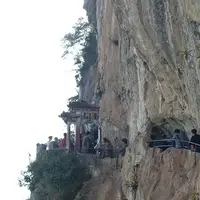
Western Hills & Dragon Gate 西山龙门
Taoist grottoes and a single-file ledge path cut into a cliff high above Dianchi Lake
-
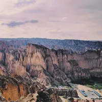
Yellow River Stone Forest 黄河石林
Towering conglomerate pillars and sheepskin rafts on a bend of the Yellow River
-
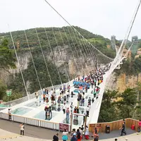
Zhangjiajie Grand Canyon 张家界大峡谷
A forested gorge in Cili, best known for its glass bridge
-
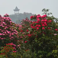
Baili Dujuan Rhododendron Forest 百里杜鹃
A mountain forest of wild rhododendrons that blazes pink, red and white in spring
-
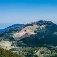
Beitou and Yangmingshan 北投·阳明山
Steaming hot-spring valley and a volcanic park, both inside Taipei
-
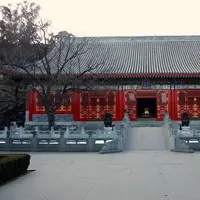
Fragrant Hills Park 香山公园
Wooded former imperial hills that turn red with smoke-tree leaves each autumn
-
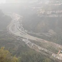
Linzhou Taihang Grand Canyon 太行大峡谷
Red-cliff gorges, waterfalls and a cliff-top road on the Taihang escarpment
-
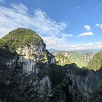
Longgang National Geopark 龙缸
A 335 m 'dragon vat' sinkhole with a glass walkway jutting off the cliff
-
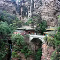
Mount Cangyan 苍岩山
A temple built into a gorge, with a hall that bridges the cliffs
-
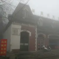
Mount Jigong 鸡公山
A cool Dabie Mountains ridge dotted with early-20th-century summer villas
-
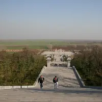
Mount Mangdang 芒砀山
Rock-cut royal tombs of the Western Han kings of Liang on a low plain-side hill
-
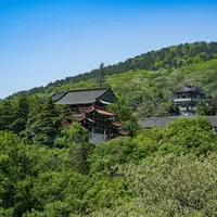
Mount Mao (Maoshan) 茅山
Birthplace of Shangqing Taoism, with a 33 m statue of Laozi among wooded hills
-
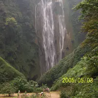
Tongling Grand Canyon 通灵大峡谷
A forested gorge by the Vietnamese border, ending at a 188 m waterfall
-
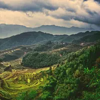
Yunhe Rice Terraces 云和梯田
Terraces stacked up a mountain in hundreds of layers, with a cable car and a stone village
-
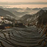
Ziquejie Rice Terraces 紫鹊界梯田
Rice terraces watered by mountain springs, settled since the Qin and Han dynasties
-
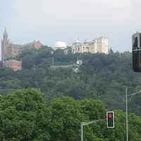
Sheshan Hills 佘山
Wooded hills with a hilltop basilica and a Jesuit observatory above the Songjiang plain
By region
Henan (49) · Hunan (39) · Sichuan (39) · Hebei (32) · Guangxi (31) · Zhejiang (30) · Jiangxi (30) · Shandong (28) · Hubei (27) · Anhui (23) · Jiangsu (22) · Liaoning (21) · Guangdong (21) · Shanxi (20) · Fujian (20) · Heilongjiang (16) · Chongqing (15) · Shaanxi (15) · Taiwan (13) · Gansu (12) · Yunnan (11) · Jilin (10) · Xinjiang (10) · Guizhou (9) · Hainan (7) · Beijing (4) · Inner Mongolia (4) · Tianjin (3) · Tibet (3) · Ningxia (3) · Qinghai (2) · Shanghai (1) · Hong Kong (1) · Macau (1)
Henan 49 places
- Shaolin Temple 少林寺 5A scenic area · National heritage site · UNESCO World Heritage
The cradle of Chan Buddhism and kung fu, at the foot of Mount Song - Wanxian Mountain (Guoliang) 万仙山 4A scenic area
A village that hand-cut a road through the cliff face - Yuntai Mountain 云台山 5A scenic area
Red-rock gorges, pools and waterfalls on the southern Taihang - Linzhou Taihang Grand Canyon 太行大峡谷 5A scenic area
Red-cliff gorges, waterfalls and a cliff-top road on the Taihang escarpment - Mount Jigong 鸡公山 5A scenic area · National heritage site
A cool Dabie Mountains ridge dotted with early-20th-century summer villas - Mount Mangdang 芒砀山 5A scenic area · National heritage site
Rock-cut royal tombs of the Western Han kings of Liang on a low plain-side hill - Anshan Forest Park 安山森林公园 4A scenic area · on the map
A provincial forest park on Anshan, a wooded hill in Quanhepu township in the east of Gushi County. - Baiyun Mountain 白云山 5A scenic area
A high forested part of the Funiu range in southern Song County, on the watershed of the Yangtze, Yellow and Huai rivers, protected as a national forest park and nature reserve. - Changshou Mountain, Zhulin 竹林长寿山 4A scenic area · on the map
A hill park of about 8.7 km² at Zhulin town in eastern Gongyi, best known for its autumn red leaves and for rocks likened to a dragon and a turtle, which gave it its old name of Longgui Mountain. - Chaoyang Mountain 朝阳山 4A scenic area · on the map
A mountain area just west of Qi County town, best known for Chaoyang Temple, a 'hanging temple' built against the rock face, and an Eastern Wei cave carved with rows of small Buddha figures. - Daimei Mountain 黛眉山 4A scenic area · on the map
A mountain scenic area in the far north of Xin'an County, on the south bank of the Yellow River upstream of the Xiaolangdi Dam. - Dasu Mountain National Forest Park 大苏山 4A scenic area · on the map
A national forest park of low wooded hills south-west of Guangshan town, set up in 2015 and taking in Dasu Mountain, Longshou Mountain and the Wangmu Daoist temple area. - Erlang Mountain, Wugang 二郎山 4A scenic area · on the map
A forested hill on the south shore of Shimantan Reservoir, part of the Shimantan National Forest Park and named after the legend of the god Erlang carrying mountains to chase the suns. - Erlong Mountain Scenic Area 中原二龙山 4A scenic area · on the map
A mountain scenic area in the north of Neixiang County, inside the Funiu Mountain Global Geopark, named for a ridge of ten linked peaks said to look like two dragons playing with a pearl. - Ganshan National Forest Park 甘山国家森林公园 4A scenic area · on the map
A national forest park in the mountains about 20 km south of Sanmenxia, rising to Ganlu Peak at about 1,885 m, with forest walks, autumn red-leaf areas, a water play area and a butterfly valley. - Guanshan Geopark 关山 4A scenic area · on the map
A national geopark in the Taihang Mountains north-west of Huixian, named after the ancient Zixia pass on a route through the range. - Guling Mountain 古灵山 4A scenic area · on the map
A Taihang mountain area north-west of Qi County promoted as a setting of the Investiture of the Gods legends and a centre of the cult of the goddess Nüwa, with a Nüwa Palace temple complex, rafting on Taigong Lake, a glass suspension bridge and a cable car towards a bronze-roofed summit shrine. - Hanshan Mountain, Lingbao 汉山 4A scenic area · on the map
A high, thickly wooded mountain in Guxian town, Lingbao, next to the Xiaoqinling nature reserve, whose Jinding summit rises to about 2,200 m. - Huaguo Mountain National Forest Park 花果山 4A scenic area · on the map
A forested mountain in south-western Yiyang County that shares its name with the Mountain of Flowers and Fruit, home of the Monkey King in Journey to the West, and plays on the story with a Water Curtain Cave square and Monkey King themes. - Huangbai Mountain National Forest Park 黄柏山 4A scenic area · on the map
A national forest park of forested ridges and valleys in the Dabie Mountains at the southern tip of Shangcheng County, where Henan meets Hubei and Anhui. - Jiaoding Mountain 轿顶山 4A scenic area · on the map
A mountain scenic area in the Taihang range north of Huixian, rated 4A in 2015, with red cliffs and forested slopes reached by a mountain road that visitors may drive up. - Jinding Mountain 金顶山 4A scenic area · on the map
A national forest park in Yifeng town where the Funiu and Tongbai ranges meet, on the climatic border between the subtropical and warm-temperate zones, with six peaks, dense mixed forest and rock formations. - Jingangtai Maoer Peak Scenic Area 金刚台猫耳峰 4A scenic area · on the map
A mountain scenic area on Jingangtai, the highest peak of the Dabie Mountains in Henan, within the Jingangtai National Geopark south-east of Shangcheng town. - Jinlan Mountain National Forest Park 金兰山 4A scenic area · on the map
A national forest park in the wooded Dabie hills on the north-western edge of Xin County town. - Jiufeng Mountain, Ruzhou 九峰山 4A scenic area · on the map
A range of low forested peaks in south-western Ruzhou, named for nine summits that legend links to the Jade Emperor's daughters; the highest, Dazhai, reaches 895 m. - Laole Mountain 老乐山 4A scenic area · on the map
A forested range of nine linked peaks at the eastern end of the Funiu and Tongbai mountains, the mountain scenery nearest to Zhumadian city, rising to 813 m at Yuhuang Peak. - Lingshan Scenic Area, Luoshan 灵山 4A scenic area · on the map
A granite mountain in Lingshan town, south-west Luoshan County, with forested slopes, streams and waterfalls, forming part of the Dongzhai national bird reserve. - Mount Chaya 嵖岈山 5A scenic area
A granite massif on the eastern edge of the Funiu Mountains, a national geopark whose main scenic area of about 50 km² is crowded with weathered rock pinnacles, caves and small lakes carved from granite about 140–120 million years old. - Mount Wangwu 王屋山 4A scenic area · National heritage site
A Taoist mountain north-west of Jiyuan, ranked first of the Ten Grotto-Heavens of Taoism and the setting of the fable of the Foolish Old Man who moved the mountains. - Muzhaling Scenic Area 木札岭 4A scenic area · on the map
A forested mountain area at Checun in south-eastern Song County, on the northern side of the Funiu range and within the Funiu Mountain nature reserve. - Niangniang Mountain, Lingbao 娘娘山 4A scenic area · on the map
A granite mountain and national geopark about 13 km west-south-west of Lingbao, known for its 'stone waterfalls', dark streaks running down bare granite slabs that look like ink paintings. - Paomaling Geopark 跑马岭 4A scenic area · on the map
A provincial-level geopark and forest park in the Taihang foothills of northern Weihui, named after the ridge of the same name. - Qifeng Mountain Ecotourism Area 七峰山 4A scenic area · National heritage site · on the map
The eastern end of the Funiu Mountains in northern Fangcheng County, a ridge of seven peaks topping out at 768 m with cliffs, caves, ravines and forest. - Qingyao Mountain 青要山 4A scenic area · on the map
A mountain area in north-western Xin'an County, linked in legend with the Yellow Emperor. - Shoushan Scenic Area 首山 4A scenic area · on the map
A hill just south of Xiangcheng town, linked in legend with the Yellow Emperor, who is said to have mined copper here, and ringed by rapeseed fields whose spring flowering has drawn an annual festival since 2018. - Sishan National Forest Park 寺山国家森林公园 4A scenic area · on the map
A forested hill park across the Guan River from Xixia town, covering about 7.5 km² of woodland, pools and viewpoints. - Tianchi Mountain National Forest Park 天池山 4A scenic area · on the map
A forested mountain area in north-western Song County, made up of the Tianchi ('Heavenly Lake'), Feilaishi ('Flying Rock'), Yunü Stream and Erlang Gully sections. - Tongshan Scenic Area 铜山 4A scenic area · on the map
A provincial scenic area in Biyang County made up of Tongshan mountain, the Tongshan Lake reservoir and Yunwu Peak, with forested hills, caves, waterfalls, temples and Taoist halls. - West Jiuhua Mountain 西九华山 4A scenic area · on the map
A hill scenic area in Chenlinzi town in southern Gushi County, near the Anhui border, built around Miaogao Temple, a Buddhist temple whose monks' stupas are a provincial heritage site. - Wuduo Mountain 五朵山 4A scenic area · on the map
A Taoist mountain on the border of Nanzhao and Zhenping counties whose five rocky summits rise to 1,665 m; tradition links it with Yin Xi, some 2,500 years ago, and the Tang Taoist Wu Yun. - Wuyan Mountain 五岩山 4A scenic area · on the map
A Taihang foothill in Jijiashan township, Heshan district, named for its five valleys and five rocky peaks, which tradition makes the retreat of Sun Simiao, the Tang physician revered as the King of Medicine. - Xianmen Mountain, Mianchi 仰韶仙门山 4A scenic area · on the map
A mountain valley scenic area in Duancun township, about 30 km from Mianchi town, developed by the Yangshao liquor company as part of its tourism estate; it held its opening ceremony and 4A plaque unveiling in April 2023. - Xitai Mountain 西泰山 4A scenic area · on the map
A forested mountain scenic area at Fudian in southern Ruyang County, with Lovers' Valley and the Shengshui Lake. - Xixia Dinosaur Remains Park and Laojieling 西峡恐龙遗迹园—老界岭 5A scenic area · on the map
Two separate parts of the Funiu Mountain Global Geopark in Xixia County share this 5A listing. - Yanzishan National Forest Park 燕子山 4A scenic area · on the map
A national forest park in the hills of Chuankou township, Lingbao, with stands of pagoda trees and dawn redwoods, several reservoirs and a cluster of waterfalls. - Yunlu Mountain Scenic Area 云露山 4A scenic area · on the map
A mountain scenic area of bamboo groves, forest and waterfalls at Mashankou in eastern Neixiang County, part of the Funiu Mountain Global Geopark. - Yunmeng Mountain 云梦山 4A scenic area · National heritage site · on the map
A Taihang mountain valley west of Qi County, also called Qingyan Mountain, where tradition places the retreat of Guiguzi, the Warring States master of strategy said to have taught Sun Bin, Pang Juan, Su Qin and Zhang Yi. - Zhaixinglou Scenic Area 摘星楼 4A scenic area · on the map
A mountain scenic area in the Daxiong Mountain provincial forest park in Xuzhuang town, south of Dengfeng, opened in the late 2010s beside Yanglin village. - Zhengzhou Xiangshan Scenic Area 郑州香山 4A scenic area · on the map
A leisure area built around Xiang Mountain in Daye town on the eastern side of Mount Song, named after a shrine that, by local tradition, people raised to the Tang poet Bai Juyi after he toured the area as governor in 830.
Hunan 39 places
- Zhangjiajie National Forest Park 张家界国家森林公园 5A scenic area · UNESCO World Heritage
Thousands of sandstone pillars rising out of the mist like a stone forest - Mount Heng 南岳衡山 5A scenic area · National heritage site
The Southern Peak of the Five Great Mountains, with Daoist and Buddhist temples - Tianmen Mountain 天门山 5A scenic area
A cliff-top walk to a natural arch known as Heaven's Gate, above the city - Mount Langshan 崀山 5A scenic area · UNESCO World Heritage
Red sandstone towers and a slot canyon above the Fuyi River, part of China Danxia - Zhangjiajie Grand Canyon 张家界大峡谷 4A scenic area
A forested gorge in Cili, best known for its glass bridge - Ziquejie Rice Terraces 紫鹊界梯田 4A scenic area
Rice terraces watered by mountain springs, settled since the Qin and Han dynasties - Anhua Tea-Horse Road Scenic Area 安化茶马古道 4A scenic area · on the map
A gorge-and-forest scenic area in Jiangnan town, eastern Anhua, built around stretches of the old mountain trade road on which Anhua's dark tea was carried out by horse caravans; the county presents it as the starting point of the Hunan section of the Ten-Thousand-Li Tea Road. - Chuanyan Mountain 穿岩山 4A scenic area · on the map
A forested mountain area in Tongxihe town in the Xuefeng Mountains of Xupu County, rated 4A in 2019, with the hilltop Fengxiang Yao village of guesthouses as its main base. - Dawei Mountain National Forest Park 大围山国家森林公园 4A scenic area · on the map
A national forest park of about 47 km² on the Hunan–Jiangxi border in north-eastern Liuyang, rising to 1,607.8 m at Qixing Ridge, the highest point in the Changsha area, and the source of the Liuyang River. - Daxiongshan National Forest Park 大熊山 4A scenic area · on the map
A mountain forest park in northern Xinhua whose peaks include Jiulong Feng (1,622 m), the highest in central Hunan, and Daxiong Feng (1,602 m), with gorges, waterfalls, old forest and more than 40 summits over 1,000 m. - Dayunshan National Forest Park 大云山 4A scenic area · National heritage site · on the map
A forested mountain of 911 m on the border of Yueyang County and Linxiang, a national forest park since 1996 and an old Daoist and Buddhist pilgrimage hill whose restored temples draw worshippers from Hunan, Hubei and Jiangxi, above all at the fairs on the third day of the third lunar month and the ninth day of the ninth. - Feishan Mountain 飞山 4A scenic area · on the map
A 720 m mountain north-west of Jingzhou town whose summit temple honours Yang Zaisi (860–954), a local leader of the Five Dynasties period who styled himself Lord of Feishan and is revered across the Hunan–Guizhou–Guangxi borderlands. - Feitian Mountain 飞天山 4A scenic area · on the map
A national geopark of red Danxia sandstone north-east of Chenzhou, where a river winds between cliffs and rock towers weathered into shapes likened to people and animals. - Gaoyi Ridge 高椅岭 4A scenic area · on the map
A Danxia landscape of red sandstone cliffs and ridges on the border of Suxian District and Zixing, north-east of Chenzhou, covering about 50.5 km². - Goulou Peak 岣嵝峰 4A scenic area · on the map
Goulou Peak is one of the main summits of the Hengshan range, rising in the north-east of Hengyang County on the border with Hengshan County, inside a national forest park set up in 1995 that covers about 2,070 ha, takes in five of Mount Heng's 72 peaks and rises to 1,143 m. - Heimi Peak National Forest Park 黑麋峰 4A scenic area
The highest hill in Wangcheng at 590.5 m, on the district's north-eastern border, protected as a national forest park of about 41 km² with forest covering over 80 percent. - Huilong Mountain 回龙山 4A scenic area · on the map
A mountain of about 1,413 m north of Dongjiang Lake in Zixing, rated 4A in December 2024 and visited for sunrise, sunset and sea-of-cloud views from the top and for wild azaleas in May. - Longshan National Forest Park 龙山 4A scenic area
A forested range on Lianyuan's southern border, a national forest park since 2007 centred on Yueping Peak (1,513 m), with forest cover of over 90% and seven scenic sections, among them the Feishuiya waterfall valley. - Mangshan National Forest Park 莽山 4A scenic area · on the map
A large mountain forest at the southern tip of Yizhang County on the Hunan–Guangdong border, protected as a national nature reserve and national forest park; its subtropical forest has species named after it, such as the Mangshan pit viper. - Mount Zhao 昭山 4A scenic area
A 185 m hill on the east bank of the Xiang River at the Xiangtan–Changsha border, whose misty views after rain were painted by Mi Fu as 'Mountain Market in Clearing Mist', one of the classic Eight Views of Xiaoxiang; legend says King Zhao of Zhou drowned in the pool below. - Mufu Mountain (Tianyue Mufushan) 幕阜山 4A scenic area
The main peak of the Mufu range, about 1,600 m high, on Hunan's border with Hubei and Jiangxi in northern Pingjiang, a national forest park since 2005 that stays cool even in midsummer. - Pengshan Scenic Area, Li County 彭山 4A scenic area · on the map
A forested hill area in Linan town, across the Li River from Li County town, rated 4A and listed as a national forest-wellness pilot base. - Qishan Forest Park 岐山 4A scenic area · on the map
Qishan, formerly called Fenghuang Shan and counted among the 72 peaks of Mount Heng, is a hill in the west of Hengnan County rising to 741 m, protected as a provincial forest park since 1998. - Shunhuang Mountain 舜皇山 4A scenic area · on the map
A forested range on Dong'an County's western border with Xinning County, protected as a national forest park, whose main peak rises to 1,882 m. - Siming Mountain 四明山 4A scenic area · on the map
A forested mountain on the western edge of Qidong County, said to take its name from the four neighbouring counties it looks out over; it became a provincial forest park in 2004 and a national forest park in 2014. - Suxian Ridge 苏仙岭 4A scenic area · National heritage site · on the map
A wooded hill on the north-eastern edge of central Chenzhou, named after the legend of a local man who became an immortal ('Su the Immortal'); paths climb past the White Deer Cave, the 'Ascension Stone' and other spots tied to the story. - Taiping Mountain, Longshan 太平山 4A scenic area · on the map
A forested mountain park about 4 km from Longshan county town, long a Buddhist site with temple halls on its slopes. - Tiantang Mountain National Forest Park 天堂山国家森林公园 on the map
A national forest park on Tiantang Mountain in Changning, in southern Hengyang prefecture, managed by its own park office. - Wanfo Mountain 万佛山 4A scenic area · on the map
A Danxia landscape of red sandstone peaks, cliffs and forest in Wanfoshan town, Tongdao, whose main summit rises to 635 m; together with nearby Dong villages it became a national scenic area in 2009. - Wangxian Ridge 王仙岭 4A scenic area · on the map
A forested hill scenic area on the south-eastern edge of Chenzhou city, with walks among streams and small waterfalls under the trees. - Wanyang Mountain 万洋山 4A scenic area · on the map
A mountain scenic area in Guidong County near the Jiangxi border, part of the Luoxiao range, whose high meadows above 1,500 m, natural tarn and lines of wind turbines are marketed as a 'southern grassland'; azaleas flower on the slopes in spring. - Wujianshan National Forest Park 五尖山国家森林公园 4A scenic area · on the map
A wooded hill of five peaks, the highest 588 m, rising just south-west of Linxiang city, a national forest park since 2008 that covers about 2,880 ha with forest cover of 98%. - Yangmingshan National Forest Park 阳明山 4A scenic area
A mountain forest park in north-eastern Shuangpai County, a national forest park since 1992, rising to about 1,625 m. - Yingzhu Mountain 影珠山 4A scenic area · on the map
A forested ridge of about 509 m in Fulin town, northern Changsha County, with more than 70 linked peaks and spurs, terraced fields, pools, bamboo groves and rock outcrops, and sunrise views over the clouds from the top. - Yunbing Mountain 云冰山 4A scenic area · on the map
A mountain scenic area at Nanfeng'ao on the Hunan–Guangdong border south of Lanshan, where a flight of 520 steps climbs to a 1,388 m pass and a viewing platform that straddles the two provinces. - Yunshan National Forest Park 云山国家森林公园 4A scenic area · on the map
A mountain forest park just south of Wugang, an outlier of the Xuefeng range with seventy-one peaks rising to Zixiao Peak at 1,372.5 m, known for drifting cloud and cool summers. - Yuntai Mountain, Anhua 云台山 4A scenic area · on the map
A tea-growing mountain in Malu town, western Anhua, whose top is a basin of about 9 km² rising to 998 m and often wrapped in cloud, known locally as 'the plain on the mountain'. - Yunyang Mountain 云阳山 4A scenic area · on the map
A forested mountain rising straight behind Chaling county town, protected as a national forest park of about 89 km², which local tradition links with the Yan Emperor Shennong and with tea, and which was briefly honoured as the Southern Peak in the early Tang. - Zijin Mountain 紫金山 4A scenic area · on the map
A forested hill beside Kaiyun, the county town of Hengshan County, counted in the Mount Heng range as Jinzi Peak.
Sichuan 39 places
- Jiuzhaigou Valley 九寨沟 5A scenic area · UNESCO World Heritage
Lakes so clear you can count the fallen trees lying on their beds - Daocheng Yading 稻城亚丁 5A scenic area
Three sacred snow peaks, glacial lakes and Tibetan meadows high on the plateau - Hailuogou Glacier 海螺沟 5A scenic area
A glacier spilling down into fir forest beneath Mount Gongga, Sichuan's highest peak - Mount Emei 峨眉山 5A scenic area · National heritage site · UNESCO World Heritage
A sacred Buddhist mountain of mist, monasteries and a golden summit above the clouds - Mount Siguniang 四姑娘山 5A scenic area · UNESCO World Heritage
Four 'sister' snow peaks above three alpine valleys of forest, meadow and lakes - Mount Qingcheng 青城山 5A scenic area · National heritage site · UNESCO World Heritage
A cradle of Taoism, where forest stairways climb past temples and cave shrines - Jianmen Pass 剑门关 5A scenic area · National heritage site
The cliff-walled gate on the old road to Shu that Li Bai said one man could hold - Shunan Bamboo Sea 蜀南竹海 4A scenic area
Ridge upon ridge of feathery bamboo, laced with misty trails, waterfalls and cliff shrines - Songpan Ancient Town 松潘古城 National heritage site
A walled market town of the old tea-and-horse trade, and a base for horse treks - Mount Mengding 蒙顶山 4A scenic area
Misty tea terraces and an imperial tea garden where tea growing is said to have begun - Baoshan Scenic Area, Pengzhou 彭州宝山 4A scenic area · on the map
A tourist area around Baoshan village in the Longmen Mountains of Pengzhou, combining two forested valleys, Taiyangwan and Huilonggou, with a hot-spring resort and village tourism. - Batai Mountain 八台山 4A scenic area · on the map
Batai Mountain, south-east of Wanyuan city in the Daba range, is a national geopark of isolated peaks and sheer cliffs, known for sunrise views, seas of cloud and 'Buddha's light' halos. - Bowang Mountain 僰王山 4A scenic area · on the map
A forested mountain area in Xingwen County named after the ancient Bo people, whose stone gateway and wall remains survive on the mountain; it is a provincial scenic area and part of the Xingwen UNESCO Global Geopark. - Danjing Mountain 丹景山 4A scenic area · on the map
A wooded mountain in Pengzhou known for tree peonies since at least the Song dynasty, when the poet Lu You wrote that Tianpeng (Pengzhou) peonies were the finest in Sichuan. - Folai Mountain, Changning 佛来山 4A scenic area · on the map
A pear-growing hill area near Changning town, centred on Foli village, part of a belt of some 12,000 mu of pear orchards. - Guangwu Mountain 光雾山 5A scenic area · 4A scenic area · on the map
Guangwushan covers more than 400 km² of the Micang range on the Sichuan–Shaanxi border, with limestone peaks, deep valleys, caves and large tracts of beech forest rising to 2,507 m. - Haizi Mountain Forest Resort 海子山 on the map
A mountain resort area around Wangyu town in Yucheng district, Ya'an, run by a rural-tourism company under the name Shiwai Xiangcun. - Huangjia Mountain, Pingchang 皇家山 4A scenic area · on the map
A tea-growing hill area of about 12.6 km² spanning Xixing and Tuya towns, where more than 400 hectares of tea bushes follow the slopes and low clouds often settle in the valleys. - Huaying Mountain 华蓥山 4A scenic area
Huaying Mountain is a long ridge on the eastern side of the Sichuan Basin, dividing the central Sichuan hills from the parallel ridges further east, and the scenic area above Huaying city is promoted for its stone forest, caves and forest walks. - Jianshan Scenic Area, Zigong 尖山 4A scenic area · on the map
A rural hill area of 2.86 km² in Rongbian town outside Zigong, more than 70% wooded, best known for its peach orchards and the peach-blossom fair that opens each March. - Jiulong Mountain–Lutang Mountain Tourist Area, Mianzhu 九龙山—麓棠山 4A scenic area · on the map
A rural tourism belt along the foot of the Longmen Mountains west of Mianzhu, spread over several townships. - Longhua Old Town and Baxian Mountain 龙华古镇与八仙山 4A scenic area · on the map
Longhua is an old town in Pingshan County with stone-paved lanes and the Liang Bridge over the clear Xiaolong stream, shaded by old huangjue fig trees. - Luoji Mountain 螺髻山 4A scenic area · on the map
Luoji Mountain is a range running south from Qionghai Lake near Xichang, with summits above 4,300 metres. - Micang Mountain National Forest Park 米仓山国家森林公园 on the map
A national forest park in the Micang Mountains of Nanjiang county, in northern Sichuan near the Shaanxi border, with visitor car parks and a shuttle-bus route into the forest. - Mount Douchuan and Yunyan Temple 窦圌山 4A scenic area · National heritage site
Mount Douchuan rises above the east bank of the Fu River north of Jiangyou, its bare rock summit peaks linked by suspended iron chains. - Mount Jiuhuang 九皇山 4A scenic area · on the map
A limestone mountain area in eastern Beichuan County known for the Ape King Cave and other karst caves. - Mount Luofu, Anzhou 罗浮山 4A scenic area · on the map
An isolated, steep and wooded hill in western Anzhou District, raised from an ancient seabed by tectonic movement, which in mist seems to float in the clouds. - Mount Wawu 瓦屋山 4A scenic area · on the map
A flat-topped mountain in south-western Hongya County whose long, roof-like summit plateau gives it its name, 'Tiled House Mountain'. - Mount Xunlong 寻龙山 4A scenic area · on the map
A small scenic area of eroded conglomerate rock beside the new Beichuan county town, with rock forests, a waterfall and a cave explored by boat. - Sanao Snow Mountain 三奥雪山 4A scenic area · on the map
Three snow peaks, Aotaiji, Aotaimei and Aotaina, rising above Luhua, the county town of Heishui. - Tiantai Mountain (Qionglai) 天台山 5A scenic area
A forested mountain area in western Qionglai, protected as a national scenic area and forest park and included in the Sichuan Giant Panda Sanctuaries World Heritage Site. - Wufeng Mountain 五峰山 4A scenic area · on the map
Wufeng Mountain in eastern Dazhu county is a national forest park; its ridges, between 600 and 1,080 m, are covered by a bamboo forest of many species that stretches for tens of kilometres. - Xiling Snow Mountain 西岭雪山 4A scenic area · on the map
A mountain scenic area in the Qionglai range in Dayi County, crowned by Daxuetang, at 5,364 m the highest peak in Chengdu municipality. - Xinlong Red Mountains 新龙红山 4A scenic area · on the map
The Red Mountains lie in Yinduo township in the north-west of Xinlong County. - Xishan Scenic Area, Nanchong 西山风景区 4A scenic area · on the map
A chain of wooded hills on the western edge of Nanchong's Shunqing district, laid out as a large park with paths, temples and views over the city. - Yala Snow Mountain, Daofu 亚拉雪山 4A scenic area · on the map
Yala (Zhara Lhatse), the 5,820-metre sacred peak that dominates the Tagong grassland, also rises above Daofu County to the north, and this scenic area covers that northern side. - Yuping Mountain 玉屏山 on the map
A forested mountain of about 1,200 m beside Liujiang ancient town in Hongya county, developed as a leisure area with hiking trails, a forest adventure park, a forest-themed hotel and a campsite. - Zengjiashan 曾家山 4A scenic area · on the map
A karst upland in Chaotian District, mostly 1,300–1,400 m above sea level, where stone forests, sinkholes, gorges and caves are scattered among farmland and forest. - Zhougong Mountain 周公山 4A scenic area · on the map
A forested outlier of the Qionglai range just south of Ya'an city, rising to about 1,743 metres and encircled by the Zhougong and Qingyi rivers.
Hebei 32 places
- Jinshanling Great Wall 金山岭长城 5A scenic area · National heritage site · UNESCO World Heritage
A Ming ridge-top wall of 67 towers, restored at one end and wild towards Simatai - Yesanpo National Park 野三坡 5A scenic area
Karst gorges, a rafting river and a Great Wall pass, about two hours south-west of Beijing - Baishi Mountain 白石山 5A scenic area
White marble peaks, cliff-hung walkways and glass skywalks in the Taihang range - Nüwa Palace 娲皇宫 5A scenic area · National heritage site
Cliffside temple halls to the legendary goddess who mended the sky - Mount Cangyan 苍岩山 4A scenic area · National heritage site
A temple built into a gorge, with a hall that bridges the cliffs - Changshou Mountain 长寿山 4A scenic area · on the map
A small rocky hill north of Shanhaiguan, laid out as a scenic area with footpaths up its slopes. - Cuiyunshan Forest Scenic Area 翠云山森林风景区 4A scenic area · on the map
A forested mountain area at Chongli with peaks above 2,000 m, developed as a mountain resort around the Galaxy ski area. - Fenghuang Mountain, Qianxi 凤凰山 4A scenic area · on the map
A limestone mountain about 400 m high in Xinji town, southern Qianxi, named for its resemblance to a phoenix with spread wings, with secondary forest and a Buddhist temple, Putuo Chan Temple, at its foot. - Gu Wudang Mountain 古武当山 4A scenic area · on the map
A mountain scenic area in the Taihang range north-west of Wu'an, whose main summit, the Golden Peak, rises above 1,400 m. - Hanwang Jiuzhai Scenic Area 韩王九寨 4A scenic area · on the map
A mountain scenic area in the Taihang foothills south of She County town, in the Qingzhang River area, themed in part on the Han general Han Xin, with a 'Han King Valley', re-created 'Qin' and 'Han' stockade settings, hiking routes to summit viewpoints and mountain camping. - Jiming Mountain 鸡鸣山 4A scenic area
An isolated peak of about 1,100 m on the east side of Xiahuayuan, nicknamed the 'flying peak' because it stands alone above the Yang River valley, within a scenic area of about 17.5 sq km. - Manshan Huaxi Valley 漫山花溪谷 4A scenic area · on the map
A mountain-valley leisure and holiday resort on the south side of the Wuyuezhai massif, developed from 2011 around two former mountain hamlets. - Mount Langya 狼牙山 4A scenic area
A scenic mountain area in the Taihang range in the west of Yi County, known for the story of the 'Five Heroes of Mount Langya'. - Qinglong Mountain, Luanzhou 青龙山 4A scenic area · on the map
A forested mountain scenic area in the north-west of Luanzhou, a spur of the Yan Mountains, with Buddhist and Taoist temples and walking routes through pine and cypress woods. - Qipanshan Scenic Area 棋盘山 4A scenic area · on the map
A forested mountain scenic area of about 20 km² in the Taihang foothills of western Zanhuang County, divided into four sub-areas (Apricot Valley, Qipanshan, Camel Peak and Eight Immortals Ridge) with more than 110 named sights, among them dozens of peaks, cliffs and caves. - Qiushan Scenic Area 秋山 4A scenic area · on the map
A forested hill-and-valley scenic area of about 8 km² in the Taihang foothills of Lingshou County, bounded by reservoirs on three sides, with more than 95 percent plant cover, small waterfalls, lakes and stone outcrops. - Shuangta Mountain 双塔山 4A scenic area · on the map
Two tall rock pillars rise side by side beside the Luan River on the western edge of Chengde city, in Shuangluan District. - Taihang Wuzhi Mountain 太行五指山 4A scenic area · on the map
A mountain scenic area south of Shexian town, named for five peaks that resemble the fingers of the Buddha's hand, the highest reaching 1,283 m. - Tangjiawan Scenic Area, Chengde County 唐家湾 4A scenic area · on the map
A resort area in Cangzi township, Chengde County, built around red Danxia sandstone peaks, Tianmen Lake and a hot spring. - Tenglongshan 藤龙山 4A scenic area · on the map
A mountain scenic area of about 8 square kilometres in Wangpo township, in the north-west of Pingshan County, known for woodland hung with vines. - Tiangui Mountain 天桂山 4A scenic area · on the map
A mountain scenic area of steep peaks, caves and springs in the Taihang hills of Pingshan County, with a large Taoist temple complex, Qinglong Guan, that is said locally to have begun as a late-Ming imperial lodge. - Tianhe Mountain, Xingtai 天河山 4A scenic area · on the map
A scenic mountain area of about 30 square km on the Hebei–Shanxi border, with ravines, streams and waterfalls below a high meadow and a main peak of 1,780 m. - Tiantai Mountain, Lincheng 天台山 4A scenic area · on the map
A mountain scenic area in the Taihang foothills north-west of Lincheng, in the same hills as Kongshan Baiyun Cave and Qishan Lake. - Tianti Mountain, Xingtai 天梯山 4A scenic area · on the map
A hill scenic area in Xindu District, the nearest of the district's mountain 4A sites to Xingtai, known for the red autumn foliage of wild smoke trees growing on its cliffs. - Tiger Mountain Scenic Area, Quyang 虎山风景区 4A scenic area · on the map
A mountain scenic area of more than 20 square kilometres in the Taihang foothills at Quyang's northern edge, named after a tiger-shaped rock near the summit. - Xiantaishan Forest Park 仙台山 on the map
Xiantaishan is a national forest park and provincial nature reserve of about 6,900 ha in Xinzhuang township, in the Taihang foothills west of Shijiazhuang. - Xiaowutai Huichuan Scenic Area 小五台辉川景区 4A scenic area · on the map
A mountain-valley scenic area on the southern side of the Xiaowutai range, at Huichuan village in Yuxian's Baishu township, on Hebei's list of 4A scenic areas. - Xinglong Mountain Scenic Area 兴隆山 4A scenic area · on the map
A hill-country scenic area in the Yan Mountains of Xinglong County, with steep rock peaks, dense forest, streams and cliff-side plank walkways, plus a vertical lift up one cliff face. - Yunmeng Mountain, Xingtai 云梦山 4A scenic area · on the map
A mountain gorge area on the Hebei–Shanxi border in Xindu District, laid out in four tiers called the 'pot-heaven' levels, with a main peak of about 1,300 m and a clear stream running through it. - Zijin Mountain, Xingtai 紫金山 4A scenic area · on the map
A high mountain area in Baian township, Xindu District, averaging more than 1,300 m above sea level, with Motianling as its highest peak at about 1,750 m. - Ziyun Mountain 紫云山 4A scenic area · on the map
A mountain scenic area of about 5 km² in the Taihang hills of Pingshan County, with a main peak of 1,128 m, more than twenty natural limestone caves hung with stalactites, stone-built farmhouses and red autumn foliage on the slopes. - Zushan 祖山 4A scenic area · on the map
Zushan, called the 'ancestor of the Yanshan', is a large mountain scenic area in the Yanshan range north of Qinhuangdao; its highest peak, Tiannü Peak, rises to 1,428 m.
Guangxi 31 places
- Longji Rice Terraces 龙脊梯田 4A scenic area
Rice paddies stacked up the mountains like the scales on a dragon's back - Jingjiang Princes' Palace & Solitary Beauty Peak 靖江王城·独秀峰 5A scenic area · National heritage site
A Ming princes' walled seat in central Guilin, with a limestone peak and exam hall - Qingxiu Mountain 青秀山 5A scenic area
Nanning's green hill park of cycads, orchids, a temple and a hilltop pagoda - Tongling Grand Canyon 通灵大峡谷 4A scenic area
A forested gorge by the Vietnamese border, ending at a 188 m waterfall - Bala Monkey Mountain 巴腊猴山 4A scenic area · on the map
A forested karst valley at Bala hamlet in Qiaoyin township, where villagers have protected a troop of more than 600 macaques since reforestation began in the 1990s, and the monkeys come to feeding areas and let visitors approach closely. - Bazhaigou 八寨沟 4A scenic area · on the map
A forested valley on the northern flank of the Shiwan Mountains in Guitai town, where a spring-fed gorge of about 16 km runs through subtropical forest with streams, pools and waterfalls. - Beidi Mountain 北帝山 4A scenic area · on the map
A forested mountain area on the southern flank of the Dayao Mountains in Dapeng township, Pingnan, rising to Beidi peak at about 1,300 m and covering some 22 km² of woods, gorges and waterfalls. - Daguishan National Forest Park 大桂山国家森林公园 4A scenic area · on the map
A national forest park in the Dagui Mountains at Butou town, south of Hezhou city, one of the first national forest parks approved in China, with forest covering about 93% of its area. - Daming Mountain 大明山 4A scenic area · on the map
A mountain range in central Guangxi, about 68 km long and spanning Wuming, Shanglin, Mashan and Binyang, whose main peak, Longtou Shan, reaches 1,760 m, the highest in central-southern Guangxi, and which the Tropic of Cancer crosses. - Danlu Mountain 丹炉山 4A scenic area · on the map
A wooded hill scenic area at Danlu hamlet in Wuai town, built around the remains of a Ming-dynasty alchemy site that the county describes as one of the most complete found in China, with karst caves and local Taoist, lantern-dance and tusi (chieftain) traditions. - Darongshan National Forest Park 大容山国家森林公园 4A scenic area · on the map
A 4,825-hectare national forest park on Darong Mountain north of Beiliu, whose 1,275 m summit is the highest point in Yulin prefecture. - Dawangling Scenic Area 大王岭 4A scenic area · on the map
A forest scenic area in the heart of the Dawangling nature reserve, known for its well-preserved old-growth forest, groves of tree ferns and river rafting. - Duqiao Mountain 都峤山 4A scenic area · on the map
A red-sandstone (Danxia) mountain south-east of Rong County town, a Taoist retreat since the Han dynasty and counted as the 20th Taoist grotto-heaven. - Fengshan Geopark and Sanmenhai 凤山国家地质公园·三门海 4A scenic area · on the map
Fengshan's half of the Leye–Fengshan UNESCO Global Geopark, designated in 2010, a karst landscape of peak clusters, caves, sinkholes and natural bridges. - Guiping Xishan (West Hill) 桂平西山 4A scenic area · on the map
A wooded Buddhist hill, also called Siling Shan, rising just west of Guiping at the meeting of the Qian and Yu rivers, protected as a national scenic area and national geopark of about 13 km². - Gupo Mountain National Forest Park 姑婆山 4A scenic area · on the map
A forested mountain park about 26 km north of central Hezhou, near the Hunan and Guangdong borders, with 25 peaks over 1,000 m and a highest summit of 1,844 m, the tallest in eastern Guangxi; its many cliffs give waterfalls in almost every ravine. - Gushagou 古沙沟 4A scenic area · on the map
A mountain area in north-eastern Jinxiu, largely inside the Dayao Mountains national nature reserve, combining rafting on the Changliu River gorge, the Lingzu canyon with its clear stream and coloured pebbles, the old village of Lingzu, red maple woods on Niulingding and the high Yao village of Bale. - Kitten Mountain (Mao'er Shan) 猫儿山 4A scenic area · on the map
At 2,141.5 m, Kitten Mountain is the highest peak in Guangxi and is often called the highest in South China; it rises on the border of Xing'an and Ziyuan counties. - Liufeng Mountain 六峰山 4A scenic area · on the map
A wooded hill rising 182 m above the Mingke River in the centre of Lingshan town, named after its six peaks and admired as a beauty spot since the Song dynasty; it was rated 4A in 2017 and was a filming location for the TV series The Bad Kids. - Liuwan Mountains Forest Park 六万大山森林公园 4A scenic area · on the map
A forest park in the Liuwan Mountains, a range about 70 km long on the borders of Yulin, Bobai and Pubei whose main peak, Kuishanding, reaches 1,118 m. - Longhu Mountain 龙虎山 4A scenic area · on the map
A nature reserve of forested limestone hills in Pingshan township, Long'an County, known as one of China's 'four great monkey mountains' for its more than 3,000 wild rhesus macaques. - Mingshan Eco-Tourism Area 名山 4A scenic area · on the map
A hill area in Chenping town in southern Binyang County, made up of three peaks whose highest, Mingshan Top, rises to 876 m, the second-highest point in the county, above plum orchards and villages. - Nawu Mountain Forest Park 那雾山森林公园 4A scenic area · on the map
A forest park of about 230 hectares on Nawu Mountain in Nali town, rated 4A in 2019, within a regional geopark. - Paiyangshan Forest Park 派阳山森林公园 4A scenic area · on the map
A forest park of about 1,340 hectares on a state forest farm in Ningming County, covered in Tongmian pine and star-anise plantations with clear streams running through the valleys. - Pingtianshan National Forest Park 平天山国家森林公园 4A scenic area · on the map
A national forest park of about 1,676 hectares in the hills north-west of Guigang, with dense forest, canyons, waterfalls, tree ferns and hillside tea gardens. - Shengtang Mountain 圣堂山 4A scenic area · on the map
The main peak of the Dayao Mountains and, at 1,979 m, the highest summit in central Guangxi, revered by the Yao as a holy mountain. - Shibiao Mountain 石表山 4A scenic area · on the map
A red-sandstone (danxia) landscape in Xiangqi town in the south of Teng County, about 16 km² of red cliffs and peaks above a river with sandbanks, bamboo groves and the old village of Daojia. - Tianlongding Mountain Park 天龙顶山地公园 4A scenic area · on the map
A mountain park in Nandu town in the south of Cenxi, around Tianlongding, at 1,211 m the highest peak in Wuzhou prefecture, known for its grassy summit meadows and for seas of cloud that form at a relatively low altitude. - White Cloud Mountain (Baiyun Shan), Wuzhou 白云山 4A scenic area · on the map
A forested hill park on the north-east edge of Wuzhou's old town, opened in 1981, covering about 355 ha over two summits and rising to 367 m, the highest point in urban Wuzhou. - Wuhuang Mountain 五皇山 4A scenic area · on the map
A granite upland of about 40 km² around Longmen town, with nine main peaks averaging some 700 m and topped by Qingshanding at 778.8 m, known for fields of egg-shaped boulders, high meadows, tea gardens, terraces, streams and waterfalls. - Yao Mountain 尧山 4A scenic area · on the map
At 909 m, Yao Mountain on the north-eastern edge of Guilin is the highest peak in the city area and, unlike the limestone towers around it, a soil-covered mountain.
Zhejiang 30 places
- Mount Putuo 普陀山 5A scenic area
A Buddhist island in the East China Sea, home of Guanyin, the bodhisattva of compassion - Yandang Mountains 雁荡山 5A scenic area · National heritage site
Volcanic cliffs, cave temples and a 197 m waterfall, with rock silhouettes lit at night - Mount Jianglang & Nianbadu 江郎山·廿八都 5A scenic area · UNESCO World Heritage
Three red cliffs, a sky-thin gorge and a border-road town of 140-plus surnames - Mount Mogan 莫干山 4A scenic area · National heritage site
Bamboo-clad hills and century-old summer villas, a cool escape from Hangzhou and Shanghai - Shenxianju 神仙居 5A scenic area
Sheer volcanic cliffs, cloud-wrapped pinnacles and a glass footbridge over a gorge - Tiantai Mountain 天台山 5A scenic area · National heritage site
Cradle of Tiantai Buddhism: a Sui-dynasty temple, a stone-beam waterfall, a high peak - Yunhe Rice Terraces 云和梯田 5A scenic area
Terraces stacked up a mountain in hundreds of layers, with a cable car and a stone village - Chaoshan Scenic Area 超山 4A scenic area
A low hill on the plain north-east of Hangzhou, famous for centuries for its plum trees and made popular by poets and artists in the late Qing and early Republican years. - Chuanyan Nineteen Peaks 穿岩十九峰 4A scenic area · on the map
A scenic area of red sandstone cliffs in Jingling town, south-west Xinchang, named after a row of nineteen peaks that rise above the meeting of several mountain streams. - Daming Mountain 大明山 4A scenic area · on the map
A mountain scenic area in Qingliangfeng town on the far western edge of Lin'an, on the border with Anhui, whose cliffs and rock pinnacles are often compared to Huangshan. - Dapeng Mountain 达蓬山 4A scenic area · on the map
A 422 m hill near the coast north of Ningbo, renamed after the legend that the Qin-dynasty court sorcerer Xu Fu set sail from here for the islands of the immortals. - Fangshan, Wenling 方山 4A scenic area
A flat-topped mountain of volcanic rhyolite in Daxi town, western Wenling, on the border with Yueqing, ringed by sheer cliffs but open on top, where lakes and ponds dot the summit plateau and wild azaleas flower in spring; the Taizhou government describes it as the largest Mesozoic rhyolite volcanic platform in Asia. - Fuzhi Mountain 覆卮山 4A scenic area · on the map
A mountain of the Siming range where Shangyu, Shengzhou and Yuyao meet, rising to about 860 m as the highest point in Shangyu; its name, 'the upturned wine cup', comes from a line by the fifth-century poet Xie Lingyun, who wrote of drinking and composing poems on the mountain, then turning his cup over. - Gaoting Hill 皋亭山 4A scenic area · on the map
A chain of wooded hills about 9 km long on the north-eastern edge of urban Hangzhou, rising to 361 m at Gaoting peak; the western end is Banshan National Forest Park and the eastern end the Gaoting Shan scenic area. - Gutianshan National Nature Reserve 古田山 4A scenic area · on the map
A national nature reserve of about 81 km² in the mountains of western Kaihua on the Jiangxi border, set up in 1975 and upgraded in 2001 to protect subtropical evergreen broadleaf forest. - Jinzi Peak (Qingyuan National Forest Park) 巾子峰 4A scenic area · on the map
A forested mountain area a few kilometres north-west of Qingyuan town, centred on Jinzi Peak and run as a state-owned scenic area. - Jiufeng Mountain, Beilun 九峰山 4A scenic area · on the map
A forested range of hills in Daqi, Beilun district, with 26 peaks, two lakes and valleys of streams, pools, rock formations and waterfalls, and walking routes popular with Ningbo hikers; the Ruiyan Temple valley lies on its eastern side. - Lingjiu Mountain Forest Base, Quzhou 衢州灵鹫山 on the map
A forested mountain area in Jiuhua township, Kecheng, covering roughly 4,960 hectares of forest by the 2020 listing. - Longquan Mountain (Fengyang Mountain) 龙泉山 4A scenic area · on the map
A mountain resort area on Fengyang Mountain inside the Fengyangshan–Baishanzu National Nature Reserve, crowned by Huangmao Peak, at 1,929 m the highest point in Zhejiang. - Middle Yandang Mountain 中雁荡山 4A scenic area · on the map
A national scenic area in the hills south-west of Yueqing, described as the 'toe' of the Yandang range and centred on Yuzeng Peak, a pale rock dome named for its resemblance to an ancient steamer pot. - Mount Fugai 浮盖山 4A scenic area · on the map
A forested mountain on the Zhejiang–Fujian border just south of Nianbadu, an outlier of the Xianxia range whose 1,146 m summit lies on the Fujian side. - Mount Tianmu 天目山 4A scenic area
A forested mountain in western Lin'an, about 80 km west of Hangzhou, whose West Tianmu peak (1,506 m) and its slopes have been a national nature reserve since 1986 and a UNESCO biosphere reserve since 1996. - Niutou Mountain National Forest Park, Wuyi 牛头山 4A scenic area · on the map
A national forest park in the mountains of western Wuyi County around Niutou Mountain, which at about 1,560 m is billed as the highest peak in Jinhua prefecture. - Qianfo Mountain, Suichang 千佛山 4A scenic area · on the map
A privately run mountain park in Shilian town in western Suichang, named for rock formations said to resemble a thousand Buddhas. - South Yandang Mountain 南雁荡山 4A scenic area · on the map
A national scenic area in western Pingyang with five sections of rocky peaks, caves, clear streams and waterfalls, long paired with the northern Yandang Mountains. - Tongling Mountain Forest Park 铜铃山森林公园 4A scenic area · on the map
A national forest park in western Wencheng, with forest over about 98% of its area and rare wildlife such as Cabot's tragopan. - Wuyanling National Nature Reserve 乌岩岭 4A scenic area
A national nature reserve of 18,861.5 ha in north-western Taishun, set up mainly to protect Cabot's tragopan, a pheasant found only in China, and one of the best-preserved subtropical evergreen broadleaf forests in eastern China. - Xianhua Mountain, Pujiang 仙华山 4A scenic area · on the map
A national scenic area in the north of Pujiang County whose summit, above 600 m, is a cluster of sheer volcanic rock pinnacles; the highest, Shaonü Peak, reaches 720.8 m. - Yaowang Mountain 药王山 4A scenic area · on the map
A forested mountain scenic area in southern Qujiang, part of the Ziweishan National Forest Park, promoted for its clean air and themed on traditional Chinese medicine, from which it takes its name ('Medicine King Mountain'). - Yucang Mountain 玉苍山 4A scenic area · on the map
A granite mountain north-west of Cangnan's county town, rising to 921.5 m and protected as a national forest park since 1991.
Jiangxi 30 places
- Mount Lushan 庐山 5A scenic area · National heritage site · UNESCO World Heritage
Misty peaks, waterfalls and a hill station of stone villas above the Yangtze - Mount Sanqing 三清山 5A scenic area · National heritage site · UNESCO World Heritage
Granite pillars in cloud and pine, and cliffside plank walks to a Taoist palace - Mount Longhu 龙虎山 5A scenic area · UNESCO World Heritage
Red cliffs over a quiet river, the cradle of the Celestial Masters and Yue cliff coffins - Wugong Shan Scenic Area (Luxi side) 武功山 5A scenic area
High alpine meadows on a granite ridge, climbed for sunrise and sea of cloud - Guifeng 龟峰 5A scenic area · UNESCO World Heritage
Thirty-six red Danxia peaks stacked like turtles, praised by Xu Xiake - Anjishan Forest Park, Longnan 安基山 4A scenic area · on the map
Anjishan is a provincial forest park in Chenglong town, west-south-west of Longnan, with dense woodland and a stretch of river. - Cuiweifeng 翠微峰 4A scenic area · on the map
A cluster of red-sandstone Danxia peaks and cliffs on the north-western edge of Ningdu town, with a path to the summit at Lingxiao Pavilion and a glass walkway on the mountainside. - Gushan Scenic Area, Xinfeng 谷山 4A scenic area · on the map
A wooded hill park on the south-western edge of Xinfeng town, laid out as a forest park and topped by the Xinfeng Pavilion (Xinfeng Ge). - Huaiyu Mountains, Yushan 怀玉山 4A scenic area · on the map
The Huaiyu hills in north-west Yushan County, next to Mount Sanqing, rise to Yungai Peak (1,538 m) and Yuya Peak (1,380 m) and have been a place of learning since the Southern Song, when Zhu Xi lectured here. - Lingu Peak 灵谷峰 4A scenic area · on the map
Lingu Peak is a wooded hill of a little over 300 m on the eastern outskirts of Fuzhou (Jiangxi), laid out with footpaths and listed as a 4A scenic area in 2018. - Lion Peak, Meiling 梅岭狮子峰 4A scenic area · on the map
Lion Peak is a peak on the north-western side of the Meiling hills in Wanli district, named for its resemblance to a crouching lion, with a stream valley, bamboo woods, boulders, a suspension bridge and a summit viewpoint. - Magu Mountain 麻姑山 4A scenic area · on the map
Magu Mountain is a wooded mountain area west of Nancheng that Taoist tradition counts as the 28th of the 36 lesser cave-heavens, linked with the immortal Magu. - Mingyue Mountain 明月山 5A scenic area · on the map
A 136 km² mountain on the border of Yichun's Yuanzhou district and An'fu county, named for its half-moon outline, with its main peak, Taiping, at 1,735.6 m. - Mount Dajue 大觉山 5A scenic area · on the map
Mount Dajue is a forested mountain and canyon area of about 204 sq km on the western side of the Wuyi range in Zixi County, Fuzhou (Jiangxi). - Mount Damao, Dexing 大茅山 4A scenic area · on the map
Damaoshan is a mountain of the Huaiyu range in the south-east of Dexing, with a main peak of 1,392 m, and has been a national scenic area since 2012. - Mount Gexian 葛仙山 4A scenic area
Mount Gexian is a 1,096 m peak of the Wuyi range in Yanshan County, a Taoist mountain where legend holds that the Taoist Ge Xuan became an immortal. - Mount Lingshan 灵山 4A scenic area · on the map
Lingshan is a granite mountain in the north of Guangxin District, with 72 peaks and 36 waterfalls, rock formations known as Sleeping Beauty, the Dragon's Spine and the Kissing Fish, and a main summit of 1,496 m. - Nan Wudang Mountain 南武当山 4A scenic area · on the map
A national scenic area of 13.5 sq km in Wudang town, near the Guangdong border, where 99 red-rock peaks rise from the valley beside National Road 105 to a main summit of 864 m. - Nanshan Forest Park, Duchang 鄱阳湖南山 4A scenic area · on the map
A wooded hill on the southern side of Duchang town, laid out as a forest park, with views over the wide waters of Poyang Lake and old temples. - Pingshan Scenic Area, Yudu 屏山 4A scenic area · on the map
Pingshan is a mountain in the far south of Yudu county whose summit, at 1,314 m the highest in the county, is covered by about 50,000 mu (roughly 3,300 hectares) of natural grassland. - Qixingling Ski Resort, Tonggu 七星岭 4A scenic area · on the map
A mountain resort in Paibu town with a ski area whose slopes the county uses for mass-participation ski races. - Sanbaishan Scenic Area 三百山 5A scenic area · on the map
A forested mountain area in south-eastern Anyuan, on the Jiangxi–Guangdong border, where the Dongjiang (East River), a main water source for Hong Kong and Guangdong, rises. - Tianlong Mountain, Quannan 天龙山 4A scenic area · on the map
A forested mountain scenic area in Jinlong town, Quannan county, with trails through pine woodland. - Tianzhufeng, Tonggu 天柱峰 4A scenic area · on the map
A forested mountain scenic area on the shore of Jiulong Lake in Daduan town, in the county with the highest forest cover in Jiangxi. - Tongbo Mountain, Guangfeng 铜钹山 4A scenic area · on the map
Tongbo Mountain is the highest part of Guangfeng, a forested ridge of the Wuyi range on the Fujian border whose main peak reaches 1,534.6 m; its northern slopes have been a national forest park since 2002. - Xiufeng Scenic Area 秀峰 4A scenic area · National heritage site
A scenic area at the southern foot of Mount Lushan, centred on Longtan pool and the site of Xiufeng Temple, which was founded under the Southern Tang. - Yangmingshan Forest Park, Chongyi 阳明山国家森林公园 4A scenic area · on the map
A forest park of about 69 sq km on the Hunan–Guangdong–Jiangxi border, rising to 1,259.5 m beside the county town of Chongyi. - Yashan, Dayu 丫山 4A scenic area · on the map
A mountain resort area of more than 30,000 mu in Huanglong town, inside Meiguan National Forest Park and named after its highest peak, Shuangxiu, whose Y-shaped summit gives the place its name (ya means a fork). - Yeniu Waterfall Canyon 野牛瀑大峡谷 4A scenic area · on the map
A gorge about 13 km long on the Wugong Shan range in Anfu, cut by the Gexian River, with waterfalls, pools, odd rock formations and old pines; it is the walking approach to the Yangshimu peaks. - Yunding Area, Wugong Shan 武功山云顶 4A scenic area · on the map
Yunding is a separately rated part of the Luxi side of Wugong Shan, listed as a national 4A scenic area in its own right in 2022 rather than as part of the 5A core.
Shandong 28 places
- Mount Tai 泰山 5A scenic area · National heritage site · UNESCO World Heritage
China's most sacred peak, climbed by emperors and by night hikers chasing sunrise - Mount Lao (Laoshan) 崂山 5A scenic area · National heritage site
A granite Taoist mountain rising straight from the Yellow Sea, east of Qingdao - Changdao: South and North Changshan Islands 长岛南北长山 4A scenic area
Linked Bohai Strait islands of sea cliffs, a crescent beach and fishermen's seafood - Mount Meng (Yimengshan) Scenic Area 沂蒙山景区 5A scenic area
Shandong's second-highest peak, with granite ridges, cloud seas and turtle-shaped rocks - Cangma Mountain and Guan Mountain 苍马山·冠山 4A scenic area · on the map
Cangma Mountain and Guan Mountain are two wooded hill areas north-east of Linshu town, listed together as one 4A scenic area. - Daji Mountain, Laizhou 大基山 4A scenic area · on the map
Daji Mountain is a forested valley and peak (478 m) on the south-east edge of Laizhou that has long been a Taoist retreat associated with the Quanzhen master Qiu Chuji, and temple halls around Daji Lake, including the Taiqing Palace, were rebuilt from the early 2000s. - Daqing Mountain, Wulian 大青山 4A scenic area · on the map
Daqing Mountain is a forested hill area of about 30 km² south-west of Wulian town, with gorges, caves, waterfalls and a pagoda, plus a hotel and play facilities on the upper slopes. - Dazhu Mountain Scenic Area 大珠山 4A scenic area · on the map
A mountain scenic area of about 65 km² in the south of the West Coast New Area, whose main peak, Dazhaiding, rises to 486 m. - Dengshan Scenic Area 磴山 4A scenic area · on the map
Dengshan is a forested hill about 3 km from the coast in Hushan town, Lanshan District, with springs, bamboo groves and the Hongyun Temple. - Fanggan Eco-Tourism Area 房干生态旅游区 4A scenic area · on the map
A hill and gorge scenic area at Fanggan village in Xueye subdistrict, Laiwu, which the Jinan tourism bureau describes as combining mountains, water, forest, springs, waterfalls and rock formations. - Jinshan Scenic Area, Juye 金山 4A scenic area · National heritage site · on the map
Jinshan is a low hill in Hetaoyuan town, about 1.5 km from north to south and rising to 133 m, with karst caves, springs and walking paths; part of it lies in a provincial geopark. - Likou Mountain 里口山 4A scenic area · on the map
Likou Mountain is a range of hills with peaks above 400 m on the south-western edge of Weihai, made a provincial scenic area in 2004 and described by the city as an urban mountain park. - Lotus Mountain, Laiwu 莲花山 4A scenic area · on the map
A representative scenic area of Laiwu's southern hills, named for its ring of peaks, which resemble a lotus. - Maogong Mountain 毛公山 4A scenic area · on the map
Maogong Mountain is a hill area of about 3.2 sq km in Chengyang district, known for a natural rock about 8.3 m high that locals say resembles a standing figure of Mao Zedong in a tunic suit; villagers came across it in 2008 while building a hiking path. - Mount Kunyu 昆嵛山 4A scenic area
Mount Kunyu is a forested granite range at the eastern end of the Shandong peninsula, rising to 923 m at Taibo Peak and regarded as the birthplace of Quanzhen Daoism in the 12th century. - Mount Yi, Zoucheng 峄山 4A scenic area · on the map
A granite hill south of Zoucheng, known in ancient times as Dongshan, the "eastern mountain" that the Mencius says Confucius climbed. - Niulang Mountain, Zaozhuang 枣庄牛郎山 on the map
A hill scenic area in Shizhong District, Zaozhuang, in southern Shandong, developed by a local tourism company. - Qingdao Chashan Scenic Area 茶山风景区 4A scenic area · on the map
A hill scenic area north of Pingdu, laid out in seven zones, including children's play, eco-tourism, villa stays and a pilgrimage area, under the theme of rocks, springs, flowers and temples. - Qishan Scenic Area, Zichuan 齐山 4A scenic area · on the map
A mountain scenic area of about 36 sq km south of Taihe town, billed as themed on Qi culture, with a 7.5 km walking route past a waterfall, a cliff-top spot called Tangsanzhai, an old plank road and a cave called Qimen Cave. - Shimen Mountain, Qufu 石门山 4A scenic area · on the map
A wooded hill once called Longmen Mountain and renamed for two facing peaks that look like a stone gate; the main peak, Shenghan, is 406 m high. - Taihe Mountain, Qingzhou 泰和山 4A scenic area · on the map
A mountain scenic area of about 20 square kilometres in the south-western hills of Qingzhou, combining forest, valley scenery and religious sites. - Tanxishan Scenic Area, Zichuan 潭溪山 4A scenic area · on the map
A mountain resort on the Zibo–Qingzhou border, in the Ezhuang area of Taihe town, with about nine sq km open to visitors, more than a hundred natural sights and a highest peak of 867 m. - Wulian Mountain 五莲山 4A scenic area · on the map
Wulian Mountain is a granite mountain area of about 73 km² in Wulian County, made up of Wulian Mountain itself, neighbouring Jiuxian Mountain and the Longtan gorge and lake. - Xinfu Mountain (Lotus Mountain) 新甫山 4A scenic area · on the map
A mountain scenic area on Xinfu Mountain, also called Lotus Mountain from its nine peaks, which rises to 994 m north-west of Xintai. - Xiong'er Mountain Geopark 熊耳山国家地质公园 4A scenic area · on the map
This national geopark in Beizhuang town, Shanting District, centres on a limestone mesa 509 m high, one of the flat-topped crags typical of southern Shandong. - Yangtianshan National Forest Park, Qingzhou 仰天山国家森林公园 4A scenic area · on the map
A forested mountain park in the hills of south-west Qingzhou, known as a summer retreat and for its spring locust-blossom season. - Yuanshan National Forest Park 原山国家森林公园 4A scenic area · on the map
A hilly forest park of about 1,700 hectares on the south-western edge of Boshan, approved as a national forest park in 1992. - Zhushan National Forest Park 珠山国家森林公园 4A scenic area · on the map
A forested granite mountain park on Xiaozhu Mountain, whose main peak, Dading, reaches 724.9 m and which continues the Laoshan range.
Hubei 27 places
- Wudang Mountains 武当山 5A scenic area · National heritage site · UNESCO World Heritage
Taoist palaces strung along forested ridges, and the legendary birthplace of tai chi - Shennongjia 神农架生态旅游区 5A scenic area · UNESCO World Heritage
Primeval forest and alpine meadow on the roof of central China, a UNESCO forest reserve - Enshi Grand Canyon 恩施大峡谷 5A scenic area
A limestone canyon with a 150 m rock pillar, a cliff plank road and a waterfall floor - Bodaofeng, Luotian 薄刀峰 4A scenic area · on the map
Bodaofeng is a mountain scenic area in Shengli town in the north of Luotian county, in the Dabie Mountains of north-eastern Hubei, and is promoted as a cool summer retreat. - Dahong Mountain 大洪山 4A scenic area · on the map
A stand-alone mountain massif of about 305 km² that straddles Suizhou, Jingshan and Zhongxiang, with 127 km² and its highest peak, Baozhu Peak (1,055 m), in Suizhou. - Daxie Mountain 大薤山 4A scenic area · on the map
A forested mountain in south-western Gucheng, run as a national forest park and holiday area, whose main peak, Daughter Peak, reaches about 1,099 m. - Dongfang Mountain 东方山 4A scenic area · on the map
A forested hill of about 475 m with three main peaks, described as the largest forest park in Huangshi's urban area and named for the Han writer Dongfang Shuo, who by local tradition studied and practised Daoism here. - Fobao Mountain, Lichuan 佛宝山 4A scenic area · on the map
A mountain scenic area in the hills of Lichuan, with forest cover of more than 95 percent. - Guifeng Mountain, Macheng 龟峰山 5A scenic area · on the map
Guifeng Mountain is a mountain scenic area in Guishan town, Macheng, at the southern foot of the central Dabie Mountains near the Hubei–Henan–Anhui border. - Jiugong Mountains 九宫山 4A scenic area
A forested mountain resort in the Mufu range on the Hubei–Jiangxi border, with a main summit of about 1,650 m and summer temperatures that local authorities put at around 21°C. The scenic area is known for Yunzhong Lake, a high-altitude lake at about 1,230 m, waterfalls and a Song-dynasty Daoist heritage, and it has a ski slope in winter and a wind farm on the ridges. - Jiuzhen Mountain 九真山 4A scenic area · on the map
A wooded range of nine linked peaks in Caidian whose main summit, at 276 m, is billed as the highest point on the Jianghan Plain; forest covers more than 90% of the scenic area. - Leishan Scenic Area, Daye 雷山风景区 4A scenic area · on the map
A hill scenic area in Chengui town, about 15 km west of Daye, covering some 55 km² in three zones: Xiaoleishan, with pines and oddly shaped rocks, Daquangou, a stream gorge with cascades and a reservoir, and Tiantaishan. - Liuzhuya Mountain Resort, Baokang 六柱垭 4A scenic area · on the map
A high-mountain leisure area at up to about 1,500 m, built on reclaimed phosphate-mining land in Huanglongguan village, Maqiao town, and rated 4A in 2024. - Longfeng Mountain Eco-Park, Daye 龙凤山 4A scenic area · on the map
A rural-tourism park of nearly 14,000 mu around the twin peaks of Qinglong and Yufeng at Shuanggangkou in Liurenba town, run by one company as a farming-and-tourism enterprise. - Lulin Mountain Scenic Area 绿林山 4A scenic area · on the map
A mountain scenic area at Lulin town in northern Jingshan, on the Dahong Mountain side, tied by local tradition to the Lulin peasant uprising of AD 17 against Wang Mang's Xin dynasty, which gave Chinese the phrase for outlaws of the green forest. - Nanjinguan Grand Canyon 南津关大峡谷 4A scenic area · on the map
An 8 km forested canyon on the Xiling Gorge side of Yiling district, with a height difference of about 400 m between its ends, developed for hiking, stream-tracing and canyoning (rope descents down the stream), alongside zip-line and cliff-climbing activities. - Qingjiang Fangshan Scenic Area, Changyang 清江方山 4A scenic area · on the map
A mountain scenic area of about 60 square kilometres in the core of the Qingjiang National Forest Park, with karst peaks, ravines, streams and waterfalls above Zhengjiabang village. - Sanjiaoshan Scenic Area, Xishui 三角山 4A scenic area · on the map
Sanjiaoshan is a mountain scenic area in Lüyang township, Xishui, on the southern slopes of the Dabie Mountains, and is also a national forest park. - Shengjingshan Eco-tourism Area 圣境山 4A scenic area · on the map
A hill and woodland eco-tourism area on the edge of Jingmen, best known for paragliding, with launch points, a large purpose-built landing ground and a training base that runs multi-day courses. - Shuangfeng Mountain, Xiaochang 双峰山 4A scenic area · on the map
A hill resort and national forest park in Xiaochang County, in the foothills of the Dabie Mountains, centred on its twin-summit main peak, Shuangru Peak, which at 888 m is billed as the highest peak in Xiaogan. - Taizishan National Forest Park 太子山国家森林公园 4A scenic area · on the map
A national forest park in the hills of south-western Jingshan, with wooded walking trails. - Tiantai Mountain, Hong'an 天台山 4A scenic area · on the map
Tiantai Mountain is a forested mountain area in the far north of Hong'an county, on the Hubei–Henan border, with a platform-shaped main peak, steep rock faces and named viewpoints along its stone steps. - Wudang Daming Peak 武当大明峰 4A scenic area · on the map
A mountain scenic area in Guanshan town, west of the Wudang Mountains' main peak, which Shiyan's tourism commission puts at about 1,316 m in height and roughly 39 sq km in area. - Wudang South Pilgrim Path 武当山南神道 4A scenic area · on the map
A walking-oriented scenic area on the south-western flank of the Wudang Mountains in Guanshan town, on the old pilgrim route by which worshippers from Sichuan, Shaanxi and western Hubei once came to Wudang. - Wunaoshan National Forest Park, Macheng 五脑山国家森林公园 4A scenic area · on the map
A national forest park in the wooded hills just north-west of Macheng city, run by its own management office. - Wuyunshan Ecotourism Area, Qichun 雾云山 4A scenic area · on the map
A mountain tea-and-terrace area in the hills of northern Qichun, at an average altitude of about 800 m. - Xishan Scenic Area, Ezhou 西山风景区 4A scenic area · on the map
A wooded hill park in the west of Ezhou, once called Fanshan, that preserves traces of the Wu state of the Three Kingdoms, whose ruler Sun Quan is said to have built a palace here.
Anhui 23 places
- Huangshan (Yellow Mountain) 黄山 5A scenic area · National heritage site · UNESCO World Heritage
Granite spires, wind-bent pines and a sea of clouds straight out of an ink painting - Mount Jiuhua 九华山 5A scenic area
A Buddhist sacred mountain where 99 temples cling to granite peaks and mist - Mount Tianzhu 天柱山 5A scenic area
A granite pillar among fifty peaks, with boulder caves and a mountain lake - Mount Langya 琅琊山 5A scenic area · National heritage site
The wooded hills behind Ouyang Xiu's Old Drunkard's Pavilion - Mount Qiyun 齐云山 4A scenic area · National heritage site
Red sandstone cliffs, cave shrines and over a thousand years of Taoist worship - Bagong Mountain Scenic Area 八公山 4A scenic area
A range of some 40 low peaks between Huainan and Shou County, named after the 'Eight Gentlemen' of the Western Han prince Liu An, who compiled the Huainanzi here and, by legend, invented tofu; the Battle of Fei River of 383 was fought below them. - Baochan Mountain 褒禅山 4A scenic area · on the map
Baochan Mountain, a wooded hill north-east of Hanshan county town, was once called Hua Shan and took its present name from the Tang monk Huibao, who built a hermitage at its foot and was buried here. - Daguling Gorge 打鼓岭 4A scenic area · on the map
A deep wooded gorge on the Dagu stream in Meixi township, in the mountains of Yi county, where a path climbs through bamboo forest past clear pools such as the Fairy Pool, a 'water-curtain cave' behind a falling spring and the three-tiered Sandie waterfall. - Fenghuang Mountain 凤凰山 4A scenic area · on the map
A group of low hills in Shun'an town, south-east of Tongling, known for Fengdan medicinal peony and named in 2000 'China's home of the medicinal peony'. - Fushan Mountain 浮山 4A scenic area · National heritage site · on the map
An extinct volcano of the early Cretaceous on the shore of Baidang Lake in northern Zongyang, which seems to float on the water and is called 'the foremost literary mountain' for the poets who came here, from Meng Jiao and Bai Juyi in the Tang to Fan Zhongyan, Wang Anshi and Wang Yangming. - Huangfu Mountain 皇甫山 4A scenic area · on the map
A range of forested hills in Nanqiao District, west of Chuzhou, protected as a national forest park, with a provincial nature reserve named after it in the same hills. - Huizhou–Hangzhou Ancient Trail 徽杭古道 4A scenic area · National heritage site
The Huizhou–Hangzhou Ancient Trail is a stone-paved mountain path, begun in the Tang, along which Huizhou merchants carried goods towards Hangzhou, and it is now a popular hiking route. - Jilong Mountain and Banyue Lake 鸡笼山 4A scenic area · on the map
Jilong Mountain is a forested hill of about 240 m in western He County, an outlier of the Dabie range with some 20,000 mu of woodland. - Jingting Mountain 敬亭山 4A scenic area · on the map
Jingting Mountain is a range of low wooded hills on Xuancheng's northern edge, rising to 324 m at Cuiyun Peak, and is known as the 'poetry mountain' of the south. - Maren Qifeng 马仁奇峰 4A scenic area · on the map
A forested range of limestone peaks rising to 316 m in Suncun town, where Fanchang meets Nanling and Tongling, protected as a national forest park and national geopark. - Miaodao Mountain 妙道山 4A scenic area · on the map
A national forest park high in the Dabie Mountains of western Yuexi county, at the end of the G318 'Cloud Road' drive that also serves Mingtang Mountain and Tianxia Gorge. - Mingtang Mountain 明堂山 4A scenic area · on the map
A three-peaked mountain of the Dabie range in Hetu town, western Yuexi, whose main summit reaches 1,563 m; legend says it is named after the ritual hall (mingtang) set up here when Emperor Wu of Han honoured nearby Mount Tianzhu. - Nanyue Shan 南岳山 4A scenic area · on the map
Nanyue Shan is a 405 m hill rising 2.5 km south of Huoshan county town, steep on its southern face and gently sloping to the north. - Taihu Mountain 太湖山 4A scenic area · on the map
Taihu Mountain in southern Hanshan County is a wooded upland made up of the Taihushan National Forest Park, about 1,800 ha with 95% forest cover, and a deer park. - Wanfo Mountain 万佛山 4A scenic area · on the map
Wanfo Mountain is a forested range in south-western Shucheng County, a national forest park and geopark of about 50 km² whose main peak, Laofoding, reaches 1,539 m. - Yashan Scenic Area 丫山风景区 on the map
A mountain scenic area in Nanling County, southern Wuhu, known for its flower fields and stone forest. - Yefu Mountain National Forest Park 冶父山 4A scenic area · on the map
A wooded hill north-east of Lujiang town, protected as a national forest park and named, by legend, after the swordsmith Ou Yezi, who is said to have forged swords here. - Zipeng Mountain National Forest Park 紫蓬山 4A scenic area · on the map
A range of low wooded hills in Feixi County south-west of Hefei, protected as a national forest park and laced with walking trails.
Jiangsu 22 places
- Purple Mountain & Sun Yat-sen Mausoleum 南京钟山风景区 5A scenic area · National heritage site
A forested mountain on Nanjing's edge, crowned by a blue-roofed hilltop tomb - Jinshan, Jiaoshan and Beigushan 金山·焦山·北固山 5A scenic area · National heritage site
Zhenjiang's three Yangtze hills: temples, pagodas and the White Snake legend - Mount Huaguo 花果山 5A scenic area · National heritage site
The mountain that the Monkey King of Journey to the West calls home - Mount Mao (Maoshan) 茅山 5A scenic area
Birthplace of Shangqing Taoism, with a 33 m statue of Laozi among wooded hills - Aishan Scenic Area, Pizhou 艾山 4A scenic area · on the map
A hill scenic area of about 15 km² in Tiefu, northern Pizhou, that mixes woodland scenery with restored historic sites. - Baimajian Eco-Park 白马涧生态园 4A scenic area · on the map
A park of about 1.5 km² in the wooded hills on Suzhou's western edge, west of Fengqiao in the High-tech District, which the city calls the district's 'green lung'; legend makes the valley a horse farm of the King of Wu. - Dadong Mountain 大洞山 4A scenic area · on the map
At 361 m the highest hill in the Xuzhou area, rising on the southern edge of Jiawang district centre and managed as a wooded scenic area. - Dayangshan National Forest Park 大阳山国家森林公园 4A scenic area · on the map
A national forest park covering Yangshan, a wooded range of hills on the north-western edge of Suzhou whose main peak, Jianque Peak (338 m), is the second-highest around the city. - Dayi Mountain, Guanyun 大伊山 4A scenic area · National heritage site · on the map
A cluster of twelve low peaks, the highest 226.7 m, on the northern edge of Guanyun county town, with the centuries-old Stone Buddha Temple (Shifo Si), a large bronze seated Buddha completed in 2009 and old rock carvings such as a Yuan-dynasty sika deer. - Haishang Yuntai Mountain 海上云台山 4A scenic area · on the map
A forested mountain area in the coastal Yuntai hills above Sucheng, in Lianyun district, whose summit viewpoints look over Lianyungang port and Lian Island. - Longbeishan Forest Park 龙背山森林公园 4A scenic area · on the map
A wooded hill park of about 5.5 km² on the southern edge of Yixing's city centre. - Maling Mountain 马陵山 4A scenic area · National heritage site · on the map
A range of low red-sandstone hills south of Xinyi city, with Danxia-type cliffs and rock formations, caves, small lakes and pine woods, which local tradition identifies as the site of the Warring States Battle of Maling and where the Qianlong Emperor stayed on his southern tours. - Maoshan Forest World 茅山森林世界 4A scenic area · on the map
An outdoor activity park covering about 3,500 mu (some 230 hectares) of forest and bamboo on the Jintan side of Maoshan, with forest-themed attractions such as a 'magic black forest' and a rafting run through the woods. - Nanshan Scenic Area, Zhenjiang 南山 4A scenic area · on the map
A belt of low wooded hills on the southern edge of Zhenjiang, rising to 185 metres at Jiuhua Shan and protected as a scenic area of about 15.6 square kilometres, known as the city's 'mountain forest'. - Pingshan Forest Park 平山森林公园 4A scenic area · on the map
A wooded hill park of about 22 km² in Liuhe District, north of the Yangtze, which the district describes as its largest green conservation area, with forest cover of more than 85% and a highest point of 161 m. - Santai Mountain National Forest Park 三台山国家森林公园 4A scenic area · on the map
A forest park on low wooded hills on the northern edge of Suqian city. - Shangfang Mountain National Forest Park 上方山国家森林公园 4A scenic area · on the map
A wooded hill on the shore of Shihu Lake on Suzhou's southern edge, protected as a national forest park and known for remains linked to the ancient states of Wu and Yue. - Tianchi Mountain & Huashan (Jijian Temple) 天池山·花山 4A scenic area · National heritage site
Two wooded hills west of Suzhou, Tianchi Mountain and Huashan, which with the neighbouring Baixiangwan valley form one scenic area inside the Dongwu National Forest Park. - Tianping Mountain 天平山 4A scenic area · on the map
A low hill on Suzhou's western outskirts, long linked with the Song statesman Fan Zhongyan, whose ancestors are buried here and who is honoured in a memorial hall. - Xiangshan Scenic Area, Zhangjiagang 香山 4A scenic area · on the map
Zhangjiagang's highest hill, at 136.6 m, a wooded ridge in Jingang (formerly Nansha town) west of the city centre, laid out as a scenic area of about 4.4 km² with plum groves, the Peach Blossom Brook valley, a lake and Buddhist halls. - Xishan Island 西山 4A scenic area · on the map
The largest island in Lake Tai, a hilly landscape of orchards and villages joined to the mainland by the Taihu Bridge, with Piaomiao Peak as its high point. - Youzi Mountain 游子山 4A scenic area · on the map
A wooded range of low hills in eastern Gaochun, whose name ('the wanderer's mountain') comes from a tradition, recorded in a Song-dynasty gazetteer, that Confucius passed this way on his journey to the state of Chu.
Liaoning 21 places
- Mount Qian 千山 5A scenic area · National heritage site
Granite peaks, old pines and a hillside where temples of two faiths stand side by side - Wunü Mountain 五女山 5A scenic area · National heritage site · UNESCO World Heritage
A cliff-ringed plateau crowned by the first capital of the Koguryo kingdom - Beiputuo Mountain, Jinzhou 北普陀山 4A scenic area · on the map
A hill park of about 26 sq km on the north-western edge of Jinzhou, made up of six peaks and nine sights, with a Buddhist temple that holds Spring Festival prayer events. - Chishan Scenic Area, Wanfu 万福赤山 4A scenic area · on the map
Chishan ('Red Mountain') is a mountain national forest park in Wanfu town, south-east of Gaizhou, lying between Buyun Mountain to the east and the Yushi Reservoir to the north. - Dahei Mountain 大黑山 4A scenic area · National heritage site
A 663-metre mountain and forest park in Jinzhou, with Buddhist and Taoist temples and rock canyons, and azaleas that bloom on the slopes in mid-April. - Daxuan Mountain, Beipiao 北票大玄山 4A scenic area · on the map
Daxuan Mountain, the name the provincial culture department now gives to the Dahei Shan scenic area, is a forested mountain in the north-west of Beipiao with rocky peaks and, by the department's figure, forest cover above 93%. - Ginseng Valley Forest Park 人参谷森林公园 4A scenic area · on the map
Ginseng Valley (Renshengu) Forest Park is a hill park in Anping Township, in the north of Gongchangling District, Liaoyang, set among rocky peaks and cliff faces. - Guanmenshan Forest Park 关门山森林公园 4A scenic area
Guanmenshan is a forested valley in Benxi Manchu Autonomous County, named for two facing peaks that look like a gate, and is known above all for its autumn maples. - Haitangshan Scenic Area 海棠山 4A scenic area · on the map
A mountain of old pines and rock outcrops in Daban town, Fuxin Mongol Autonomous County, protected as a national nature reserve and forest park, with a main peak of 715.4 m. - Lingshan Scenic Area, Lianshan 灵山风景名胜区 4A scenic area · on the map
Lingshan is a hilly forest area in Lianshan District with crags, odd-shaped rocks, caves and cliffs, and an old temple complex that is a provincial heritage site. - Longfeng Mountain, Kazuo 喀左龙凤山 4A scenic area · on the map
Longfeng ('Dragon and Phoenix') Mountain is a hill scenic area east of Kazuo county town, with rock outcrops, old cypresses, an old temple, caves and springs. - Phoenix Mountain, Fengcheng 凤凰山 4A scenic area · National heritage site
Phoenix Mountain is a rocky mountain area south-east of Fengcheng, divided into West Mountain, East Mountain and Ancient City sections, with cliff-side boardwalks, a glass-floored walkway, a glass suspension bridge and several temples. - Qingliangshan Scenic Area, Xiuyan 清凉山 4A scenic area · on the map
A mountain scenic area of about 30 sq km in the north-east of Xiuyan Manchu Autonomous County, with steep peaks, deep valleys, primary forest, streams, an underground lake and hot springs, according to the provincial tourism page. - Qingyunshan Scenic Area 青云山 4A scenic area · on the map
Qingyunshan is a hill scenic area on the southern edge of Benxi city, in Mingshan District, where visitors climb up for views out over the city. - Qipanshan Scenic Area 沈阳棋盘山 4A scenic area · on the map
A hill-and-lake recreation area in north-eastern Shenyang, on a spur of the Changbai mountains and named for a boulder on Mount Qipan that is said to be a chessboard on which two of the Eight Immortals once played. - Tianhuashan Forest Park 天华山森林公园 4A scenic area · on the map
Tianhuashan is a provincial scenic area and forest park in the mountains of Guanshui town in northern Kuandian County, made a provincial forest park in January 2001. - Tianmenshan National Forest Park, Zhuanghe 天门山国家森林公园 4A scenic area · on the map
Tianmenshan National Forest Park lies in the mountains of northern Zhuanghe and borders Gaizhou, Yingkou and Xiuyan. - Tiannüshan Forest Park 天女山森林公园 4A scenic area · on the map
Tiannüshan is a forested mountain park in Fushun County whose main peak rises to 780 m, covering about 1,380 mu (some 92 ha). - Wang'er Mountain 望儿山 4A scenic area · on the map
Wang'er Shan ('Mountain of Watching for the Son') is a small lone hill of about 82 m beside Xiongyue town, topped by a Tibetan-style brick pagoda of the late Ming or early Qing and named for a legend of a mother waiting for her son's return. - Wulanmutu Mountain 乌兰木图山 4A scenic area · on the map
A mountain scenic area of about 30 sq km in Bajiazi town, Fuxin Mongol Autonomous County, whose main peak, at 831.4 m, is the highest in Fuxin prefecture. - Yiwulü Mountain 医巫闾山 4A scenic area
A mountain range some 45 km long on the western edge of Beizhen, revered since ancient times as the guardian mountain of the north and, under the Liao dynasty, an imperial hunting ground; its highest peak, Wanghai Peak, is about 870 m.
Guangdong 21 places
- Mount Danxia 丹霞山 5A scenic area · National heritage site · UNESCO World Heritage
Red sandstone cliffs and flat-topped peaks that gave the 'Danxia' landform its name - Seven Star Crags & Dinghu Mountain (Star Lake) 七星岩·鼎湖山 5A scenic area · National heritage site
Seven limestone peaks in a city lake, plus China's first nature reserve in the hills - Baiyun Mountain 白云山 5A scenic area
Guangzhou's green lung: forest trails, a cable car and city views from the summit - Mount Luofu 罗浮山 5A scenic area · National heritage site
A Daoist grotto-heaven with 432 peaks, alchemist's relics and Su Dongpo's lychees - Mount Xiqiao 西樵山 5A scenic area · National heritage site
An extinct volcano of 72 peaks with springs, caves, a huge Guanyin and an ancient quarry - Dayan Mountain Scenic Area 大雁山 4A scenic area · on the map
A wooded hill just north of Shaping, the centre of Heshan, named for its supposed likeness to a wild goose; it was opened as a scenic area in 1989, a park in 1991 and a forest park in 2006. - Guangdong First Peak (Shikengkong) 广东第一峰 4A scenic area · on the map
The scenic area around Shikengkong, at 1,902 m the highest point in Guangdong, on the Nanling range where Yangshan meets Ruyuan County and Hunan. - Guanyin Mountain National Forest Park 观音山国家森林公园 4A scenic area · on the map
A forested hill park in Zhangmutou town, south-east Dongguan, with a Buddhist temple and a large Guanyin square near the summit. - Guifeng Mountain 圭峰山 4A scenic area · on the map
A forested range of hills on the north-western edge of Xinhui's Huicheng, protected as Guifeng Mountain National Forest Park, with a hill lake, waterfalls and views over the delta plain. - Huoshan Mountain, Longchuan 霍山 4A scenic area · on the map
A mountain of red Danxia rock cliffs and crags in Tianxin town, northern Longchuan County, counted among the seven famous mountains of Guangdong and protected as a provincial forest park. - Jinzi Mountain 金子山 4A scenic area · on the map
A mountain scenic area in the uplands of Lianshan Zhuang and Yao Autonomous County, promoted as a place to see snow in southern China, with rare rime ice on the trees in winter. - Lianhua Peak, Chaoyang 莲花峰 4A scenic area · on the map
A granite headland in Haimen town, Chaoyang, named for boulders split like lotus petals and tied by legend to the Song loyalist Wen Tianxiang, who is said to have watched here in vain for the fleeing Song emperor's ships in 1278. - Longshan Scenic Area, Fengkai Geopark 封开龙山 4A scenic area · on the map
A karst scenic area in Heerkou town, part of the Fengkai National Geopark, where limestone hills rise from the valley floor in a landscape locals compare to Guilin. - Maofeng Mountain Forest Park 帽峰山森林公园 4A scenic area
Maofeng Mountain is a forested range in Taihe, northern Baiyun District, whose main peak is the highest in Guangzhou's old urban districts. - Nanhai Bay Forest Eco-park 南海湾森林生态园 4A scenic area · on the map
A forested hill park on the western side of Xiqiao in Nanhai district, laid out along the Yinxi stream with an easy streamside trail and shallow spots where children paddle. - Nankun Mountain 南昆山 4A scenic area · on the map
A forested mountain area on the Tropic of Cancer in south-western Longmen County, a provincial nature reserve since 1984 and a national forest park since 1993, whose highest peak, Tiantangding, reaches 1,228 m. - Sanlingshan National Forest Park 三岭山国家森林公园 4A scenic area · on the map
A national forest park of about 22,700 mu on the south-western edge of Zhanjiang, known locally as the city's lungs, with low wooded hills around the Chixi Reservoir. - Shenguang Mountain National Forest Park 神光山 4A scenic area · on the map
A wooded hill park in Fuxing subdistrict on the edge of Xingning, a national forest park since 2005, named after the legend that the Song scholar Luo Mengjiao studied here by a divine light before passing the imperial examinations. - Tianlu Mountain Resort 天露山 4A scenic area · on the map
A mountain resort in Lidong town on the slopes of Tianlu Mountain, which at about 1,250 m is the highest peak in south-central Guangdong. - Yinping Mountain Forest Park 银瓶山森林公园 4A scenic area · on the map
A forest park across the hills of Xiegang, Qingxi and Zhangmutou towns in south-east Dongguan, the largest in the city, rising to Yinpingzui (898 m), Dongguan's highest peak. - Zaomu Mountain 皂幕山 4A scenic area · on the map
The highest mountain in Foshan, in the south of Gaoming District, named 'black curtain' for the dense dark forest that covers its slopes.
Shanxi 20 places
- Mount Wutai 五台山 5A scenic area · National heritage site · UNESCO World Heritage
Temples, a towering white stupa and yellow-tiled roofs below five flat-topped holy peaks - Taihang Grand Canyon 太行山大峡谷 5A scenic area · 4A scenic area
Sheer gorges in the Taihang Mountains, explored by boat, cliff path and cable car - Mount Mian 绵山 5A scenic area · National heritage site
Cliff temples, plank walkways and gorges on the mountain of the Cold Food legend - Cuifeng Mountain Scenic Area 翠枫山 4A scenic area · on the map
A forested mountain scenic area south-west of Yangquan, with forest cover above 97 percent and more than 300 plant species recorded, including over 100 rare tree species. - Daquanshan Ecological Tourism Area 大泉山 4A scenic area · on the map
A loess-hill area south of Yanggao that was once bare, gullied slopes and is now about 69% forest, held up as a national model of soil and water conservation. - Hongyanling Scenic Area 红岩岭 4A scenic area · on the map
A mountain scenic area in the Taihang Mountains in north-east Pingding County, beside the Hebei border, with a planned area of 40 km² and a core of 8 km² of peaks, pine forest and karst. - Lishan Scenic Area, Yuanqu 历山风景区 4A scenic area · on the map
Lishan is a mountain scenic area in the south-east of Yuanqu County, made up of sections with separate entrances: Shunwangping, the meadow on the 2,358 m main summit, named for the legendary sage-king Shun, whom Chinese tradition places farming on Mount Li; Huangguman, the second-highest peak at 2,134 m; and Mihouyuan, where a large colony of wild macaques gathers. - Lishan, Qinshui 沁水历山 4A scenic area · on the map
The Qinshui side of the Lishan range in the Zhongtiao Mountains, a national nature reserve and forest park of about 204 square kilometres with forest, cave systems, alpine meadow and canyon scenery. - Mount Beiwudang 北武当山 4A scenic area
A mountain scenic area in Fangshan county, in the Lüliang range, which is a national-level scenic area and one of northern China's Daoist holy mountains. - Mount Jue 珏山 4A scenic area · on the map
A steep twin-peaked hill on the south bank of the Dan River, climbed by a long flight of stone steps through successive gates to temple halls near the summit, built from the Song dynasty onwards. - Mount Luya 芦芽山 4A scenic area · on the map
The highest peak of the Guancen range in Ningwu County, rising above 2,700 m and named for its stacked peaks that resemble reed shoots. - Mount Shigao 石膏山 4A scenic area · on the map
A forested mountain scenic area in the Taiyue range, rising to 2,532 m, of which about 20 of its 75 sq km are open to visitors. - Renzu Mountain 人祖山 4A scenic area · on the map
Renzu Mountain is a forested mountain area in Ji County, named for Fuxi and Nüwa, the legendary ancestors of humankind. - Tianji Mountain 天脊山 4A scenic area · on the map
A mountain scenic area in the Taihang Mountains of eastern Pingshun County, near Yanglaoyan village in Dongsitou township, which borders Henan, with streams, pools and waterfalls running in its valleys through the year. - Tianya Mountain, Yuanping 天涯山 4A scenic area · on the map
A scenic area of granite peaks and a small lake east of Yuanping, built around the story of Jie Zitui, the Spring and Autumn official remembered for carrying his mother into the mountains. - Wangmangling 王莽岭 4A scenic area · on the map
Wangmangling is a cliff-edged part of the southern Taihang range on the Shanxi–Henan border, and the scenic area covers four zones, Wangmangling, Xiyagou, Kunshan and Liuxiu City, falling from about 1,700 m to about 300 m. - Wujin Mountain National Forest Park 乌金山国家森林公园 4A scenic area · on the map
A forested mountain park on the boundary between Taiyuan and Yuci, run as a leisure resort that combines religious sites, walking paths and an amusement park. - Wulao Peak, Yongji 五老峰 4A scenic area · on the map
Wulao Peak is a mountain scenic area in the southern Zhongtiao Mountains, once known as Donghua Mountain and counted among the famous Taoist mountains of northern China. - Xicheng Mountain 析城山 4A scenic area · on the map
Xicheng Mountain is a karst summit on the north-west side of the Wangwu range, where a ring of cliffs with four gaps like city gates encloses a bowl of subalpine meadow, a landscape that is rare in northern China; the main peak is about 1,888 m. - Yunqiu Mountain 云丘山 5A scenic area · on the map
A mountain scenic area in Xiangning County, rated 5A in 2020, with a total area of 210 sq km, a core visiting zone of 35 sq km and a highest point of 1,629 m.
Fujian 20 places
- Wuyi Mountains 武夷山 5A scenic area · National heritage site · UNESCO World Heritage
Bamboo rafts, red sandstone cliffs and the birthplace of Da Hong Pao tea - Baishuiyang and Yuanyang Stream 白水洋·鸳鸯溪 5A scenic area
Wade across a flat bedrock riverbed, then walk a mandarin-duck gorge - Mount Qingyuan 清源山 5A scenic area · National heritage site · UNESCO World Heritage
Quanzhou's hill of Song–Yuan cliff carvings, with a giant stone Laozi at its foot - Mount Taimu 太姥山 5A scenic area
Granite pinnacles, cave passages and sea mist above Fujian's north coast - Guanzhai Mountain 冠豸山 5A scenic area
Sheer red cliffs and rock pillars rising from the plain beside Liancheng - Gushan (Drum Mountain) 鼓山 4A scenic area · National heritage site
Fuzhou's forested hill of Song carvings, pottery pagodas and a hillside Chan temple - Baiyun Mountain, Fu'an 福安白云山 4A scenic area · on the map
A mountain scenic area of about 67 km² north-west of Fu'an and part of the Ningde UNESCO Global Geopark, known for its volcanic-rock mountain scenery. - Beichen Mountain 北辰山 4A scenic area · on the map
A hill park of about 12 km² in Wuxian town, Tong'an, best known for the Twelve Dragon Pools, a chain of waterfalls and clear pools of different sizes running down a valley from near the top of the hill. - Jinnao Mountain (Minjiang Source Eco-tourism Area) 闽江源·金铙山 4A scenic area · on the map
The eco-tourism area of Jinnao Mountain in south-eastern Jianning, inside the Minjiang Source national nature reserve; the range's main peak, Baishiding, reaches 1,858 m, and its spur Yanfeng Mountain is taken as the true source of the Min River. - Jiufu Mountain 九阜山 4A scenic area · on the map
A forested mountain area in Xicheng town, south-west of Youxi town, lying within the Jiufushan provincial nature reserve. - Jiuxian Mountain, Dehua 九仙山 4A scenic area · on the map
A mountain of about 1,650 m in northern Dehua, on the meeting point of Chishui, Shangyong and Daming townships, with a scenic area of about 35 km² known for rime ice on its trees in winter. - Liangye Mountain 梁野山 4A scenic area · on the map
A forested mountain near Wuping county town, protected as a national nature reserve, with gorges, cliffs, deep pools and a chain of waterfalls. - Qingyun Mountain 青云山 4A scenic area · on the map
A national key scenic area of deep gorges cut into volcanic rock in Linglu township, south of Yongtai town, made up of sections such as the Yuntian stone corridor, Baima Gorge, Shuilian Palace and Qinglong Waterfall, each with trails past cascades, pools and cliffs. - Ruiyun Mountain 瑞云山 4A scenic area · on the map
A small hill scenic area of about 3 km² in Chenda town on the northern edge of Sanming city, combining forest with temple buildings and old rock inscriptions. - Ruiyun Mountain Forest Park 瑞云山 4A scenic area · on the map
A forest park in Dayang township, in the hills of northern Hanjiang District, whose peaks rise to over 1,000 m and are known for oddly shaped rocks, among them formations named the Heavenly Dog and the Sleeping Lion of the East. - Shili Lanshan 十里蓝山 4A scenic area · on the map
Shili Lanshan is a hillside leisure park in the Mayangxi Eco-Tourism Zone of Changtai, on the boundary with Xiamen, with flower fields, walking trails and a campsite that looks out over the lights of Xiamen after dark. - Shiniu Mountain 石牛山 4A scenic area · on the map
A granite mountain in Shuikou town, north-eastern Dehua, named after a great rock on it that looks like a bull, and protected as a national forest park and national geopark. - Tianzhu Mountain Forest Park 天竺山森林公园 4A scenic area · on the map
Forested hills in Dongfu, Haicang, on Xiamen's western mainland edge, with lakes and valleys, a bamboo garden of more than 200 kinds of bamboo and around 60 cultural spots, including small Buddhist and Taoist temples such as Longmen Temple and Zhenji Temple. - Yunding Scenic Area 永泰云顶 4A scenic area · on the map
A mountain-top scenic area on the summit plateau of Qingyun Mountain in Linglu township, most of it above 1,100 m, opened in 2010. - Yunling Mountain 云灵山 4A scenic area · on the map
A privately run mountain scenic area beside National Road 316 in Longdou village, Shuibei town, north-west of Shaowu city.
Heilongjiang 16 places
- Wudalianchi Volcanic Field 五大连池 5A scenic area
Fourteen young volcanoes, black lava fields, a chain of lakes and cold mineral springs - Erlongshan Scenic Area 二龙山风景区 4A scenic area · on the map
A lake-and-hill scenic area around the Erlong reservoir in Binxian County, east of Harbin; the dam was built between 1958 and 1974, and the lake gives the area its name. - Jiguanshan Scenic Area 鸡冠山景区 4A scenic area · on the map
A forested hill area in Mulan County, north-east of Harbin, made up of a geopark, a forest park and the remains of a base of the Northeast Anti-Japanese United Army. - Jinlongshan National Forest Park 金龙山国家森林公园 4A scenic area · on the map
A national forest park in the hills south-east of Harbin, approved in 2007, whose main peak, Jinlong Mountain, reaches 826 m. - Luding Mountain, Huma 鹿鼎山 4A scenic area · on the map
A steep hill beside Huma town on the Heilongjiang River, named after Jin Yong's novel 'The Deer and the Cauldron'. - Luolemishan Scenic Area 罗勒密山景区 4A scenic area · on the map
A forest tourism area at Hongqi forest farm, run by the Fangzheng forestry bureau and listed in the province's 2025 review as the Yuanyang Peak Scenic Area, with a walk up Yuanyang Peak past rock formations and a waterfall; the area reaches 1,357 m. - Mingshan Scenic Area, Luobei 萝北名山景区 4A scenic area · on the map
A riverside scenic area at Mingshan town on the Heilongjiang (Amur) River, centred on the wooded Mingshan Island and a riverside park along the shore. - Phoenix Mountain National Forest Park 凤凰山国家森林公园 4A scenic area · on the map
A forest park of about 50,000 ha in the mountains of southern Wuchang, run by the Shanhetun Forestry Bureau and also designated a national geological park. - Pingshan Forest Tourism Area 森工平山 4A scenic area · on the map
A forest recreation area in the hills of Acheng district, centred on a semi-wild deer park where more than a thousand sika and red deer roam and visitors can feed them, according to the district government. - Qilinshan Scenic Area, Jidong 麒麟山景区 4A scenic area · on the map
Rock peaks and a lake in Xingnong town, Jidong county, named for a ridge whose north and south peaks are said to look like the head and tail of a qilin, the mythical beast. - Qingshan National Forest Park 青山国家森林公园 4A scenic area · on the map
A forested mountain park of about 28,500 ha in Lingdong district, south of Shuangyashan, with 82% tree cover, rocky peaks and many streams. - Qixingshan National Forest Park 七星山国家森林公园 4A scenic area
A forest park on the northern slope of the Wanda Mountains where Jixian, Lingdong district and Huanan County meet, named for seven rock crags; the highest, at 852.7 m, is billed as the first peak of the Sanjiang Plain. - Songfengshan Scenic Area 松峰山 4A scenic area · on the map
A forested mountain south-east of Harbin, whose main peak, Chimney Peak, is 627 m, long used as a Daoist retreat. - Toulong Mountain 透龙山 4A scenic area · on the map
A small hill on the southern slope of the Lesser Khingan range, named for two caves facing each other beside a waterfall; its 'nine peaks and eighteen sights' include Mandarin Duck Tree, Immortal Maiden Cave and Crouching Tiger Peak. - Xianglushan Forest Park 香炉山国家森林公园 4A scenic area · on the map
A forest park in the southern hills of Binxian County, named after its main peak, which is shaped like an incense burner and rises to 790 m. - Xishui National Forest Park 溪水国家森林公园 4A scenic area · on the map
A national forest park in the Xishui forest area of the Shangganling forestry bureau, in the Lesser Khingan mountains of Youhao district.
Chongqing 15 places
- Wulong Karst 武隆喀斯特 5A scenic area · UNESCO World Heritage
Three colossal natural bridges, a sinkhole canyon and a cave in the hills of Wulong - Mount Jinfo 金佛山 5A scenic area · UNESCO World Heritage
A cliff-ringed karst table mountain with cable cars, caves and a winter snow season - Simian Mountain 四面山 5A scenic area
Forest, red cliffs, lakes and over a hundred waterfalls, a cool retreat from Chongqing - Tiankeng Difeng (Xiaozhai Tiankeng & Tianjing Gorge) 天坑地缝 4A scenic area
A 600 m-deep sinkhole and a slot canyon above an underground river - Longgang National Geopark 龙缸 5A scenic area
A 335 m 'dragon vat' sinkhole with a glass walkway jutting off the cliff - Da Eling Scenic Area (Eling Park) 大鹅岭 4A scenic area
A hilltop scenic area on the narrow ridge of the Yuzhong peninsula, rated 4A in 2022 and centred on Eling Park, laid out in 1909 as the villa garden of the merchant Li Yaoting at the highest point of the peninsula. - Dafengbao Forest, Huangshui 大风堡 4A scenic area · on the map
The core forest area of Huangshui National Forest Park, which reaches 1,934 m, with dense old woodland and more than 20 marked sights along its trails. - Geleshan National Forest Park 歌乐山国家森林公园 4A scenic area · on the map
A wooded ridge on the western edge of central Chongqing, made a national forest park in 2004, whose highest point, 693 m, is at Yunding Temple. - Gujian Mountain 古剑山 4A scenic area · on the map
A forested mountain near Qijiang town, counted among the 'New Twelve Views of Bayu', where visitors climb for sunrise and seas of cloud from the summit. - Jinyun Mountain 缙云山 4A scenic area · National heritage site · on the map
A forested ridge above the Jialing River on the north-western edge of Beibei, protected as a national nature reserve and long a centre of Buddhism in the Chongqing area. - Mowei Mountain 摩围山 4A scenic area · on the map
A forested mountain near Pengshui town, at around 1,400 m above sea level, with forest cover of about 91 percent, listed as one of China's 'forest oxygen bars'. - Shisun Mountain (Yunwuping) 石笋山 4A scenic area · on the map
A pair of forested hills on the border of Jiangjin and Yongchuan, known locally as the 'male' and 'female' Shisun peaks, with a small lake, several Buddhist and Taoist shrines and the old walls of the Yunwuping hill fort. - Three Gorges Summit (Sanxia Zhidian) 三峡之巅 4A scenic area · on the map
A mountain-top scenic area opened in 2020 along more than 10 km of the ridge of Chijia Mountain above Kuimen, whose highest point, at 1,388 m, looks down on the Yangtze entering Qutang Gorge. - Wanshou Mountain, Shizhu 万寿山 4A scenic area · on the map
A craggy forested mountain at 1,200–1,500 m east of Shizhu county town, topped by the two rock pillars that, in local legend, gave the county its name ('stone pillars'). - Wulingshan National Forest Park, Fuling 武陵山国家森林公园 4A scenic area · on the map
A forest park on the Wuling Mountains in south-eastern Fuling, centred on the old Damu state forest farm, with dense forest and upland grassland.
Shaanxi 15 places
- Mount Hua 华山 5A scenic area
Sheer granite peaks, stairways cut into cliffs and a notorious plank walk - Mount Taibai 太白山 5A scenic area
Forest roads and a cable car climb to 3,511 metres on the Qinling range's highest peak - Cuihua Mountain 翠华山 4A scenic area · on the map
A national geopark in the Zhongnan range of the Qinling Mountains, south of Xi'an, known for the huge rock blocks and boulder fields left by ancient landslides. - Guiguling (Yunwu Mountain) 鬼谷岭 4A scenic area · on the map
The highest mountain in Shiquan County, also called Yunwu Mountain and protected as a national forest park, where the Warring States strategist Guiguzi is said to have taught his disciples. - Huanglong Mountain Scenic Area 黄龙山 4A scenic area · on the map
A 13 km² forest scenic area in the wooded Huanglong Mountains on the south-western edge of Huanglong town, with its visitor centre at Dianzihe village. - Jiulong Mountain, Chencang 九龙山 4A scenic area · on the map
A mountain scenic area in western Chencang District whose nine converging peaks are said to resemble nine dragons, with red-sandstone Danxia cliffs rising to 1,910 m and forest. - Laoshan National Forest Park 劳山国家森林公园 4A scenic area · on the map
A national forest park in the Lao Shan hills of south-western Ganquan County, south of Yan'an, where secondary forest covers the loess hills; the provincial forestry bureau puts its forest cover at 92%. - Longtou Mountain 龙头山 4A scenic area · on the map
A mountain resort in the Micang range on the Sichuan border south of Hanzhong, on limestone riddled with caves and sinkholes, with viewpoints and sights such as Hanwang Terrace, Fairy Cave and the Longtou waterfall. - Nangong Mountain National Forest Park 南宫山 4A scenic area · on the map
A national forest park of 7,648 ha in eastern Langao County, described by the provincial government as the first in Shaanxi, whose three-peaked summit, Jinding, reaches 2,267 m. - Qinling Jiangshan Scenic Area 秦岭江山 4A scenic area · on the map
A forest scenic area of about 2,400 ha in Yaoshi town in the north of Shangzhou District, near the source of the Dan River, with more than 90% forest cover. - Shaohua Mountain National Forest Park 少华山国家森林公园 4A scenic area · on the map
A national forest park on the northern slopes of the Qinling Mountains south-east of Huazhou, named Shaohua ('Lesser Hua') as the smaller neighbour of Mount Hua further east. - Tayun Mountain 塔云山 4A scenic area · on the map
A pagoda-shaped peak in Chaiping town, south-west of Zhen'an town, crowned by a group of Daoist temple buildings more than 500 years old. - Tianzhu Mountain (Shanyang) 天竺山 4A scenic area · on the map
A national forest park of steep crags and pinnacles about 30 km south-east of Shanyang town, rising to 2,074 m; its best-known sights are the free-standing rock pillar called Tianzhu Moxiao, the knife-edge Daobeiliang ridge and seas of cloud after rain. - Wangshun Mountain 王顺山 4A scenic area · on the map
A national forest park in Lantian County, part of the Zhongnan range of the Qinling, covering about 36 km² and topped by Jade Emperor Peak at 2,239 m, with sheer rock faces that have earned it the nickname of Shaanxi's little Huangshan. - Wuzi Mountain 午子山 4A scenic area · on the map
A wooded hill a little over 10 km south-east of Xixiang town, covered by some 200 hectares of lacebark pine, a rare tree with mottled pale bark.
Taiwan 13 places
- Alishan 阿里山
Giant cypresses, a sunrise over Jade Mountain and a narrow-gauge forest railway - Taroko Gorge 太鲁阁峡谷
A marble canyon cut by the Liwu River, with many trails still shut after the 2024 quake - Fo Guang Shan 佛光山
A great Buddhist monastery, eight pagodas and a vast seated Buddha near Kaohsiung - Beitou and Yangmingshan 北投·阳明山
Steaming hot-spring valley and a volcanic park, both inside Taipei - Basianshan National Forest Recreation Area 八仙山国家森林游乐区
A mountain forest park in Heping District on the site of a former logging operation that ran from 1915 to 1963 and opened as a recreation area in 1986. - Dasyueshan National Forest Recreation Area 大雪山国家森林游乐区
A high forest park above 2,000 m in Heping District, on the site of a logging station worked from 1958. - Dayuling 大禹岭 on the map
A high pass at about 2,565 metres on the Central Cross-Island Highway, between Hehuanshan and Mt Bilu inside Taroko National Park. - Dongyanshan Forest Recreation Area 东眼山国家森林游乐区 on the map
A forest recreation area in Fuxing with a sea of Japanese cedar, old logging relics such as cable machines and timber carts beside the trails, and fossil outcrops with trace fossils of shrimps and crabs about 30 million years old. - Lala Mountain 拉拉山国家森林游乐区 on the map
A mountain of 2,031 m on the Taoyuan and New Taipei boundary, with a forest recreation area near the Atayal village of Upper Baling in the cloud belt. - Mount Dabajian 大霸尖山
A 3,492 m peak in the northern Snow Mountain Range, inside Shei-Pa National Park, with a sheer, barrel-like summit. - Shoushan (Monkey Mountain) 寿山 on the map
A coral-limestone hill of about 350 m on the western edge of Kaohsiung, north of the harbour entrance, once named Ape Hill by the Dutch for its Formosan rock macaques. - Yushan National Park 玉山国家公园 on the map
The largest national park on land in Taiwan, covering 103,121 hectares across Nantou, Chiayi, Kaohsiung and Hualien. - Zhiben National Forest Recreation Area 知本国家森林游乐区 on the map
A tropical monsoon forest of about 110 hectares, rising from 110 m to 650 m above sea level, with streams, waterfalls, a suspension bridge and a medicinal-plant garden.
Gansu 12 places
- Zhagana 扎尕那 4A scenic area
Tibetan villages and barley terraces under a limestone amphitheatre of peaks - Kongtong Mountains 崆峒山 5A scenic area · National heritage site
A sacred Taoist mountain of forested crags and Ming-era temples west of Pingliang - Yellow River Stone Forest 黄河石林 4A scenic area
Towering conglomerate pillars and sheepskin rafts on a bend of the Yellow River - Jialing River Gorges, Hui County 嘉陵江峡谷群 4A scenic area · on the map
A large scenic area of 217.6 km² along the gorges of the upper Jialing River in south-eastern Hui County, with cliffs, forest, caves and waterfalls, among them the Meiya Falls, which drop more than 400 m. - Laga Mountain 拉尕山 4A scenic area · on the map
A mountain area 33 km west of Zhouqu county town, between Jiuzhaigou and Lazikou, whose Tibetan name means 'a place the immortals love'. - Nanping Mountain, Lintao 南屏山 4A scenic area · on the map
Nanping Mountain rises south of Lintao to an average height of about 2,800 m, and its snow-capped summit is the setting of 'Snow on the Southern Hills', one of the old Eight Views of Taoyang. - Pingshanhu Grand Canyon 平山湖大峡谷 4A scenic area · on the map
A canyon of red sandstone and conglomerate cut into the desert hills north-east of Zhangye, opened to visitors in 2014, where trails and viewpoints lead along the ridges and down into narrow gorges of a 95 km² scenic area. - Renshou Mountain, Anning 仁寿山 4A scenic area · on the map
A hill park on the north side of Anning District in western Lanzhou, set among peach orchards. - Xinglong Mountain 兴隆山 4A scenic area · on the map
A forested mountain range in Yuzhong County south-east of Lanzhou, protected as a national nature reserve since 1988, whose seven peaks rise to 3,021 m. - Yanzhi Mountains 焉支山 4A scenic area
A forested outlier of the Qilian range south of Shandan, rising to 3,978 m, which the Han general Huo Qubing won from the Xiongnu and where Emperor Yang of Sui is said to have received envoys from 27 states in 609. - Yuelu Mountain, Lintao 岳麓山 4A scenic area · on the map
Yuelu Mountain is the wooded hill on the eastern edge of Lintao town, long a Daoist site and a meeting place for scholars. - Zheyang and Guiqing Mountains 遮阳山、贵清山 4A scenic area · on the map
Two forested mountain areas in the south of Zhang County that together make up a national forest park.
Yunnan 11 places
- Meili Snow Mountain & Yubeng 梅里雪山与雨崩 4A scenic area · UNESCO World Heritage
Yunnan's highest peak, sacred and unclimbed, with a trek to a village beneath its glaciers - Tiger Leaping Gorge 虎跳峡 4A scenic area
A classic two-day trail high above one of the world's deepest gorges - Jade Dragon Snow Mountain 玉龙雪山 5A scenic area
A glacier-hung massif on Lijiang's doorstep, with a cable car to over 4,500 metres - Nujiang Grand Canyon & Bingzhongluo 怒江大峡谷与丙中洛 4A scenic area
A deep, remote river canyon of Lisu and Nu villages, mission churches and a horseshoe bend - Western Hills & Dragon Gate 西山龙门 4A scenic area · National heritage site
Taoist grottoes and a single-file ledge path cut into a cliff high above Dianchi Lake - Dahai Grassland Mountain 大海草山 4A scenic area · on the map
Dahai Caoshan ('Dahai grass mountain') is an expanse of high, open grassland in the Wumeng Mountains, in Dahai township south of Huize, ranging from about 2,570 m to 4,017 m. - Jiaozi Snow Mountain 轿子雪山 4A scenic area · on the map
A high massif on the border of Luquan County and Dongchuan District in northern Kunming, rising to more than 4,000 metres as the highest point of the eastern Yunnan–Guizhou Plateau. - Laoyin Mountain 老阴山 4A scenic area · on the map
The forested mountain that rises steeply above the east side of Gejiu, the old tin-mining city, to a summit of about 2,160 m. - Lion Mountain, Wuding 武定狮子山 4A scenic area · on the map
Lion Mountain, just west of Wuding town, has long been called the 'first mountain of the south-west'. - Shika Snow Mountain 石卡雪山 4A scenic area · on the map
A mountain rising to around 4,500 metres just south-west of Shangri-La town; its Tibetan name is said to refer to a place where red deer roam. - Zixi Mountain 紫溪山 4A scenic area · on the map
Zixi Mountain, west of Chuxiong city, was one of Yunnan's Buddhist holy mountains in the Ming and Qing dynasties and is now a forest park and summer retreat.
Jilin 10 places
- Changbai Mountain & Heaven Lake 长白山天池 5A scenic area
A volcanic crater lake on the China–North Korea border, often wrapped in cloud - Jilin ski resorts: Beidahu & Songhua Lake 北大湖与松花湖滑雪场 4A scenic area
Two big ski mountains within an hour of Jilin City, one with Asian Winter Games history - Baijifeng Forest Park, Tonghua 白鸡峰 4A scenic area · on the map
A national forest park in the mountains south-east of Tonghua, centred on Baijifeng ('White Chicken Peak', 1,318 m), the highest peak in the city's surroundings. - Hongshifeng Scenic Area 红石峰 4A scenic area · on the map
Hongshifeng is a forested area at the Hongshi forestry station east of Erdaobaihe, with old forest and unusual rock outcrops. - Jiguanshan Forest Park, Meihekou 鸡冠山 4A scenic area · on the map
A mountain forest park of about 15 km² in the Changbai Mountains foothills in the south-west of Meihekou, named for a peak shaped like a rooster's comb. - Lafa Mountain National Forest Park 拉法山国家森林公园 4A scenic area · on the map
A forest park around Lafa Mountain, a rocky peak of 886 m that rises from a flat plain north of Jiaohe, known for its nine-peaked outline and its many natural caves. - Laobaishan Primeval Forest Scenic Area 老白山 4A scenic area · on the map
A forest tourism area developed by a state forestry company on former logging land in the Huangnihe district of Dunhua. - Piyanshan Cultural Tourism Scenic Area 琵岩山 4A scenic area · on the map
Piyanshan is a hill beside Longjing from which visitors look over the Hailan River valley and the prefecture's largest apple-pear orchard, which flowers in spring. - Wunüfeng National Forest Park, Ji'an 五女峰 4A scenic area · on the map
A mountain forest park north of Ji'an, named for a line of steep peaks said to resemble five women in green veils. - Zhuque Mountain National Forest Park 朱雀山国家森林公园 4A scenic area · on the map
A forested mountain park on the south-eastern edge of Jilin, one of the four hills that local tradition places around the city, with Zhuque, the Vermilion Bird, standing for the south.
Xinjiang 10 places
- Kanas Lake 喀纳斯湖 5A scenic area
A milky-turquoise lake in the Altai forests that turns gold each autumn - Heavenly Lake of Tianshan 天山天池 5A scenic area
An alpine lake beneath snowy Bogda Peak, a day trip from Ürümqi - Nalati Grassland 那拉提草原 5A scenic area
A green plateau meadow where Kazakh herders ride beneath spruce slopes - Kalajun Grassland 喀拉峻草原 5A scenic area · UNESCO World Heritage
Rolling alpine meadows, flower terraces and snow peaks above Tekes - Aktas Girl Peak 阿克塔斯姑娘峰 4A scenic area · on the map
Upland grassland on the Aktas pastures north-west of Tekes, a 'sky grassland' of flower meadows in early summer, with primulas and globeflowers, and forest edges below snow peaks. - Beishan Forest Park, Hejing 北山森林公园 4A scenic area · on the map
A forest park on formerly bare gobi hills at the north-western edge of Hejing town, where gravel quarries were moved out from 2013 and more than 50 kinds of trees and shrubs, among them desert poplar, oleaster, sea buckthorn and walnut, were planted on drip irrigation fed from the Huangshui gully. - Daxigou Fushou Mountain 中华福寿山 4A scenic area · on the map
Hills of wild fruit forest in Daxigou township, Huocheng County, where some 60 kinds of wild fruit tree grow, mainly wild apple, wild cherry plum, apricot and hawthorn; the wild cherry plum here is its only natural population in China. - East Tianshan Scenic Area, Hami 哈密东天山 4A scenic area · on the map
This mountain scenic area north of Hami links four spots in the eastern Tian Shan: Mingsha Shan, a singing sand dune; the alpine meadows of Baishitou, named after a lone white boulder; Songshutang, cool in summer and snowy in winter; and Tianshan Temple, a viewpoint whose temple is said to date back to the Tang. - Wusu Foshan National Forest Park 佛山国家森林公园 4A scenic area · on the map
A national forest park of 39,000 ha in the Tianshan south of Wusu, made up of the Daifuseng, Bayingou and Wulansadeke areas of mountain forest, grassy slopes and river valleys. - Xinjiang Kunlun Mountain Scenic Area 新疆昆仑山景区 4A scenic area · on the map
A large mountain scenic area in the central Kunlun above Ulughsay township, south of Qira, covering more than 596 km² of high grassland, valleys and snow peaks; it grew out of the Banlange summer pasture and was rated 4A in 2021 as 'Kunlun Shengjing'.
Guizhou 9 places
- Fanjingshan 梵净山 5A scenic area · UNESCO World Heritage
A Buddhist 'pure land' above the clouds, with temples on two rock pinnacles - Libo Zhangjiang Scenic Area (Xiaoqikong and Daqikong) 荔波樟江景区 5A scenic area · UNESCO World Heritage
Emerald pools, stepped waterfalls and trees growing from water in a karst forest - Hailongtun 海龙屯 4A scenic area · National heritage site · UNESCO World Heritage
A cliff-ringed Song–Ming hill fortress of stone gates, part of the Tusi Sites - Baili Dujuan Rhododendron Forest 百里杜鹃 5A scenic area
A mountain forest of wild rhododendrons that blazes pink, red and white in spring - Meihuashan Scenic Area and Ski Resort 梅花山 4A scenic area · on the map
Meihuashan is a mountain scenic area of about 40 sq km on the edge of Liupanshui, rising to about 2,499 m, with a resort park laid out in the shape of a plum blossom, a ski area first built in 2015 and a mountain cable car of nearly 10 km. - Niangniangshan National Wetland Park 娘娘山国家湿地公园 on the map
A national wetland park in the highlands of Panzhou, managed by its own park office. - Shuangyufeng Twin Peaks 双玉峰 4A scenic area · on the map
Two rounded karst peaks rising about 260 m above their surroundings, which the local Buyei call the Holy Mother Peaks, on the road from Zhenfeng towards Guiyang; many local pages still use the older name Shuangrufeng. - Youshanhe 油杉河 4A scenic area · on the map
Youshanhe is a karst gorge and forest scenic area of about 67 sq km in north-eastern Dafang, one mountain range away from Baili Dujuan. - Yuntai Mountain, Shibing 云台山 4A scenic area · on the map
Yuntai Mountain, about 13 km north of Shibing, is the best-known part of Shibing Karst, inscribed in 2014 as part of the South China Karst World Heritage property.
Hainan 7 places
- Yanoda Rainforest Cultural Tourism Zone 呀诺达雨林文化旅游区 5A scenic area
Wade up rainforest streams, climb a waterfall and ride a zip-line above the canopy - Haikou Volcanic Cluster Global Geopark 海口火山口公园 4A scenic area
Climb a young volcanic cone and walk lava tubes just south of Haikou - Baihualing Rainforest Cultural Tourism Area 百花岭 4A scenic area · on the map
A forested hill area in Hainan's central highlands, opened to visitors in 2019, with a tree-top boardwalk, tree houses, a swinging bridge over water, a glass slide and a 2 km rainforest slide, along with Baihua Waterfall, which drops more than 300 m in all. - Baishiling 白石岭 4A scenic area · on the map
A hilly area beside the Wanquan River covering 16.24 square kilometres, made up of four linked ridges with peaks, valleys, lakes and forest of about 90 percent cover, the highest point reaching 328 metres. - Bawangling 霸王岭 on the map
A forested mountain area in the Li highlands of Changjiang County, managed by the Bawangling Forestry Bureau and best known as a habitat of the Hainan gibbon. - E'xian Ridge 娥仙岭 4A scenic area · on the map
A forested limestone massif in Donghe town on the shore of the Daguangba reservoir, whose main peak, E'niang Jiufeng, rises above 1,200 metres and is covered in rainforest on karst. - Tonggu Ridge 铜鼓岭 4A scenic area · on the map
A coastal ridge at the north-eastern tip of Hainan, surrounded by sea on three sides, with 18 linked peaks and a main summit of 338 metres.
Beijing 4 places
- Great Wall at Mutianyu 慕田峪长城 5A scenic area · National heritage site · UNESCO World Heritage
Restored Ming watchtowers riding a wooded ridge, with a toboggan run back down - Fragrant Hills Park 香山公园 4A scenic area · National heritage site
Wooded former imperial hills that turn red with smoke-tree leaves each autumn - Fenghuangling 凤凰岭 4A scenic area
A scenic area of about 9.7 km² of rocky hills in north-west Haidian, named after a huge 'Fenghuangling' inscription carved on a cliff and nicknamed the 'Little Huangshan of western Beijing'. - Shenglian Mountain 圣莲山 4A scenic area · on the map
A steep limestone mountain in the upper Dashi River valley, part of the Fangshan UNESCO Global Geopark, with karst peaks, arches, caves and springs.
Inner Mongolia 4 places
- Arxan–Chaihe Scenic Area 阿尔山—柴河 5A scenic area
Crater lakes, lava forest and hot springs in the Greater Khingan Mountains - Chunkunshan 春坤山 4A scenic area · on the map
Chunkunshan is a mountain area of about 30 square kilometres in Guyang County, the highest range in Baotou, with a main peak of 2,340 metres. - Sumushan Forest Park 苏木山 4A scenic area · on the map
Sumushan is a forested range south of Xinghe where Inner Mongolia, Hebei and Shanxi meet, rising to Huangshiya at 2,334.7 m, the highest point in Ulanqab. - Wulan Mountain, Ergun 额尔古纳乌兰山 4A scenic area · on the map
A hill scenic area of 4.7 sq km on open grassland in Heishantou town, with viewing platforms on the hill.
Tianjin 3 places
- Huangyaguan Great Wall 黄崖关长城 4A scenic area
A walled pass, water gate and 'Eight Trigrams' town on a restored Great Wall ridge - Mount Pan (Panshan) 盘山 5A scenic area
The 'first mountain east of the capital': pines, odd rocks and imperial temple ruins - Jiulongshan National Forest Park 九龙山 on the map
A national forest park of about 2,126 ha in the Chuanfangyu area of Jizhou, in the hills north of Tianjin, made a national forest park in 1997.
Tibet 3 places
- Everest (Qomolangma) Base Camp 珠峰大本营 4A scenic area
Face the full north wall of Everest from around 5,000 metres - Mount Kailash and Lake Manasarovar 冈仁波齐—玛旁雍错 4A scenic area
A holy mountain and lake sacred to four faiths, walked round on a three-day pilgrim kora - Ganden Monastery 甘丹寺 National heritage site
The first great Gelug monastery, high above the Lhasa valley with a hilltop kora
Ningxia 3 places
- Rock Paintings of Helan Mountains (Helankou) 贺兰山岩画 4A scenic area · National heritage site
Thousands of ancient carved faces and animals on a Helan Mountains gorge - Helan Mountain National Forest Park (Suyukou) 贺兰山国家森林公园 4A scenic area · on the map
A forest park in the Suyukou valley of the Helan Mountains, inside the Helan Mountains national nature reserve north-west of Yinchuan. - Liupan Mountain National Forest Park 六盘山国家森林公园 4A scenic area · on the map
A national forest park in the Liupan Mountains of southern Ningxia, whose main peak, Migang Shan, reaches 2,942 m; the damp slopes carry birch, poplar, oak and bamboo thickets that stand out from the dry Loess Plateau around them.
Qinghai 2 places
- Beishan National Forest Park, Huzhu 互助北山国家森林公园 4A scenic area · on the map
A large forest park in the mountains north-east of Huzhu, rising from about 2,100 m to over 4,300 m and also a national geopark. - Gangshika Peak 岗什卡雪峰 4A scenic area
Gangshika is the highest peak of the eastern Qilian Mountains, a glaciated mountain of 5,254.5 m in Menyuan County that climbers often treat as a first snow mountain, because the approach is gradual and it lies under 160 km from Xining.
Shanghai 1 place
- Sheshan Hills 佘山 4A scenic area · National heritage site
Wooded hills with a hilltop basilica and a Jesuit observatory above the Songjiang plain
Hong Kong 1 place
- Kowloon Peak 飞鹅山
Kowloon Peak, also called Fei Ngo Shan, is the highest mountain in Kowloon, rising to about 600 metres at the north-eastern corner of New Kowloon, inside Ma On Shan Country Park.
Macau 1 place
- Guia Hill 东望洋山 Classified heritage · on the map
The largest green area on the Macau Peninsula (Colina da Guia), rising to about 90 metres and planted with pines about a century ago.
Who is in: Mountains, gorges and trails on the atlas, from the 5A and 4A lists. A first list was drawn up by rules on each place's name, description and official class, then checked by hand; updated 2026-11-05. All themes.
Cite this page
- APA
- Atlas of China. (2026, November 5). Mountains and hiking in China: 572 places on a map. https://www.atlasofchina.com/themes/mountains-hiking/
- MLA
- “Mountains and hiking in China: 572 places on a map.” Atlas of China, 5 Nov. 2026, www.atlasofchina.com/themes/mountains-hiking/.